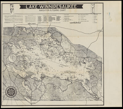
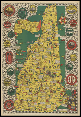
Lake Winnepesaukee New Hampshire Pictorial Map
Publisher: New England Map Co.Date/Date Range Produced: 1960
Language: EnglishRegion Depicted: New HampshireMap Type: Bird's-eye viewsDimensions: 52 x 60 cm folded to 15 x 19 cm
Historical Context: Lake Winnepesaukee is the largest lake in New Hampshire and has been a popular tourist destination for more than a century. The Abenaki named the lake Winnepesaukee which has two meanings: "Smile of the Great Spirit" or "Beautiful water in a high place". The Winnepesaukee people, a sub tribe of the Penacook lived and fished in the area.
LC Call Number: G3742.W7 1960 N3
OCLC: 1390130094
Accession Number: OML-1960-277
Subjects: Tourism
![[Map of Asia]](https://cdn1.historyit.com/iiif/2/5f34291499c4a6.60628694/64ca5f85cb3433.31589830.jpg/full/!400,400/0/default.jpg?no_errors=1)