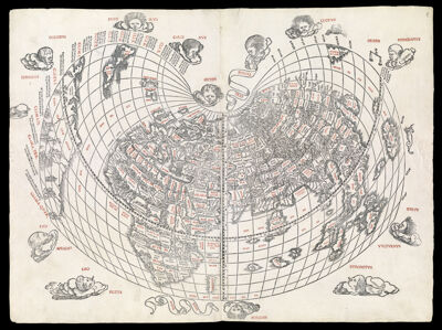
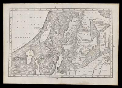
Eretz IsraelCreator:Mizrachi, Elia Date/Date Range Produced: 1527 Language:Hebrew Region Depicted:Holy LandIsraelPalestine Map Type:DiagramThematic maps Dimensions: H 30.4 X W 19.6 cm Historical Context: One of the earliest Hebrew printed maps of the Holy Land published in the “Perush Rashi” in Venice in 1527. This book (and map) were created by Rabbi Mizrachi, but was not published until after his death in 1525-26. The map is based on places mentioned in the Hebrew Bible. It represents the Holy Land as an abstract, schematic image with east at the top and the land of Israel (Eretz Israel) in the center. Accession Number: OS-1523-1 Donor:Osher Subjects:Bible --GeographyHoly LandIsraelJudaismMaps--Early works to 1800Palestine
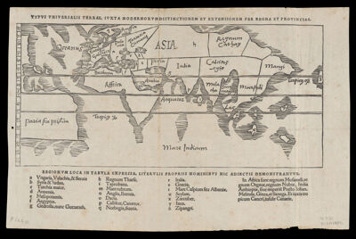
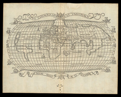
World Map.Date/Date Range Produced: 1528 Language:Italian Dimensions: 21 cm. x 38 cm. on sheet 31 cm x 43 cm. LC Call Number: G3200 1528.B6 OCLC: 896876485 Accession Number: OS-1528-2 Donor:Osher
![[West Indies-Spanish Main]](https://cdn1.historyit.com/iiif/2/5f34291499c4a6.60628694/6422f006578208.33584745.jpg/full/!400,400/0/default.jpg?no_errors=1)