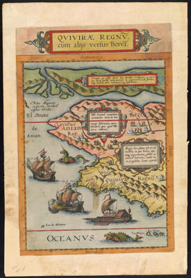
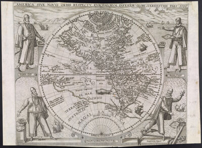
Americae Pars Borealis, Florida, Baccalaos, Canada, Corterealis. A Cornelio de Iudaeis in luce edita.
Creator: Jode, Cornelis de, 1568-1600Atlas Reference: Speculum orbis terraeDedicatee: Echter, TheodoricusDate/Date Range Produced: 1593
Language: LatinRegion Depicted: Arctic regionsBahamasCanadaGreenlandNorth AmericaMap Type: GeographicalPolitical mapsDimensions: 38 x 52 cm.
Printing Process: EngravingMaterial Type: PaperHistorical Context: De Jode's rare, seminal work is the first folio-sized atlas map to focus on North America. The map contains many remarkably early cartographic details, including a very linear representation of a double Northwest Passage running the length of the top of the map. The map is filled with annotations regarding early explorations in the New World, referencing Verazano, Cabot, Raleigh, and other explorers; an early mention of the Apaches is also present. Shown near the Northwest Passage is the early mythical great lake, Lac Conibas, which made an earlier appearance on Wytfliet's 1597 map. To the right of the title is a scene illustrating the attack on Frobisher's vessel by American Indians. Although his map was vastly superior to Ortelius' map of the Americas, De Jode's atlas sold poorly, accounting for the rarity of this work.
LC Call Number: G3300 1593 .J6
OCLC: 76701470
Accession Number: OS-1593-5
Donor: Osher