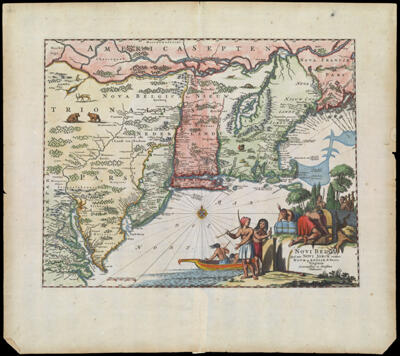
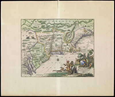
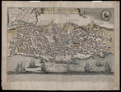
Nowel Amsterdam en Lamerique - 1662
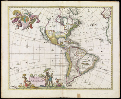
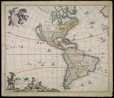
Creator: Braun, Georg, 1540 or 1541-1622Hogenberg, Frans, approximately 1539-1590Jollain, Gérard, -1683Publisher: Jollain, Gérard, -1683Date/Date Range Produced: 1672
Language: FrenchLatinRegion Depicted: Lisbon, PortugalNew York CityDimensions: H 42 x W 55.6 cm
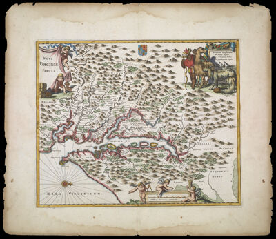
Printing Process: EngravingMaterial Type: PaperHistorical Context: This map supposedly depicts the Dutch town of Nieuw Amsterdam in 1662, two years before it was captured by the English and renamed New York. It was published as a separate broadside in France in 1672–74, perhaps as part of a series of broadsides during the wars with the Netherlands; the text at the bottom discusses Louis XIV’s liberation of Catholics in the southern Netherlands. Perhaps to make a map quickly, Gérard or François Jullien simply copied a map they had already made of Lisbon, Portugal (copied from Braun and Hogenberg’s Civitatis orbis terrarum [1574]), giving it new place names and an inset map of New Netherland. None of the features—the plazas, cathedral, abbeys, castle, city walls, the gallows (“La Iustice”)—nor the sheer extent of urbanization relate in any way to the small seventeenth-century settlement at the southern tip of Manhattan.
OCLC: 50936777
Accession Number: OS-1672-2
Donor: Osher