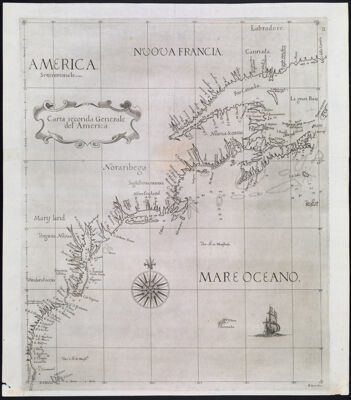
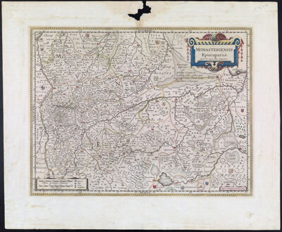
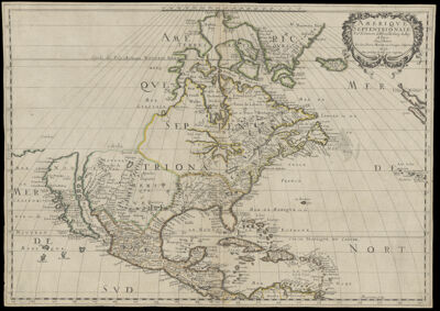
Carta seconda Generale del' America
Creator: Dudley, Robert, Sir, 1574-1649Date/Date Range Produced: 1646
Language: ItalianRegion Depicted: Atlantic Coast (North America)CanadaConnecticutDelawareFloridaGeorgiaMaineMaritime ProvincesMarylandMassachusettsNew HampshireNew JerseyNew York (State)North CarolinaNova ScotiaRhode IslandSouth CarolinaVirginiaMap Type: GeographicalNautical chartsDimensions: 23 x 21 cm.
Printing Process: EtchingMaterial Type: PaperHistorical Context: This is a reduced version of the earliest printed sea chart of the east coast of North America made by an Englishman and the first to use the Mercator projection. Its maker, Sir Robert Dudley (1574-1649), was a colorful figure in Elizabethan England. He was the illegitimate son of Robert Dudley, Earl of Leicester, a favorite of Queen Elizabeth I. Brilliant and ambitious, he became an extraordinarily skilled navigator, engineer, and chartmaker, and aspired to make a major voyage of discovery in the fashion of Sir Francis Drake. The high point of his career came in 1596 when he was knighted for his participation in a successful raid on Cadiz. He fell out of royal favor after a series of misadventures, in particular, his ill-considered support of the Essex rebellion against the Queen in 1601. Leaving England, he assumed the titles of Duke of Northumberland and Earl of Warwick, and entered the service of the Grand Duke of Tuscany. From 1606 until his death in 1649 he lived in Florence and was an influential member of the Court of the Medicis. His major accomplishment during his later years was the production of Dell'Arcano del Mare (Secrets of the Sea), a sea atlas and comprehensive treatise on navigation, shipbuilding, and naval organization. Published in 1646, this was the first sea atlas by an Englishman (expatriate notwithstanding) and the first printed sea atlas with world-wide coverage; it is generally considered to be the most distinguished of its time. The distinctive style of Dudley's charts, typical of Italian baroque art, is attributable to the elegant engraving of Antonio Francesco Lucini. It is believed that Lucini created this reduced version for a never-published "portable" edition of Dudley's sea atlas. This is one of two known examples, and the only copy in a public collection.
LC Call Number: G3320 1646 .D8
OCLC: 733564472
Accession Number: OS-1646-2
Donor: OsherSubjects: Atlantic Coast (North America)CanadaCoastsDudley, Robert, Sir, 1574-1649GalleonsLucini, Antonio Francesco, 1605-Maps--Early works to 1800Sailing ships