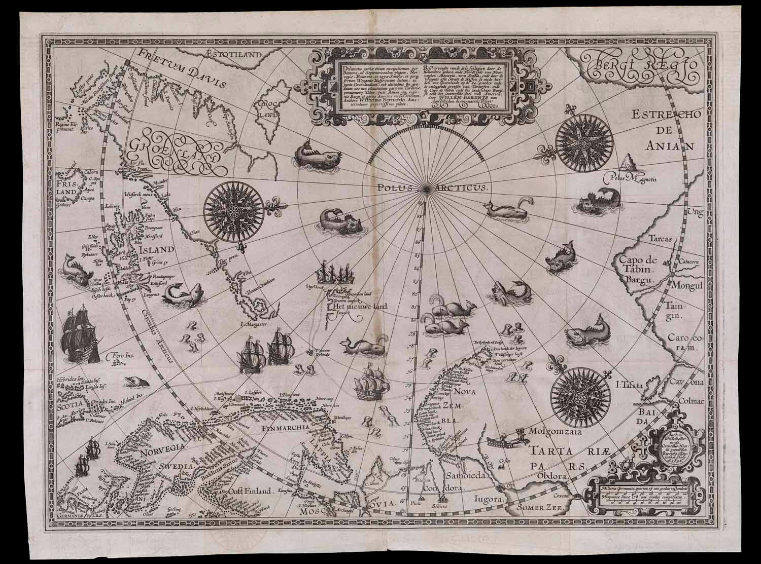
“Deliniatio cartae trium navigationum,” by William Barentsz
Title: Deliniatio cartae trium navigationum per Batavos, ad Septentrionalem plagam, Norvegiae, Moscoviae, et novae Semblae, et perque fretum Weygatis Nassovicum dictum, ac huxta Groenlandiam, sub altitudine 80 graduum nec non adiacentium partium Tartariae, promontorij Tabin, freti Anian atque regionis Bargi et partis Americae versus orientem, Authore Wilhelmo Bernardo Amstelredamo expertissimo pilota.
Title Translation: Map outlining the third voyage by the Dutch, to the Northern regions, Norway, Moscow, and New Semble, and through the Weygates strait, and also parts of Greenland, below 80 degrees, and the adjacent parts of Tartary, Tabin promontories, strait of Anian and Bargi regions and America towards the east, author Willem Barentsz Amsterdam expert captain
Barcode: 341
Creator: Barentsz, Willem, approximately 1550-1597
Date Published: 1598
Permanent URL: https://oshermaps.org/map/341.0001
Play below or on jigsawplanet.com: William Barentsz Puzzle
Directions:
Click on the image to launch the puzzle. The default difficulty setting for this puzzle is fairly easy. For a greater challenge, play on jigsawplanet.com and adjust the number of pieces using the “Play As” button in the upper right-hand corner.