“A Map of the City of Portland” by John Cullum (1836)
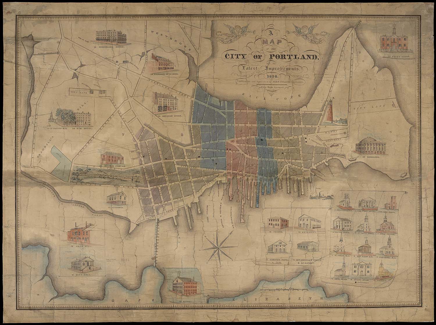
Title: A Map of the City of Portland with its Latest Improvements including a view of the principal buildings engraved and published by John Cullum, Portland.
Barcode: 11753
Creator: Cullum, John
Date Published: 1836
Permanent URL: https://oshermaps.org/map/11753.0001
More information about this map and its importance at the bottom of this page.
Play below or on jigsawplanet.com: 1836 Portland puzzle
Directions:
Click on the image to launch the puzzle. The default difficulty setting for this puzzle is fairly easy. For a greater challenge, play on jigsawplanet.com and adjust the number of pieces using the “Play As” button in the upper right-hand corner.
A recent post by our Executive Director, Libby Bischof:
https://www.facebook.com/oshermaps/posts/3229165683802284?__tn__=K-R
For a detailed reading and analysis of Cullum’s map, see Dr. Matthew Edney’s work: Edney, Matthew H. “The Highpoint of the Booster Mapping.” Section 5 of “References to the Fore! Local Boosters, Historians, and Engineers Map Antebellum Portland, Maine,” 2017.
https://oshermaps.org/special-map-exhibits/references-to-the-fore/5-the-highpoint-of-booster-mapping