

↑ Parent: Atlas du voyage de Vancouver
Collection: Osher Map Library Collection
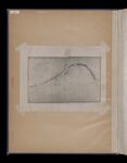
Name: The tracks and landfalls of Bering and Chirikof on the northwest coast of America from the point of separation June 20-21st 1741. Lat 49° 10' N. Long 176° 40' W. (both approx.) to the same meridian on their return June, July, August, Septmeber, October 1741.
Barcode:
Image Number:
Full Title: The tracks and landfalls of Bering and Chirikof on the northwest coast of America from the point of separation June 20-21st 1741. Lat 49° 10' N. Long 176° 40' W. (both approx.) to the same meridian on their return June, July, August, Septmeber, October 1741.
Permanent URL: