
Garci Rodriguez de Montalvo’s 1510 romance novel, Las Sergas de Esplandián (The Adventures of Esplandián), contains the first known mention of the Island of California. He wrote, “Know, that on the right hand of the Indies there is an island called California very close to the side of the Terrestrial Paradise; and it is peopled by black women, without any man among them, for they live in the manner of Amazons.” As a result, early explorers of the New World mistook the Baja Peninsula as an island. In 1533, Fortún Ximénez’s expedition ended in his death at the hands of native inhabitants. Some used this story to further the Montalvo idea of an exotic island, with cities paved with gold, and natives willing to defend their wealth. The idea certainly sold maps.
However, in 1539 Hernán Cortés sent the explorer Francisco de Ulloa and a small crew up the Gulf of California. Ulloa discovered the mouth of the Colorado River, and for about 75 years, maps clearly reflected California as a peninsula. But the island theory was revived during the mid-seventeenth century; one possible factor being Juan de Fuca’s highly disputed claim to finding the legendary Northwest Passage in 1592.
Over a century later, Euseblo Francisco Kino, an Italian Jesuit missionary and scientist, led an expedition to the Baja peninsula to establish his first mission. His maps of the region slowly made their way into the cartographic world; a world sometimes quite separate from that of science. Mapmakers, such as Gerardus Mercator, Abraham Ortelius, and later, Willem Janszoon Blaeu, correctly depicted the Baja peninsula. Yet the majority continued to depict California as an island throughout the seventeenth and eighteenth centuries. The first known instance of the return of this myth was in Michiel Colijn’s 1622 map, published in Amsterdam. This image persisted across the world for well over two centuries, even into the late nineteenth century, when westward expansion was well under way.
One of the first maps to depict the Baja California Peninsula, this work was left uncolored because of the Italian belief that copper engravings were so beautiful in themselves that color would only damage their majesty. This map is also the first map to focus only on North America and to show the Straits of Anian.
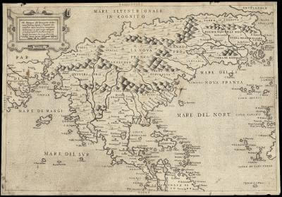
Bolognino Zaltieri and Paolo Forlani, Venice, 1566
/map/1649.0001
An early state, if not the first, of Ortelius’ ornate map of the Americas, this masterfully hand-colored copper engraving shows California as a peninsula, but does not include details that would be updated in the next few decades.

Abraham Ortelius, Antwerp, circa 1570
/map/284.0001
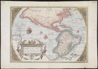
Abraham Ortelius, Antwerp, circa 1574
/map/1653.0001
This map represents English claims in the New World, and promotes the existence of the elusive Northwest Passage. Although North America is highly distorted, California does appear as a peninsula.
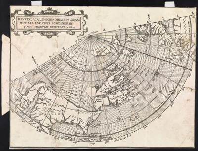
Michael Lok and Thomas Woodcock, London, 1582
/map/316.0001
Upon publication, this map was highly praised for the details in the west, particularly California.
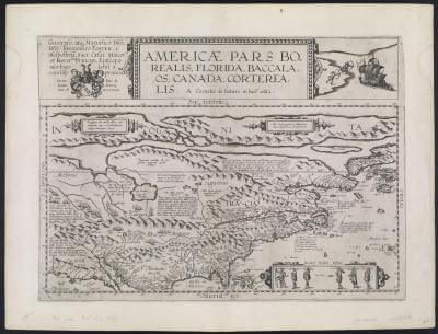
Cornelis de Jode, Antwerp, 1593
/map/1666.0001
In this second of three major states, Ortelius updates and adds several place names to California.
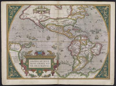
Abraham Ortelius, Antwerp, 1598
/map/1674.0001
An amateur hand-drawn map of North and South America, even this cartographic student presents California as a peninsula.
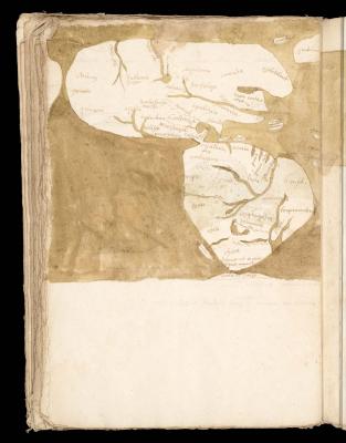
Anonymous, 1600
/map/42502.0072
Continuing in the great cartographic footsteps of his grandfather, Gerard Mercator, Michael was also a talented engraver. Although California is shown as a peninsula, there are several errors present on this map, including the large inland lake in Canada, four islands surrounding the Great Open Polar Sea in the North Pole, and a large southern continent.
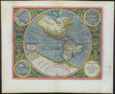
Michael Mercator, Amsterdam, 1633
/map/396.0001
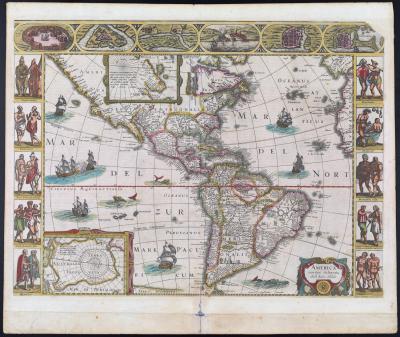
Gerard Mercator, Jodocus Hondius, Amsterdam, 1638
/map/406.0001

Willem Janszoon Blaeu, Amsterdam, 1640
/map/412.0001