Sort By:
Author
Publisher
Language
Material Type
Dimensions27 x 19.5 cm
Physical Description1 book: 24 pages
See Also
LC Call NumberGA369.D43 N67 1937
OCLC82890291
Accession NumberOML-1937-98
Subjects
Author
Publisher
Language
Material Type
Dimensions27 x 19.5 cm
Physical Description1 book: 24 pages
See Also
LC Call NumberGA369.D43 N67 1937
OCLC82890291
Accession NumberOML-1937-98
Subjects
Author
Publisher
Language
Material Type
Dimensions27 x 19.5 cm
Physical Description1 book: 24 pages
See Also
LC Call NumberGA369.D43 N67 1937
OCLC82890291
Accession NumberOML-1937-98
Subjects
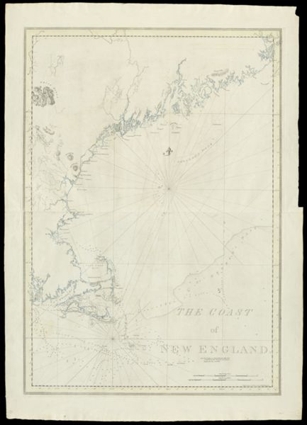
![Charts of the Coast and Harbors of New England [...] [Title page]](https://cdn1.historyit.com/iiif/2/5f34291499c4a6.60628694/684b1c80c16741.57898571.jpg/full/!600,600/0/default.jpg?no_errors=1)
Author
Publisher
Language
Material Type
Dimensions27 x 19.5 cm
Physical Description1 book: 24 pages
See Also
LC Call NumberGA369.D43 N67 1937
OCLC82890291
Accession NumberOML-1937-98
Subjects
Author
Publisher
Language
Material Type
Dimensions27 x 19.5 cm
Physical Description1 book: 24 pages
See Also
LC Call NumberGA369.D43 N67 1937
OCLC82890291
Accession NumberOML-1937-98
Subjects
Author
Publisher
Language
Material Type
Dimensions27 x 19.5 cm
Physical Description1 book: 24 pages
See Also
LC Call NumberGA369.D43 N67 1937
OCLC82890291
Accession NumberOML-1937-98
Subjects
Author
Publisher
Language
Material Type
Dimensions27 x 19.5 cm
Physical Description1 book: 24 pages
See Also
LC Call NumberGA369.D43 N67 1937
OCLC82890291
Accession NumberOML-1937-98
Subjects
Author
Publisher
Language
Material Type
Dimensions27 x 19.5 cm
Physical Description1 book: 24 pages
See Also
LC Call NumberGA369.D43 N67 1937
OCLC82890291
Accession NumberOML-1937-98
Subjects
Author
Publisher
Language
Material Type
Dimensions27 x 19.5 cm
Physical Description1 book: 24 pages
See Also
LC Call NumberGA369.D43 N67 1937
OCLC82890291
Accession NumberOML-1937-98
Subjects
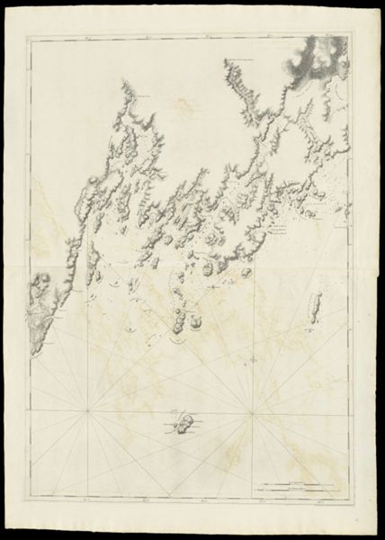
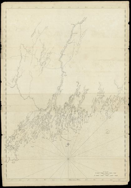
![Chart of the Coast Goldsborough to Moose Harbor. [Sheet 1 of 3]](https://cdn1.historyit.com/iiif/2/5f34291499c4a6.60628694/685af0a3e46055.23228602.jpg/full/!600,600/0/default.jpg?no_errors=1)
Author
Publisher
Language
Material Type
Dimensions27 x 19.5 cm
Physical Description1 book: 24 pages
See Also
LC Call NumberGA369.D43 N67 1937
OCLC82890291
Accession NumberOML-1937-98
Subjects