
Sir Ernest Shackleton first headed south in 1901, under Scott’s command [item 58]. Their personal differences began a heated rivalry that led Shackleton to organize three further expeditions on his own. On the Nimrod Expedition (1907–1909), Shack...
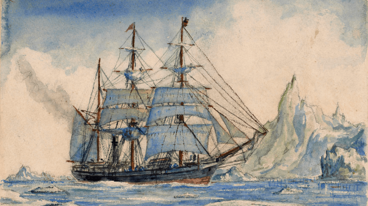
The history of the early mapping of the southern polar regions presents a continual debate between observation and reason, between solely reporting what mariners encountered and turning those partial observations into a general understanding of the r...
Many attempts were made to reach the North Pole during the nineteenth and early twentieth century, by ship, balloon, and dirigible, but all failed until Robert Peary (1856–1920) reached the pole in April 1909 with dog sledges. The race for the pole...
Northern Europeans sought for centuries to forge routes to Asia’s wealth through the Arctic. Merchants and settlers were already exploring parts of the northern coasts of Russia and Asia as early as the eleventh century. Attempts to open up the “...
September 24, 2013 ~ February 27, 2014 ... OML is pleased to present To the Ends of the Earth... and Back: Selections from the Jay I. Kislak Polar Collection, an exhibition curated by Arthur Dunkleman, Director of the Jay I. Kislak Foundation, Miami ...
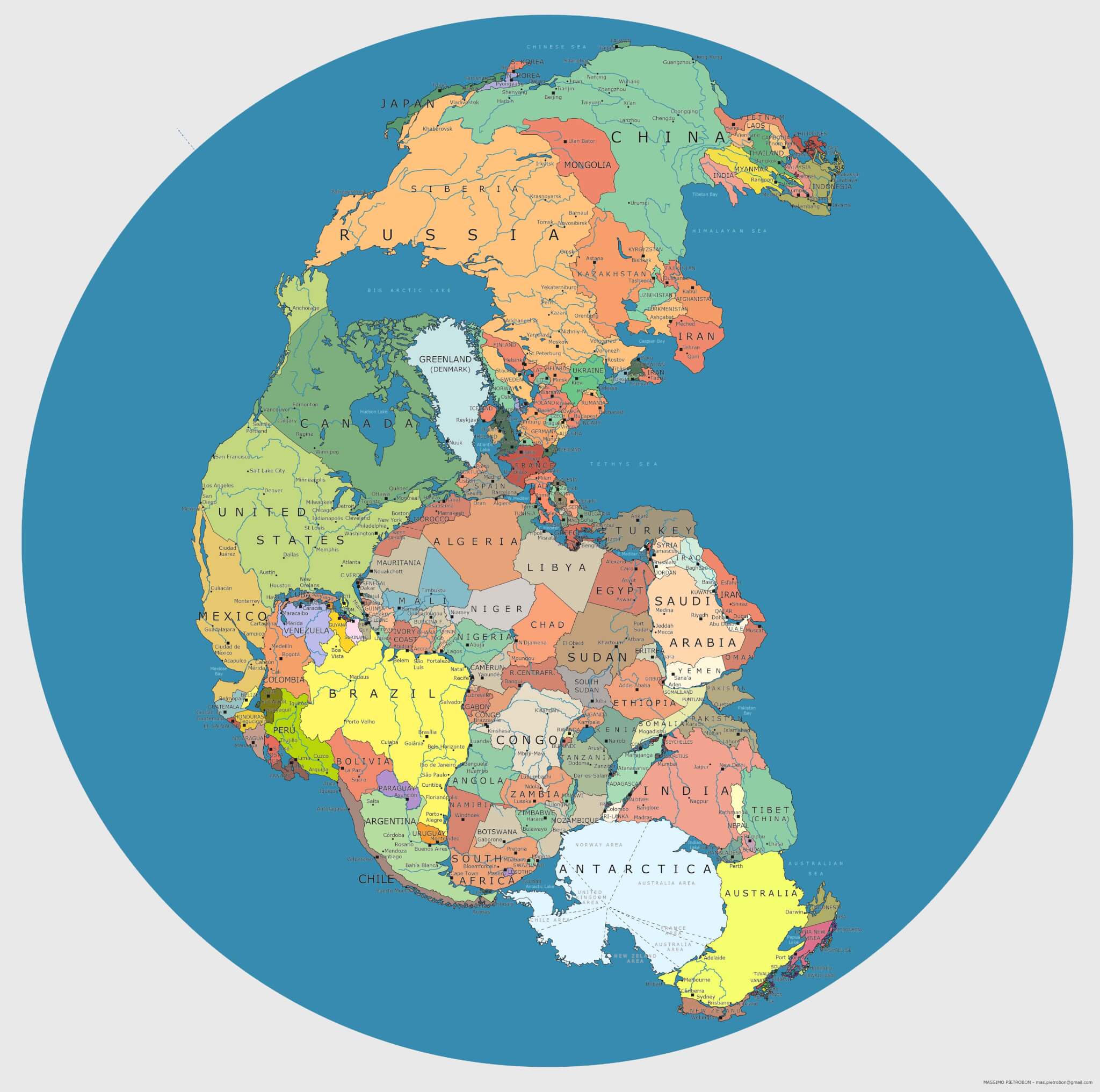
"Think about this: You wake up in New York City, decide to go for a stroll, head east after breakfast, and a short time later, still on foot, you find yourself in Morocco. Three hundred million years ago, you could have done that! There was...

The Fall/Winter 2013 issue of Cartography Corner: K-12 Education Outreach Newsletter is available for download....

Abraham Schechter at the Portland Public Library has done a nice work in getting a couple of often-used Portland atlases into a digital format. First, there's the Goodwin Atlas of 1882. Mr. Schechter writes, "Having been produced shortly before ...
There are two opposing positions in the debates swirling around the design of subway maps, and they are as inimical to each other as Good and Evil, Order and Chaos, Jedi and Trekkies. On the one hand are those that structure a subway system as a topo...
There is much more information about October's 18th series of Nebenzahl Lectures at the Newberry Library, Chicago.Entitled "The War of 1812 and American Cartography," the lectures will be held on 24-26th October, 2013, and will feature presentations ...