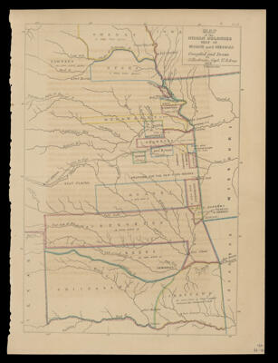
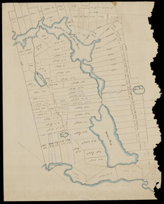
Map of the Indian Colonies West of Missouri and Arkansas
Creator: Eastman, SethDate/Date Range Produced: 1853
Language: EnglishRegion Depicted: ArkansasMissouriMap Type: GeographicalHistorical mapsDimensions: H 31.8 X W 23.5 cm
Material Type: PaperHistorical Context: Between 1830 and 1850, the U.S. government forced about 100,000 Native Americans from their homelands. The 1850 Act for the Government and Protection of Indians was a California law that gave Justices of the Peace jurisdiction in all cases related to complaints to Indians who had no ability to repeal. The act had devastating impacts on the native populations.
LC Call Number: G4052 1853.E3
OCLC: 28441281
Accession Number: OML-1853-64