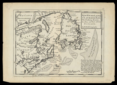
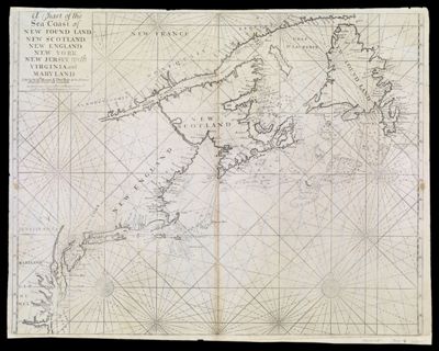
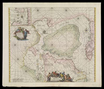
Septentrionaliora Americae Groenlandia, per Freta Davidis et Hudson at Terram Novam
Creator: Wit, Frederik deAtlas Reference: Atlas de la NavigationDate/Date Range Produced: 1739
Language: DutchLatinRegion Depicted: Baffin BayGreenlandHudson BayManitoba, CanadaNewfoundland and LabradorNorthern CanadaNunavut, CanadaOntarioMap Type: GeographicalNautical chartsDimensions: H 54.3 x W 63.8 cm
Printing Process: EngravingMaterial Type: PaperHistorical Context: This beautiful chart of Hudson Bay, Baffin Bay, Button Bay, Davis Straits, and contiguous parts of the coastline of Canada and Greenland appeared in Louis Renard's Atlas de la Navigation, one of the most striking products of Dutch maritime cartography. The atlas was updated in 1739 and 1745, and this concern with accuracy leads many historians to believe that the atlas was intended not only for consultation on shore, but also for use at sea.
LC Call Number: G3300 .W5 1739
OCLC: 173665784
Accession Number: SM-1739-6
Donor: Smith