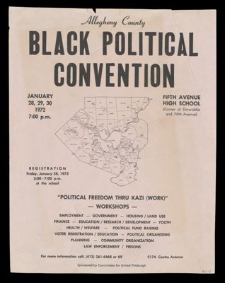
Allegheny County Black Political ConventionPublisher:Committees for United Pittsburgh, Language:English Dimensions: 28 x 21.5 cm Historical Context: From the 1950's and 1960's civil rights activists fought for freedom and equality. The 1970's marked achievements for African-Americans through their activism making strides in politics and business as well as academia. LC Call Number: E185.93.P41 1972 C6 OCLC: 1522960415 Accession Number: OML-1972-218
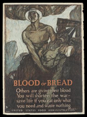
Blood or Bread.Creator:Raleigh, Henry Publisher:United States Food Administration, Date/Date Range: 1917 Language:English Type:Posters Dimensions: 74 x 54 cm Historical Context: The United States entered the war in 1917 after Germany sank three United States merchant ships. Another incentive was the British interception of the Zimmerman telegram issued from the German Foreign Office on January 17, 1917 that proposed a military contract between the German Empire and Mexico. LC Call Number: D522.25 1917 U5 OCLC: 1523090617 Accession Number: OML-1917-150 Subjects:World War, 1914-1918World War, 1914-1918--Propaganda
The Family and School Monitor -- Order is Heaven's first law, excelsior, the Temple of Liberty.Creator:Henry, James Publisher:J.H. Colton & Co. Date/Date Range: 1847 Language:English Dimensions: 105 x 80 cm on rollers Historical Context: The chart was issued during the nascent period of common school development. According to the dealer description it "represents an ambitious and deeply moralizing vision of education in service of both personal virtue and national stability". LC Call Number: LC 311 1847.H4 OCLC: 1528469291 Accession Number: OML-1847-37
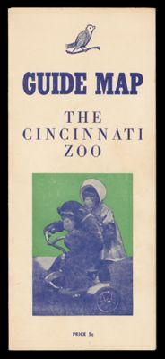
The Cincinnati Zoo Guide Map.Creator:Gunn, Wilma Language:English Dimensions: 21.5 x 28 cm, folded to 21.5 x 9 cm LC Call Number: QL 77.5 1947 G8 OCLC: 1539652817 Accession Number: OML-1947-163