Preserving the Tools of the Trade. In addition to preserving maps, we also seek to preserve the tools and other artifacts related to all aspects of map making. Given the importance of the early surveys of property to modern New England, we collect examples of early surveying instruments.
The basic technique used by Henry David Thoreau and other surveyors — of measuring bearings and distances, and then plotting these on paper — are well-illustrated by items 7, 8, and 9. To measure distances, nineteenth-century surveyors used chains (item 11). The standard chain measured 66 feet in length, equivalent to 4 rods of 16½ feet each. With chains, each divided into 100 links, the surveyor could readily calculate the area of each lot of land, 10 square chains being the same as 1 acre. Half chains of 50 links (33 feet or 2 rods) were often used in dense woodlands. The surveyor measured bearings with a compass (item 10). Compasses, of course, measured bearings with respect to magnetic north and were further deflected by any local anomalies such as deposits of iron ore. To make it easy for surveyors to measure bearings with respect to true north (see item 8), the surveyor and inventor William A. Burt developed his “solar attachment” (patented February 1836; items 12 and 13). With the attachment, the surveyor could observe the Sun at any time of day and, with reference to solar tables, determine the local magnetic variation (see item 8); he could then adjust the compass to measure bearings with respect to true north. Burt’s solar compass became standard equipment for surveyors employed by the federal government mapping the public lands in the American West, but it was not always used by surveyors working for private commissions, such as Thoreau.
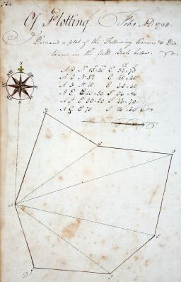
Single leaf (pp. 533-34) from a manuscript copy of an unidentified manual of surveying, dated 1798.
a) verso: “534 Of Plotting. Feb 2. A.D. 1798.”
Manuscript (pen and ink); 31cmx 19cm (paper)
OML Collections (Gift of Christina R. Pratt)

Andrew Meneely (1802–1851)
Survey compass, with alidades and plumb bob, in original case (Troy, N.Y., ca. 1850)
Brass; dial 20cm diameter, sights 40cm long
Louis Oakes Collection, on permanent loan from Louis Hilton
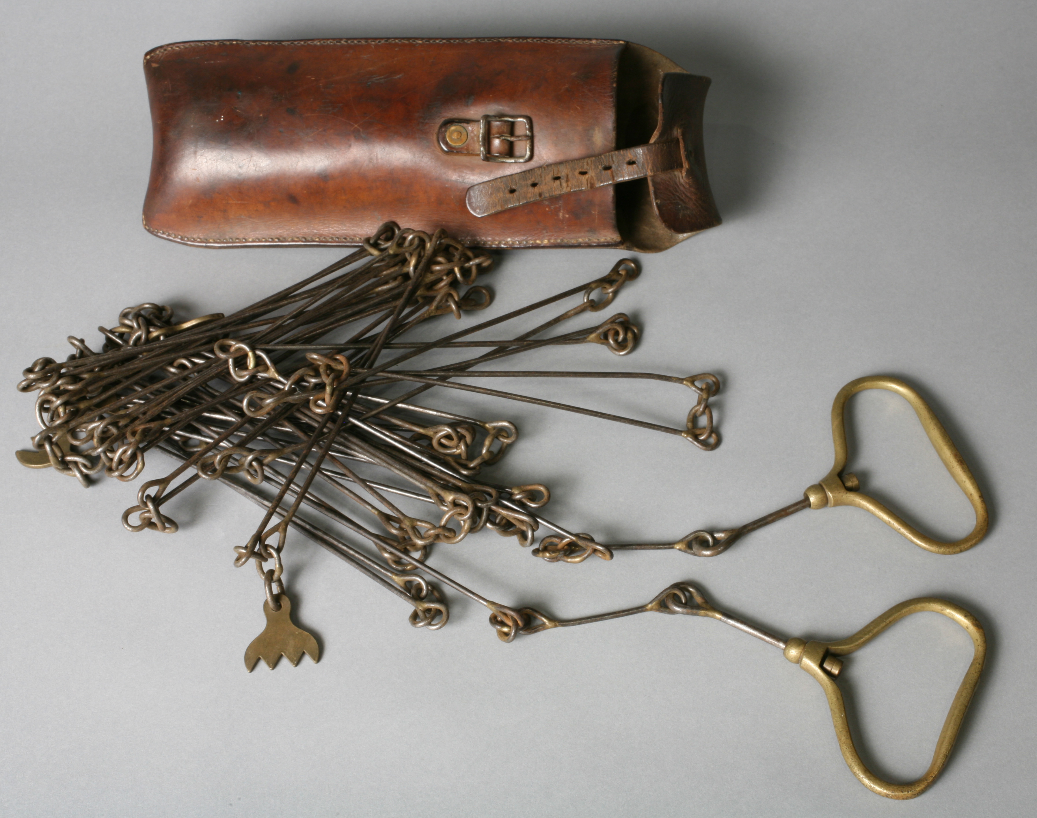
Surveyor’s 50-link half chain, with carrying case, mid-nineteenth century
Steel with brass handles; 10.06m long
Louis Oakes Collection, on permanent loan from Louis Hilton
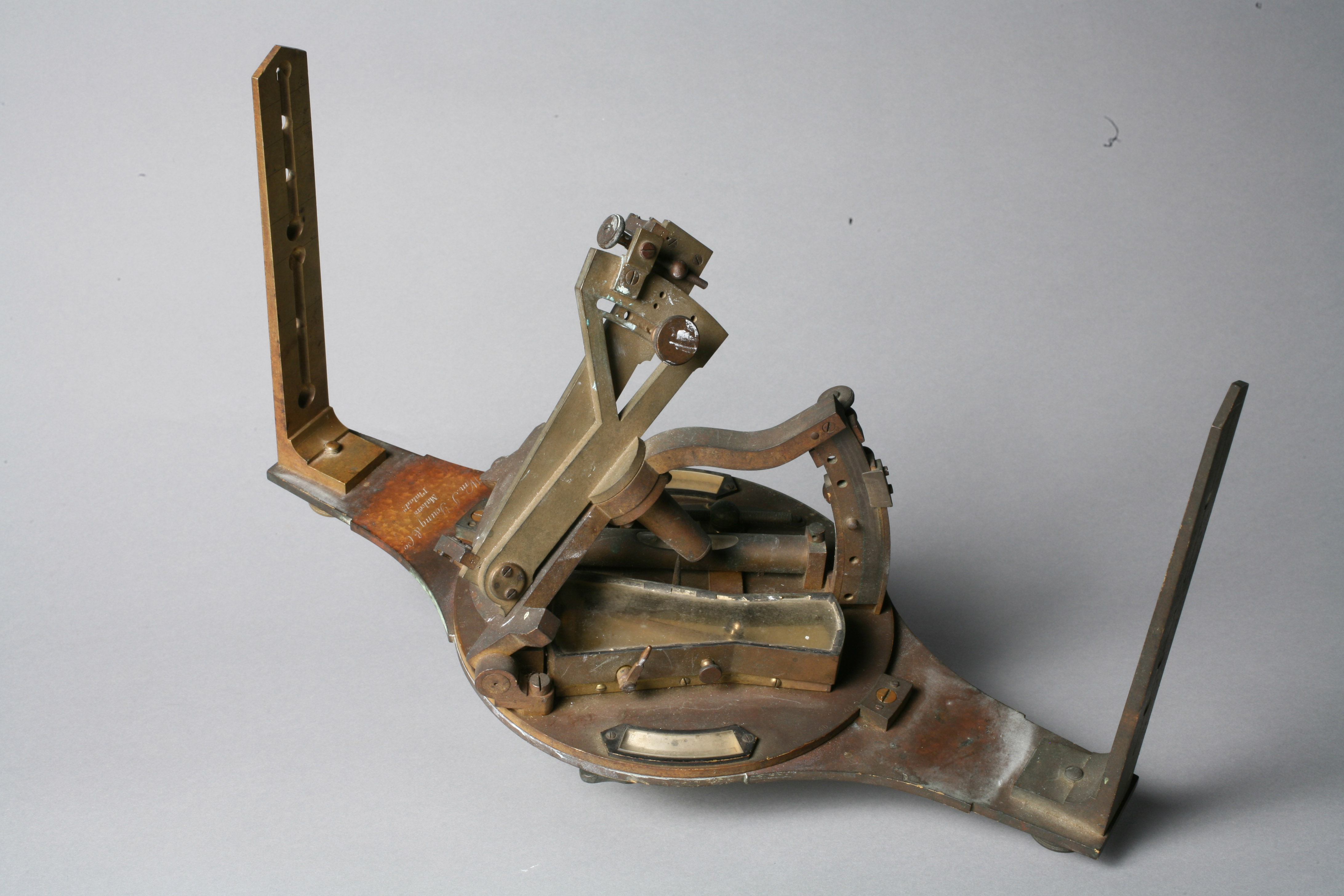
William Austin Burt (1792-1858) and John Burt (1814-1886)
Burt’s Solar Compass (without optional telescopic sight), ca. 1860
Brass; dial 17cm diameter, sights 36.5cm long
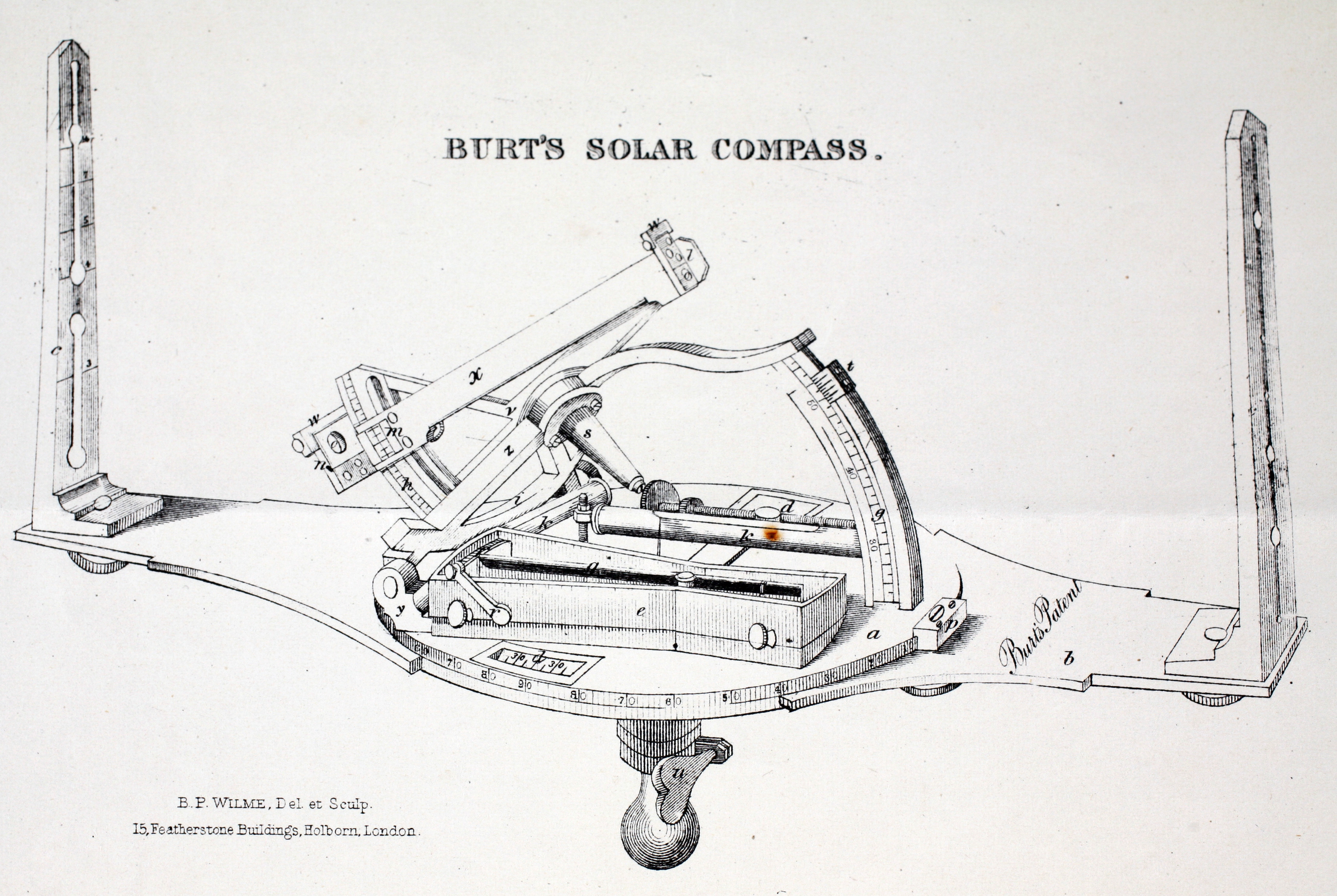
B. P. Wilme “Burt’s Solar Compass”
Frontispiece to John Burt, History of the Solar Compass, Invented by Wm. A. Burt (Detroit: O. S. Gulley’s Press, 1878)
Lithograph; 13cm x 22cm (paper).
OML Collections (gifts of Mr. & Mrs. Charles Bassett)