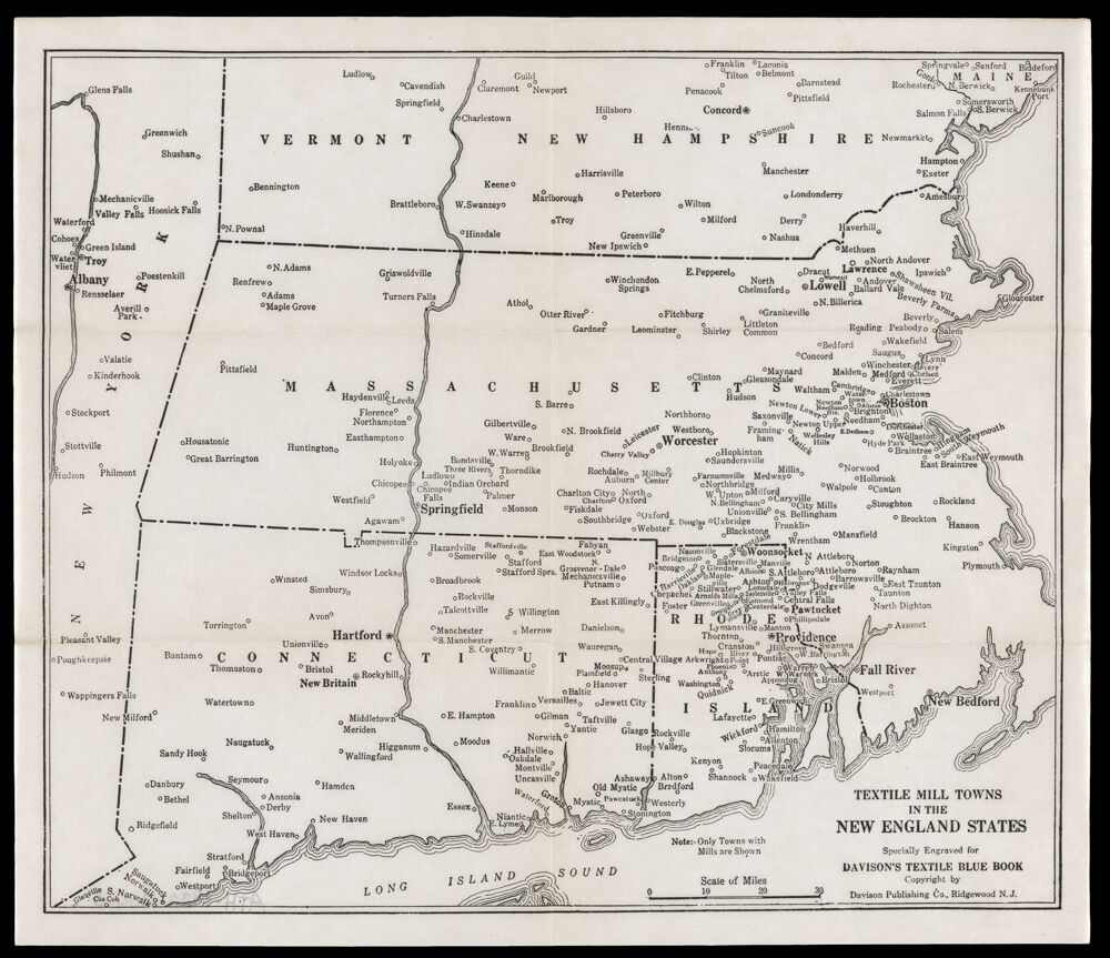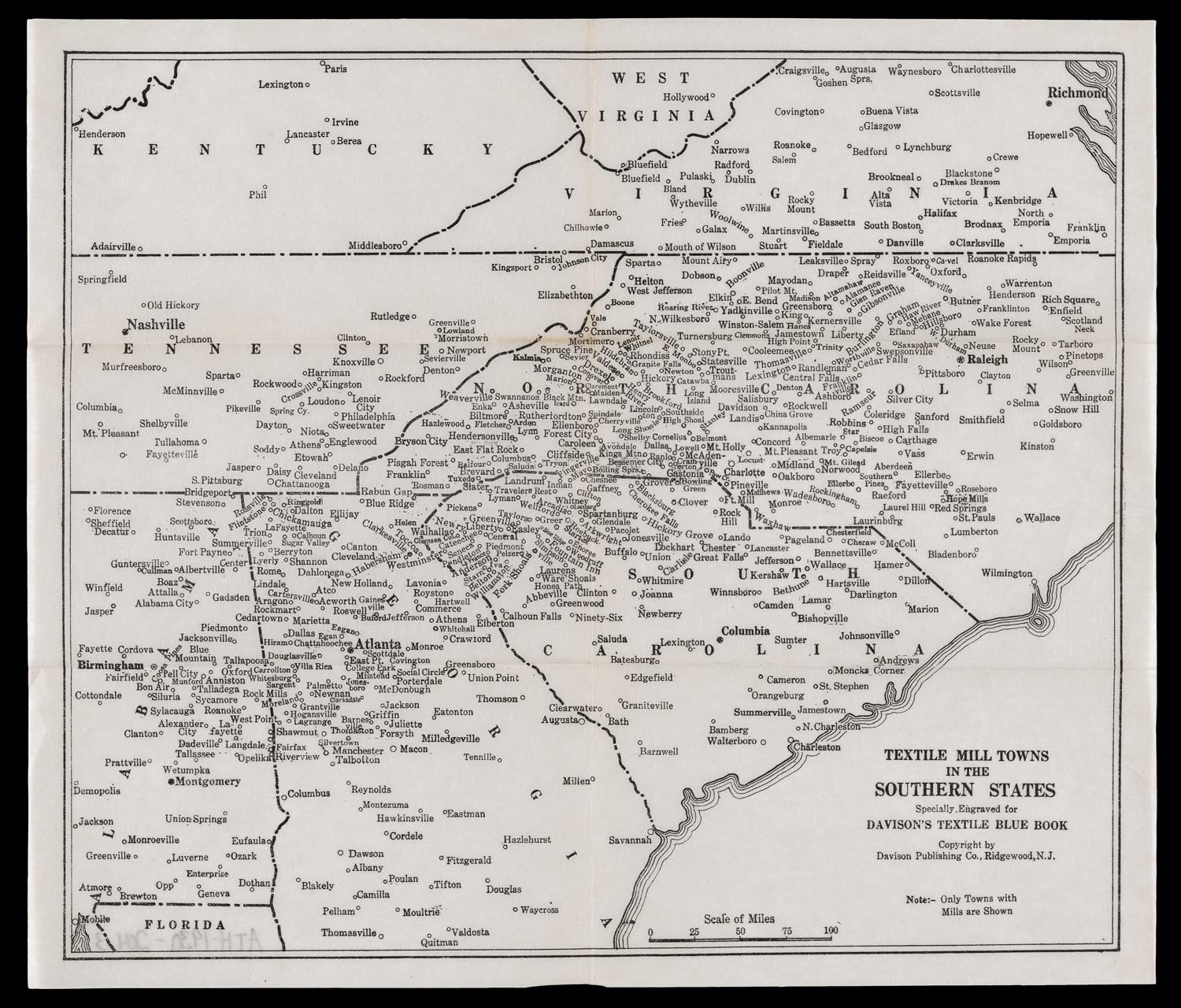
29. Textile Mill Towns in the New England States Textile Map: Maine, New Hampshire, Vermont
from Davison’s Textile Blue Book
Davison Publishing, 1930

Click on image to see larger version.
Published in the 1930 edition of the yearly Davison’s Textile Blue Book, these two maps reflect the culmination of more than one hundred years of growth and development of the New England textile industry. Small spinning mills established in the 1790s near Providence, Rhode Island, expanded to larger integrated mills outside of Boston in Waltham (1814) and Lowell (1820s). The textile industry subsequently spread rapidly throughout Rhode Island and Massachusetts into neighboring Maine, New Hampshire, Vermont and Connecticut, as depicted. While these maps show a wide distribution throughout the New England region, the industry was already starting to decline during the first quarter of the 20th century with growing competition from textile companies relocating to the South. The Great Depression of the 1930s also accelerated that trend.
30. Railway Map of the New England States, engraved expressly for Snow’s Pathfinder Railway Guide
George K. Snow, 1867

Click on image to see larger version.
The transportation needs of the growing textile industry spurred the adoption of railroads. They provided a faster alternative to roads, rivers, and canals. The region’s first steam powered railroad was the Boston and Lowell Railroad, which opened in 1835 to connect the two cities. Shortly after, the Boston and Providence and the Boston and Worcester lines were in operation. In the following decades, the rail network grew rapidly by servicing the textile industry as well as other regional industrial activity. By the middle of the 19th century, New England claimed more than half of the nation’s railroad mileage. This 1867 map, engraved for the popular travel companion Snow’s Pathfinder Railway Guide, illustrates Boston as the primary railroad hub, with New Haven, Providence, Portsmouth, and Portland serving as smaller hubs. It was through these coastal ports that southern cotton was imported for the textile industry, and textiles and other manufactured goods were shipped to domestic and foreign markets.
31. Industrial Map of New England
General Drafting Co., 1919

Click on image to see larger version.
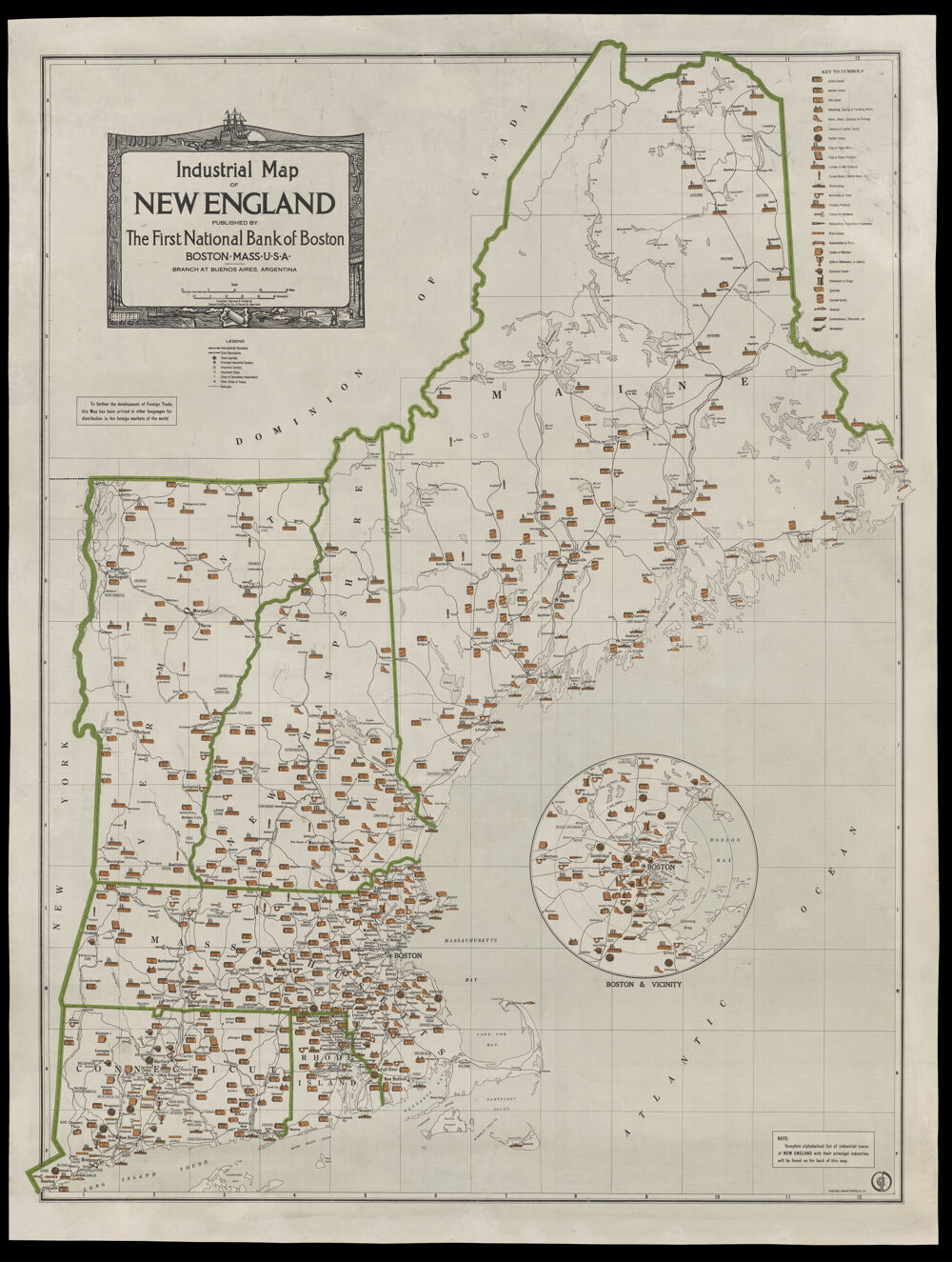
Published in 1919 by a Boston bank, this pictorial map portrays the extent of New England’s industrial growth and diversification almost a hundred years after the region’s Industrial Revolution began. The legend identifies 27 unique industries, beginning with cotton, woolen, and silk goods. It also lists other basic manufactured products such as boots, shoes, and leather goods, ending with the 20th century products of electrical goods, automobiles, and airplanes. And for the sweet toothed, there were confectionery and chocolate goods. An inset of Boston and vicinity highlights the concentration of industrial activity in the region’s largest urban area. According to a note, the map was published in other languages because it was intended to promote New England manufactured goods in foreign markets.