Are you a classroom teacher within the Greater Portland area? We are happy to lend high-quality printed reproductions of this map set at no cost as part of an Activity Kit for use in your classroom. The kit will also include a variety of age-appropriate worksheet activities, answer keys, hands-on craft or game, and all necessary instructions. If within a 30 minute drive from Portland, OML educators will deliver and pick up the activity kit from your school office. Please contact Renee Keul at renee.keul@maine.edu for more information or to reserve this map set. You may also reserve this map set at oshermaps.org/teach/activity-kits
Use these activities and maps to examine the events of the United States’ westward expansion, including encroachment onto Indigenous homelands, major land purchases, mass migrations such as the Oregon Trail and California Gold Rush.
In creating this Learn at Home theme, we have tried to make it as customizable as possible so it can be used with a variety of ages and skill sets. The “Independent Use” worksheets can be done apart from the Map Set, and have been created as PDF Forms so they do not need to be printed for your students to complete. The “Map Set” worksheets are also created as PDF Forms and use the maps listed below (or downloadable as a PDF).
Crossword Puzzle (can be used independently)
Shape of the United States worksheet (can be used independently)
Challenge Questions Sheet (to be used with map set below) –> Answers
Scavenger Hunt (to be used with map set below) –> Answers
United States Geography and Landmarks Activity –> Answers (use letter clues on PDF Map List)
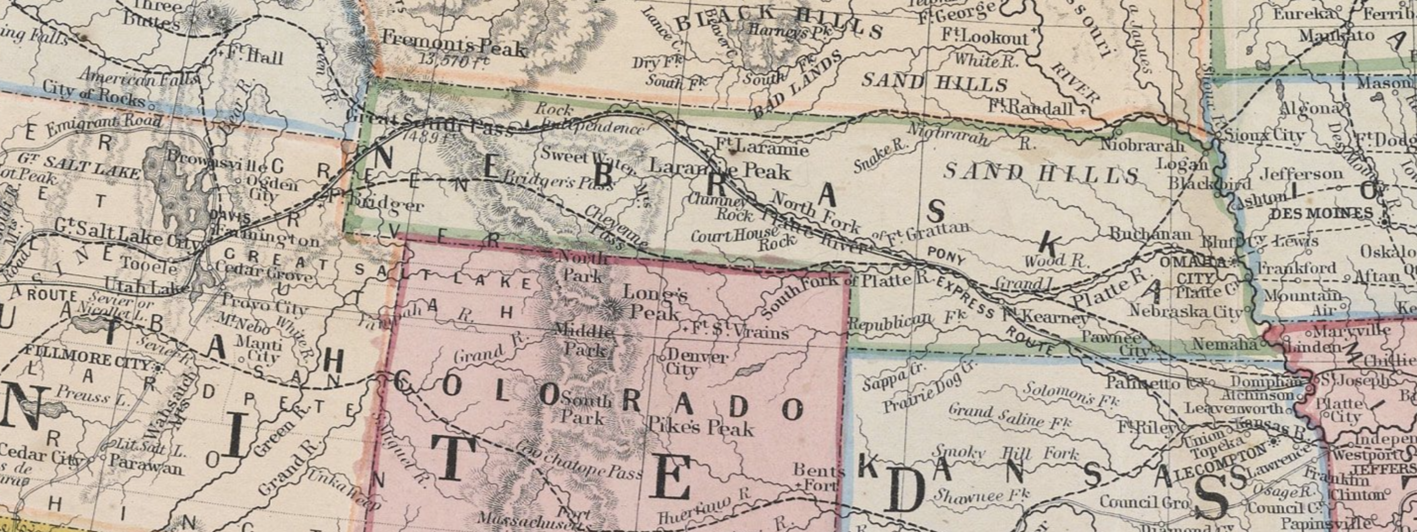
Movement of Indigenous Peoples Map Exploration –> Answers
Westward Expansion Discussion Questions (to be used with map set below)
Map Observation and Discussion Activity (to be used with maps below)
Map Research Activity (to be used with map set below)
Primary Source Analysis Tool (to be used with map set below)
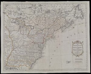
1783, Thomas Kitchin, “Map of the United States in North America with the British, French, and Spanish Dominions” – https://oshermaps.org/map/852 – Letter Clue: N
1808, Anonymous, “The United States of America according to the Treaty of Peace of 1784” – https://oshermaps.org/map/36710 – Letter Clue: S
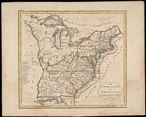
1816, John Melish, “Map of the United States with the contiguous British & Spanish Possessions” – https://oshermaps.org/map/929 – Letter Clue: O
1835, John T Hammond, “United States” – https://oshermaps.org/map/12675 – Letter Clue: W
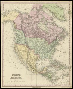
1836, Henry Schenck Tanner, “North America” – https://oshermaps.org/map/997 – Letter Clue: H
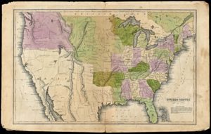
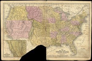
1839, Samuel Augustus Mitchell, “Map of the United States and Texas” – https://oshermaps.org/map/12625 – Letter Clue: L
1840, John Tallis and Company, “United States” – https://oshermaps.org/map/2280 – Letter Clue: J
c.1848 [drawn], 1850, Samuel Griswold Goodrich, “[Untitled map of United States]” – https://oshermaps.org/map/7654.0016 – Letter Clue: P
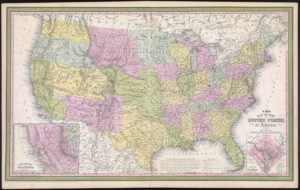
1849, Samuel Augustus Mitchell, “Map of the United States” – https://oshermaps.org/map/12642 – Letter Clue: Y
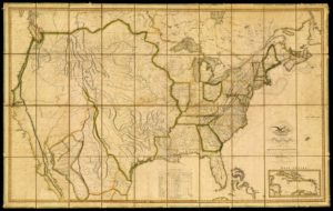
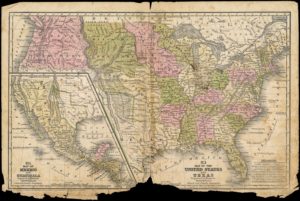
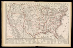
1850, James Hamilton Young, “A New Map of the United States of America” – https://oshermaps.org/map/1044 – Letter Clue: R
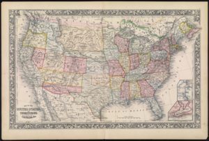
1860, S. Augustus Mitchell Jr., “Map of the United States and Territories” – https://oshermaps.org/map/2242 – Letter Clue: I
1861, P.S. Duval & Son, “Military Map of the United States & Territories Showing the Location of the Military Posts” – https://oshermaps.org/map/12851 – Letter Clue: C
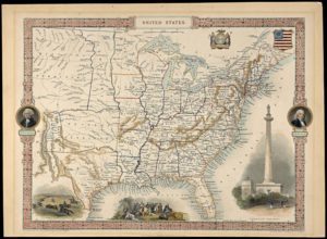
1866, Theodore Frank, “Map of the United States and Territories” – https://oshermaps.org/map/1125 – Letter Clue: U
1888, United States Office of Indian Affairs, “Map Showing the Location of the Indian Reservations” – https://oshermaps.org/map/13877 – Letter Clue: D
1916, United States Department of the Interior, “Map showing Indian Reservations in the United States” – https://oshermaps.org/map/37299 – Letter Clue: F
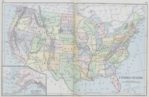
1896, H.S. Tarbell, United States from The Werner Introductory Geography – http://oshermaps.org/map/3818.0037 – Letter Clue: T
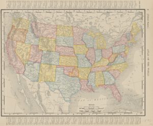
1901, Rand McNally, United States from Atlas of the World – https://oshermaps.org/map/47621 – Letter Clue: A
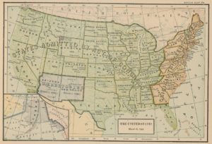
1917, Albert Bushnell Hart, The United States March 4,1909 – https://oshermaps.org/map/4894.0043 – Letter Clue: E
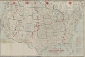
1925, George F. Cram Co., “Cram’s detailed Radio Map of the United States and Canada” – https://oshermaps.org/map/52590 – Letter Clue: M