Are you a classroom teacher within the Greater Portland area? We are happy to lend high-quality printed reproductions of this map set at no cost as part of an Activity Kit for use in your classroom. The kit will also include a variety of age-appropriate worksheet activities, answer keys, hands-on craft or game, and all necessary instructions. If within a 30 minute drive from Portland, OML educators will deliver and pick up the activity kit from your school office. Please contact Renee Keul at renee.keul@maine.edu for more information or to reserve this map set. You may also reserve this map set at oshermaps.org/teach/activity-kits
These activities and world maps are our most frequently requested resources. They can be used to teach students about mapping conventions, continents, oceans, and other landforms; or they can be examined more in depth to explore the progression of geographical knowledge in the western world and the beliefs and values that dominated western worldviews from the Renaissance to the modern era.
In creating this Learn at Home theme, we have tried to make it as customizable as possible so it can be used with a variety of ages and skill sets. The “Independent Use” worksheets can be done apart from the Map Set, and have been created as PDF Forms so they do not need to be printed for your students to complete. The “Map Set” worksheets are also created as PDF Forms and use the maps listed below (or downloadable as a PDF). Please keep in mind that any age categories are only recommendations; some of the “Map Set” worksheets ask for open-ended responses so that they can be used for a wide range of grade levels.
For Elementary
• Oceans and Continents Matching –> Answers
• Scale & Compass Roses (Gr 1-3) –> Answers
• Scale & Compass Roses (Gr 4-5) –> Answers
• Geography Vocab Crossword (Grades 2-5) –> Answers
• Looking Closer & Scavenger Hunt (to be used with maps below)
• World Maps & Landforms (to be used with maps below)
• World Maps Guided Inquiry (to be used with maps below)
For Middle/High School
• Scales, Compass Roses, and More (Gr 6+) –> Answers
• Geography Vocab Crossword (Grades 6+) –> Answers
• World War I Maps worksheet (can be used independently)
• Scavenger Hunt (to be used with maps below)
• Group Observation and Discussion Questions (to be used with map set below)
• Mapmaker Worldview Activity (to be used with map set below)
• Map Research Activity (to be used with map set below)
• Primary Source Analysis Tool (to be used with maps below)
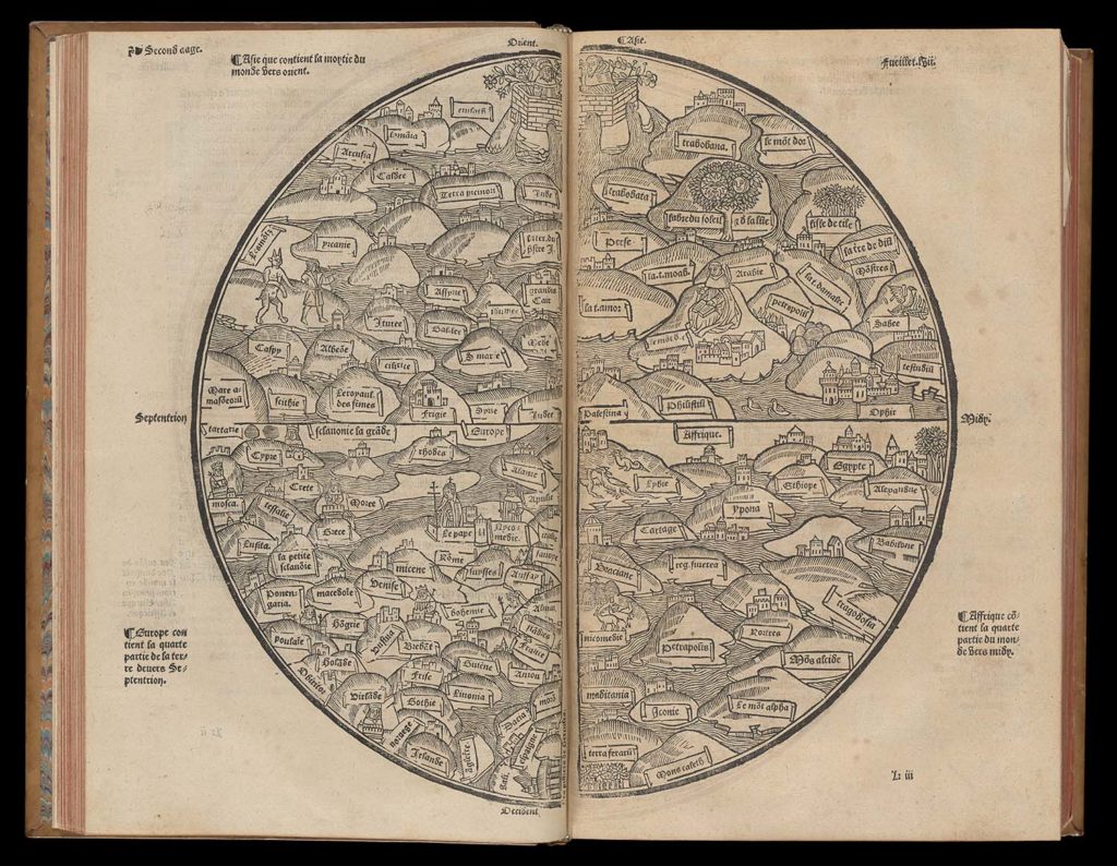
c.1200s [drawn], 1551, Anonymous, [Rudimentum Novitiorum, World Map] – https://oshermaps.org/map/7335.0148c – Letter Clue: R
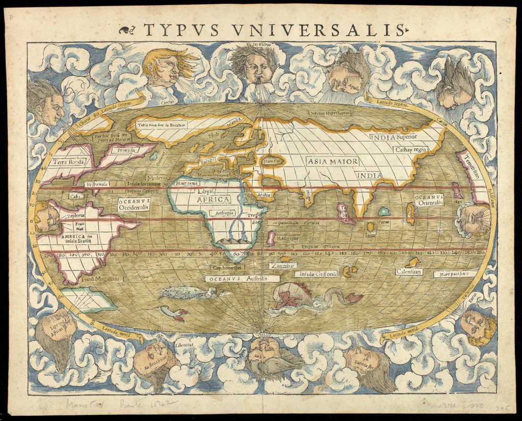
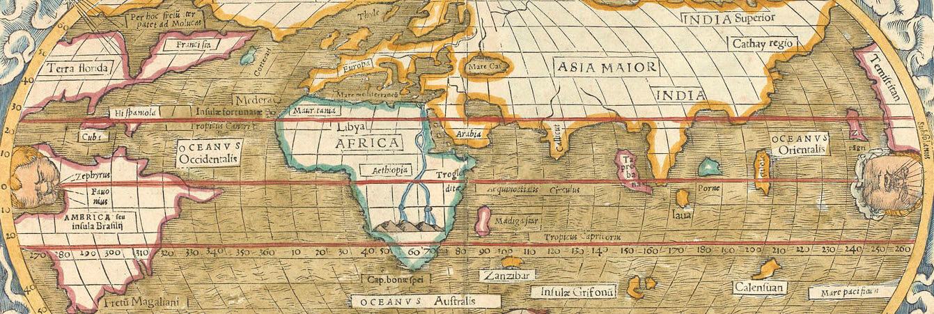
1542, Sebastian Munster, “Typus Universalis” – https://oshermaps.org/map/1639 – Letter Clue: N
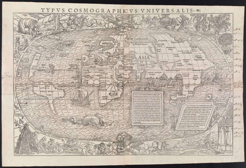
1555, Sebastian Munster, “Typus Cosmographicus Universalis” – https://oshermaps.org/map/262 – Letter Clue: Z
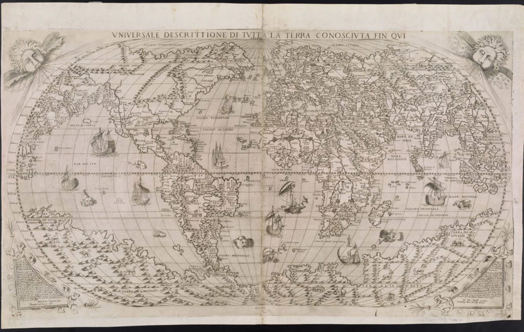
1565, Paolo Forlani, “Universale Descrittione Tutta La Terra Conosciuta Fin Qui” – https://oshermaps.org/map/280 – Letter Clue: S
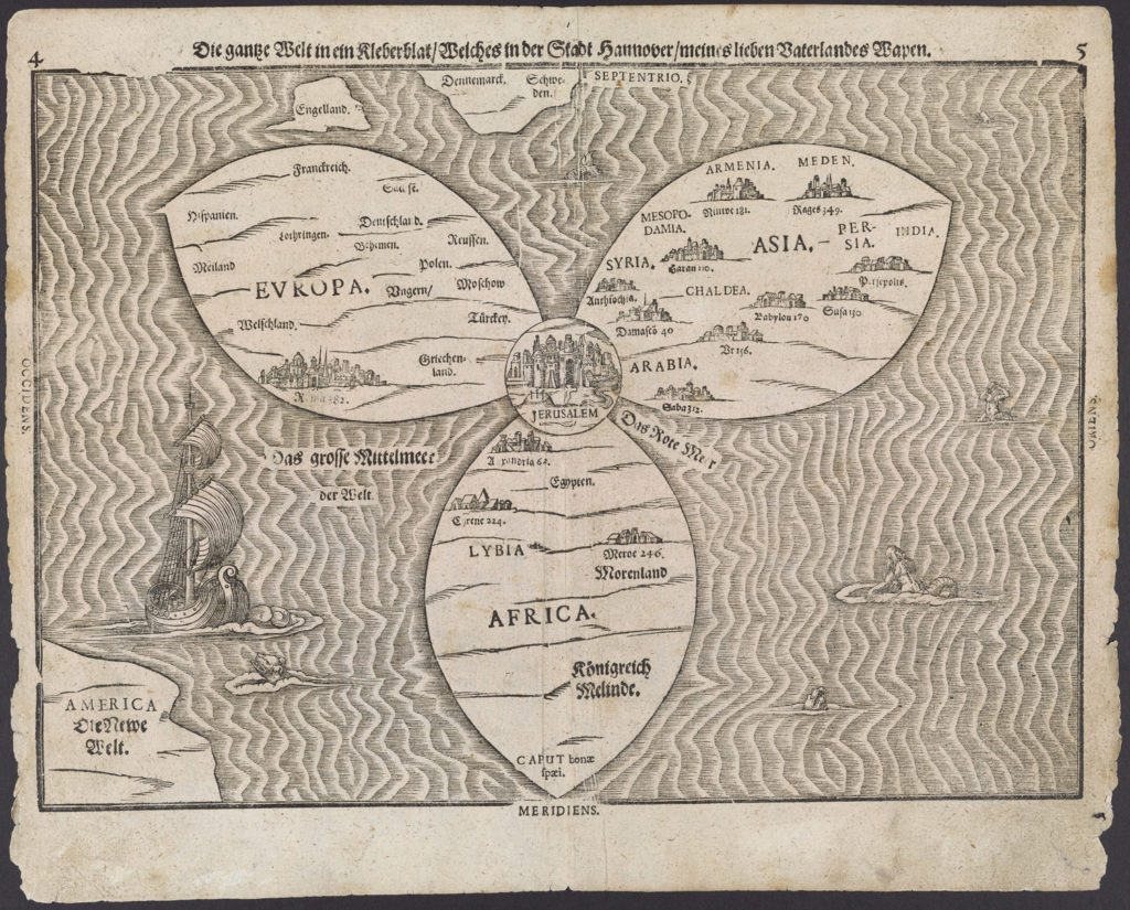
1581, Heinrich Bunting, “Die gantze Welt”. – https://oshermaps.org/map/315 – Letter Clue: A
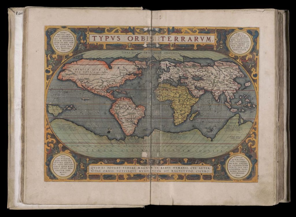
1595, Abraham Ortelius, “Typus Orbis Terrarum” – https://oshermaps.org/map/7348.0020 – Letter Clue: T
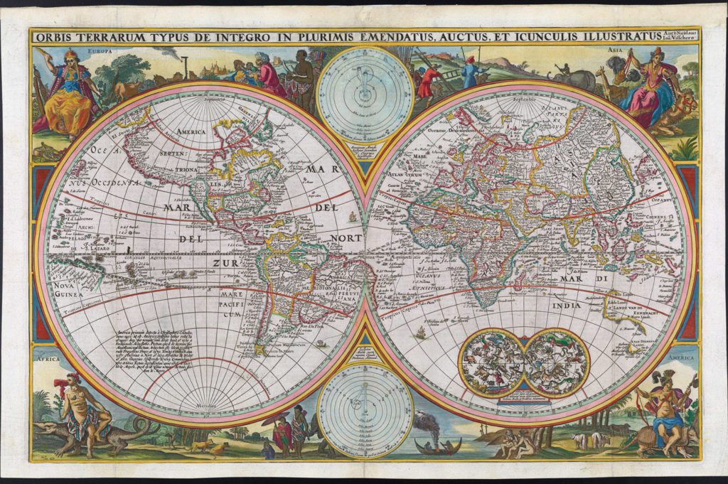
1657, Nicolaes Visscher, “Orbis Terrarum Typus” – https://oshermaps.org/map/443 – Letter Clue: D
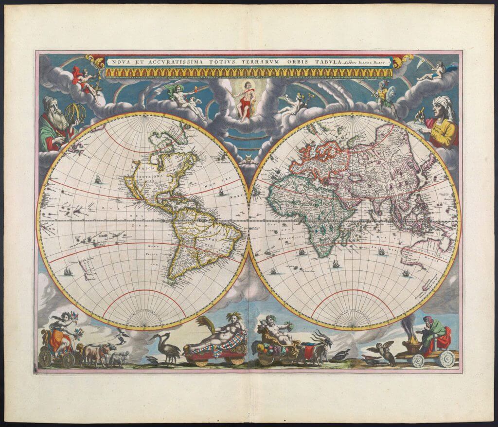
1662, Joan Blaeu, “New and Most Accurate Map of the Whole World” – https://oshermaps.org/map/458 – Letter Clue: X
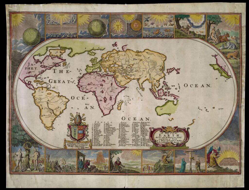
1685, Joseph Moxon, “Map of all the Earth after the Flood” – https://oshermaps.org/map/43593 – Letter Clue: P
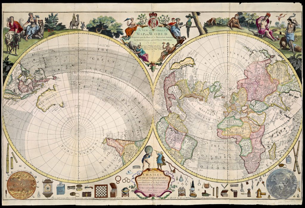
1714, Charles Price, “A New and Correct Map of the World” – https://oshermaps.org/map/597 – Letter Clue: O
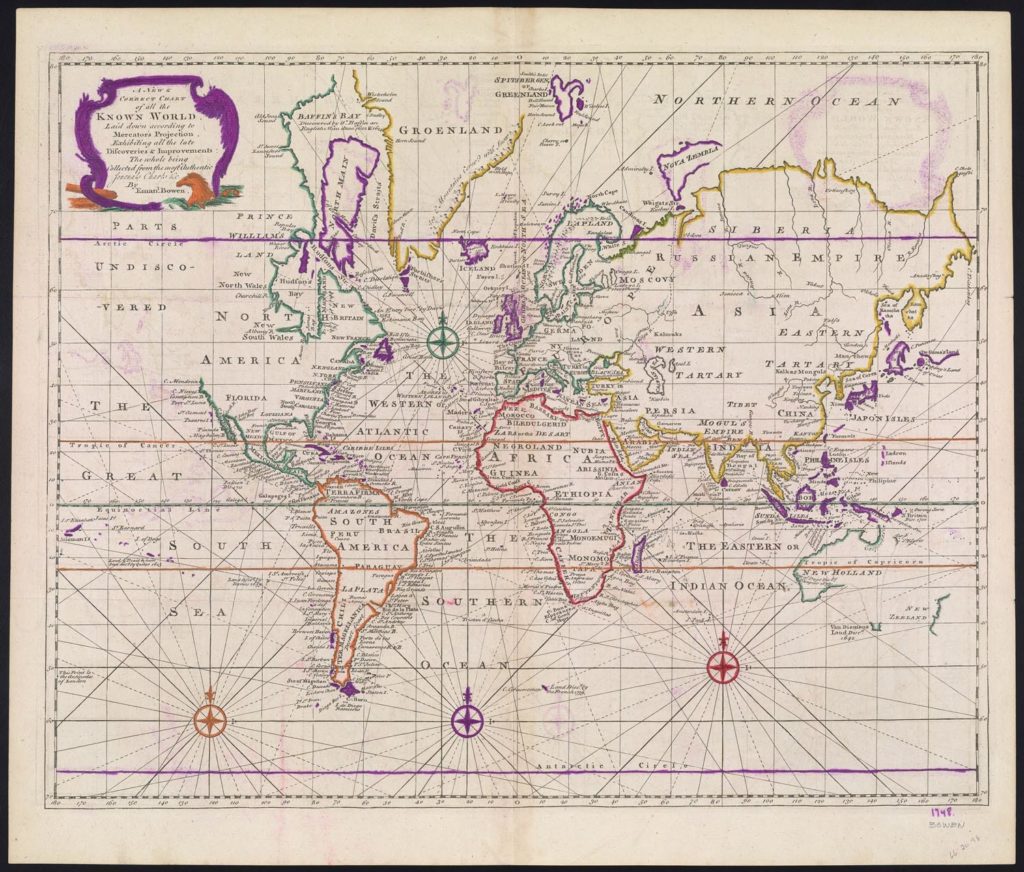
1748, Emanuel Bowen, “New and Chart of the Known World” – https://oshermaps.org/map/1900 – Letter Clue: I
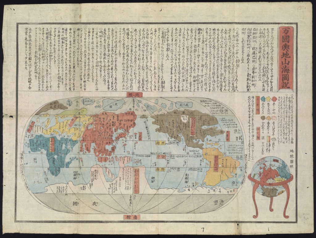
1850, Anonymous, [Japanese World Map] – https://oshermaps.org/map/1042 – Letter Clue: C
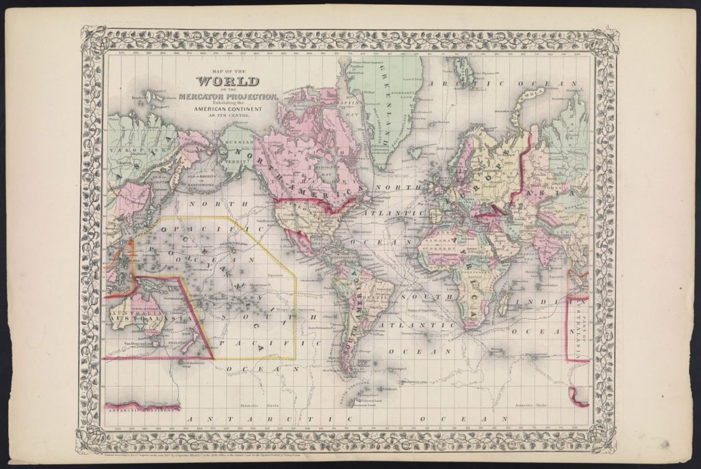
1867, S. Augustus Mitchell, Jr., “Map of the World American Continent as it’s Centre” – https://oshermaps.org/map/1126 – Letter Clue: E
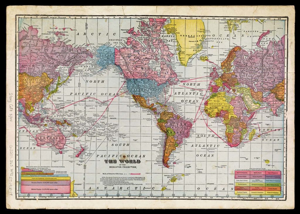
1918, Geographical Publishing Co., “The World on the Mercator Projection” – https://oshermaps.org/map/2314.0009 – Letter Clue: L
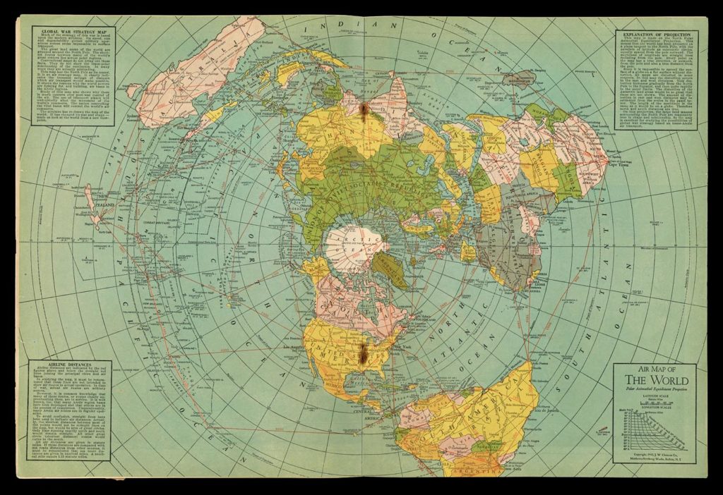
1943, The Matthews-Northrup Company, “Air Map of the World” – https://oshermaps.org/map/11620.0014 – Letter Clue: G
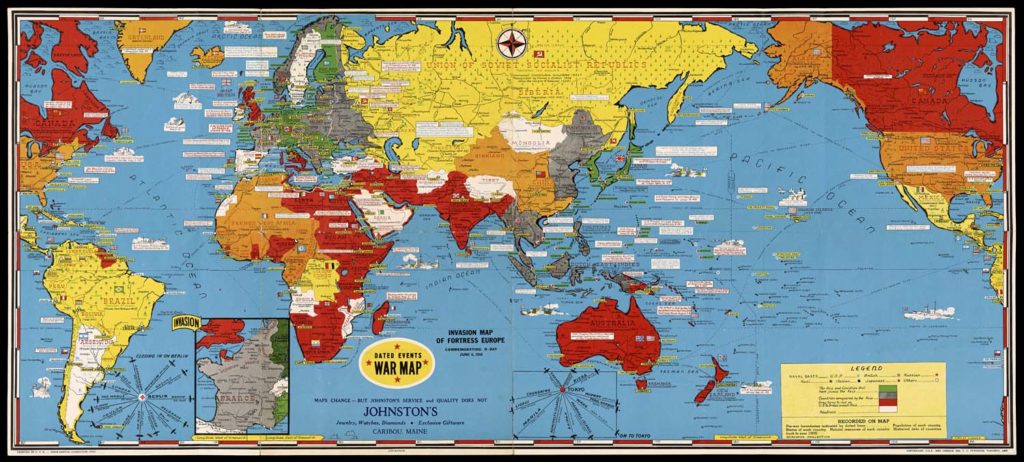
1944, Stanley F. Turner, “Dated Events War Map” 12th Edition – https://oshermaps.org/map/37685 – Letter Clue: M
See 19th Edition at https://oshermaps.org/map/12871

1950, Buckminster Fuller, “Dymaxion Map of the World” – Letter Clue: U