Sort By:
Author
Publisher
Language
Material Type
Dimensions27 x 19.5 cm
Physical Description1 book: 24 pages
See Also
LC Call NumberGA369.D43 N67 1937
OCLC82890291
Accession NumberOML-1937-98
Subjects
Author
Publisher
Language
Material Type
Dimensions27 x 19.5 cm
Physical Description1 book: 24 pages
See Also
LC Call NumberGA369.D43 N67 1937
OCLC82890291
Accession NumberOML-1937-98
Subjects
Author
Publisher
Language
Material Type
Dimensions27 x 19.5 cm
Physical Description1 book: 24 pages
See Also
LC Call NumberGA369.D43 N67 1937
OCLC82890291
Accession NumberOML-1937-98
Subjects
Author
Publisher
Language
Material Type
Dimensions27 x 19.5 cm
Physical Description1 book: 24 pages
See Also
LC Call NumberGA369.D43 N67 1937
OCLC82890291
Accession NumberOML-1937-98
Subjects
Author
Publisher
Language
Material Type
Dimensions27 x 19.5 cm
Physical Description1 book: 24 pages
See Also
LC Call NumberGA369.D43 N67 1937
OCLC82890291
Accession NumberOML-1937-98
Subjects
Author
Publisher
Language
Material Type
Dimensions27 x 19.5 cm
Physical Description1 book: 24 pages
See Also
LC Call NumberGA369.D43 N67 1937
OCLC82890291
Accession NumberOML-1937-98
Subjects
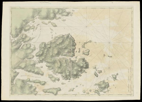
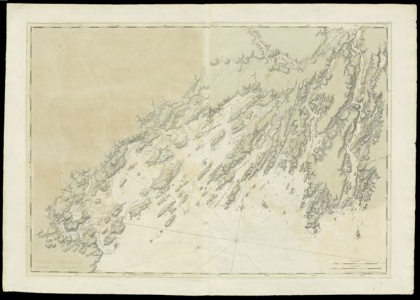
![[Coast of Maine - Two Views of Wolves Islands at Entrance of Passamaquoddy Bay]](https://cdn1.historyit.com/iiif/2/5f34291499c4a6.60628694/660c05f5428561.90663406.jpg/full/!600,600/0/default.jpg?no_errors=1)
Author
Publisher
Language
Material Type
Dimensions27 x 19.5 cm
Physical Description1 book: 24 pages
See Also
LC Call NumberGA369.D43 N67 1937
OCLC82890291
Accession NumberOML-1937-98
Subjects
Author
Publisher
Language
Material Type
Dimensions27 x 19.5 cm
Physical Description1 book: 24 pages
See Also
LC Call NumberGA369.D43 N67 1937
OCLC82890291
Accession NumberOML-1937-98
Subjects
Author
Publisher
Language
Material Type
Dimensions27 x 19.5 cm
Physical Description1 book: 24 pages
See Also
LC Call NumberGA369.D43 N67 1937
OCLC82890291
Accession NumberOML-1937-98
Subjects
Author
Publisher
Language
Material Type
Dimensions27 x 19.5 cm
Physical Description1 book: 24 pages
See Also
LC Call NumberGA369.D43 N67 1937
OCLC82890291
Accession NumberOML-1937-98
Subjects