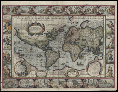
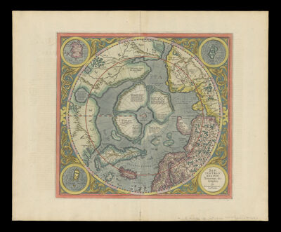
Nova Totius Terrarum Orbis Geographica Ac Hydrographica Tabula a Pet. Kaerio.
Creator: Jansson, Jan, 1588-1664Keere, Pieter van den, 1571-approximately 1646Atlas Reference: Hondius-Janssonius 1631 AppendixesDate/Date Range Produced: 1631
Language: DutchLatinRegion Depicted: WorldMap Type: GeographicalDimensions: 43 X 56 cm.
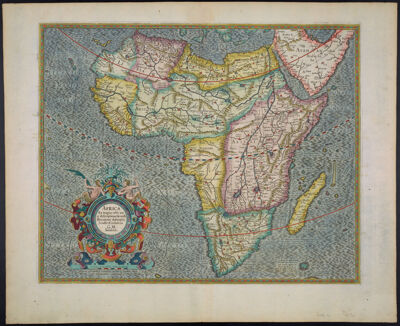
Printing Process: EngravingMaterial Type: PaperHistorical Context: This map, an example of the formal paneled border, or "carte a figure" format, is copied from the Blaeu map of 1606, considered by many to be one of the highest achievements in the art of mapmaking. It is geographically advanced, incorporating information from the latest discoveries and utilizing a rectangular grid (Mercator projection) for ease of navigation. The seas are embellished with ships and sea battles, sea monsters, and a native canoe; there are several examples of elegant swash lettering. Intricately engraved panels frame the map on all four sides. Across the top, the "seven planets" (actually the five known planets, the sun, and the moon) are represented by mythological gods and goddesses. On the right side are allegorical representations of the seasons, and on the left, personifications of the four elements. Along the bottom are vignettes of the Seven Wonders of the Ancient World. Jodocus Hondius, Jr. had sold copperplates to Blaeu who in 1630 publishes his atlas. Henrik Hondius and Janssonius, in competition with Blaeu ordered engravings of the plates identical to Blaeu's; this map is identical to Blaeu's.
LC Call Number: G3200 1631 .J3
OCLC: 830866929
Accession Number: OS-1631-3
Donor: Osher