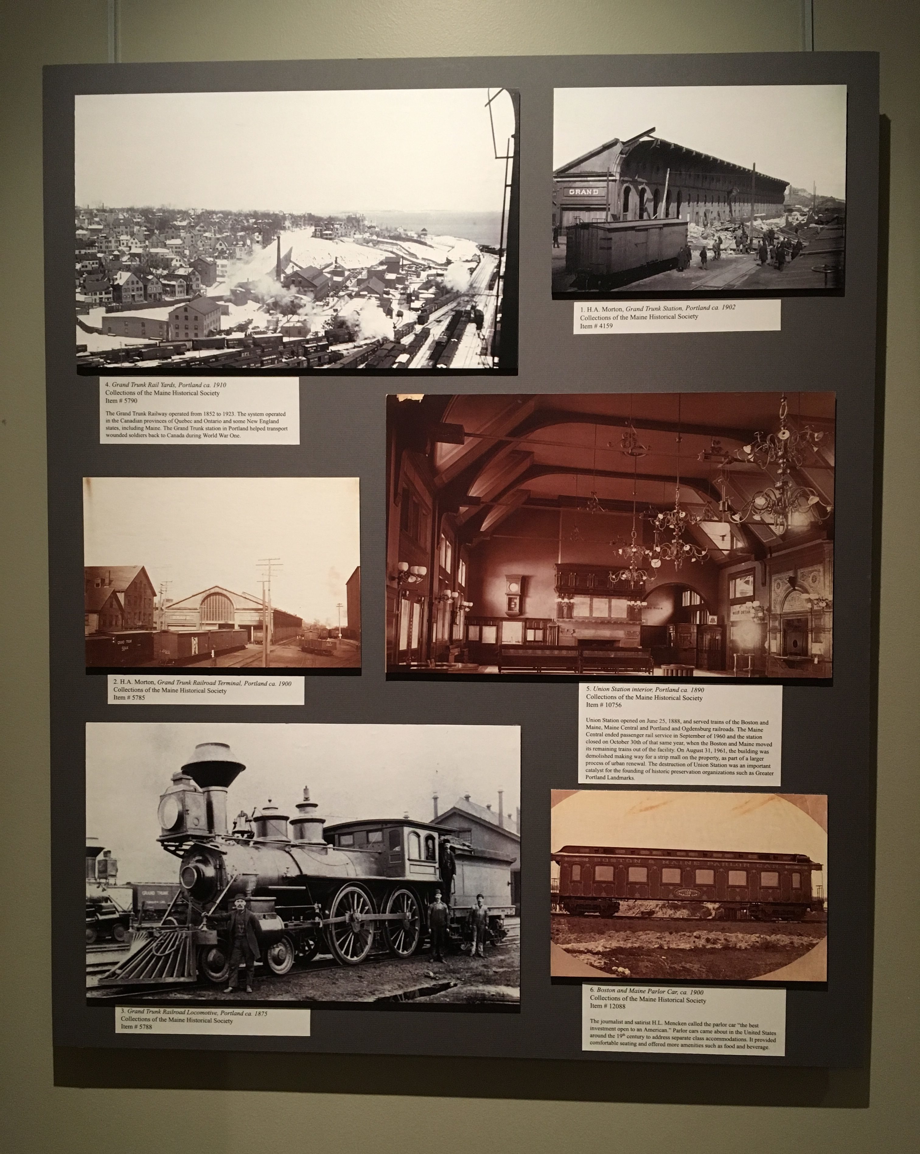
1. H.A. Morton, Grand Trunk station, Portland circa 1902.
Collections of the Maine Historical Society
Item #4159
2. H.A. Morton, Grand Trunk Railroad Terminal, ca. 1900.
Collections of the Maine Historical Society
Item #5785
3. Grand Trunk Railroad Locomotive, Portland ca. 1875.
Collections of the Maine Historical Society
Item #5788
4. Grand Trunk Rail yards, Portland ca. 1910.
Collections of the Maine Historical Society
Item #5790
The Grand Trunk Railway operated from 1852 to 1923. The system operated in the Canadian provinces of Quebec and Ontario and some New England states, including Maine. The Grand Trunk station in Portland helped transport wounded soldiers back to Canada during World War One.
5. Union Station interior, Portland ca. 1890
Collections of the Maine Historical Society
Item # 10756
Union Station opened on June 25, 1888, and served trains of the Boston and Maine, Maine Central and Portland and Ogdensburg railroads. The Maine Central ended passenger rail service in September of 1960 and the station closed on October 30th of that same year, when the Boston and Maine moved its remaining trains out of the facility. On August 31, 1961, the building was demolished making way for a strip mall on the property, as part of a larger process of urban renewal. The destruction of Union Station was an important catalyst for the founding of historic preservation organizations such as Greater Portland Landmarks.
6. Boston & Maine Parlor Car, ca. 1900.
Collections of the Maine Historical Society
Item #12088
The journalist and satirist H.L. Mencken called the parlor car “the best investment open to an American.” Parlor cars came about in the United States around the 19th century to address separate class accommodations. It provided comfortable seating and offered more amenities such as food and beverage.
7. Maine Central Railroad Company, Maine Central Railroad, Portland Division, Schedule of Trains in effect Oct. 1, 1916, 1916.
Hamilton-Thayer Map Collection
www.oshermaps.org/map/52383
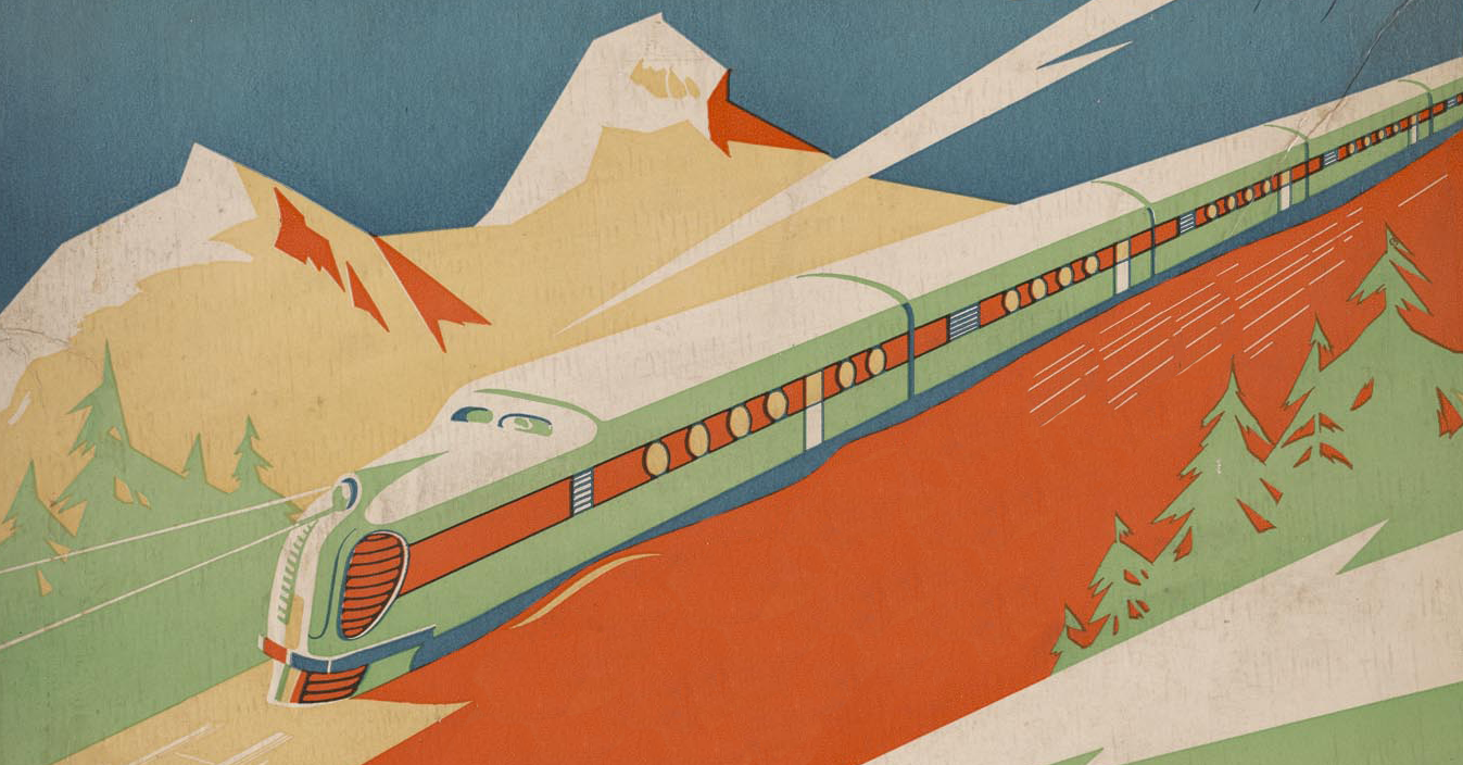
This poster-style Maine Central Railroad timetable shows passenger service in 1916 near the height of the railroad industry’s dominance of inter-city travel. Maine Central trains offered frequent service between the state’s principal cities and towns. Trains stopped at small towns on branch lines as well as providing through service on connecting lines as far as New York City and Halifax, Nova Scotia. In 1916, automobiles and paved roads were rare in Maine; coastal steamships and a few trolley lines were the only alternatives to train travel. Beginning in the 1920s, train travel began to decline due to the growing use of automobiles. While both World War I and World War II brought temporary bursts of rail passenger traffic, the decline resumed in the mid 1940s. Maine Central ran its last passenger train in 1960 and became a freight-only railroad. Passenger trains returned to Maine in 2001 with Amtrak’s Downeaster between Boston and Portland, since extended over the former Maine Central route to Brunswick.
8. Rand Avery Supply Co., Maine Central Railroad Company. 1914, 1914.
Osher Sheet Map Collection.
www.oshermaps.org/map/1402
The Maine Central Railroad was formed in 1862 by the merger of two smaller lines which connected Portland and Bangor. The Maine Central built relatively little track under its own name, and instead pursued a strategy of purchasing or leasing many shorter railroads. This expansion strategy brought the Maine Central to its fullest size by the time this map was published in 1914. With 1,223 route miles, the Maine Central was one of the longest railroads in the country, and it dominated transportation in much of Maine. The Maine Central also controlled three small, two-foot gauge lines listed on the map. In addition, the map shows two resort hotels owned by the railroad: the Mount Kineo House at Moosehead Lake and the Samoset Hotel at Rockland.
In the century after these maps, the Maine Central’s passenger business ended, and its freight traffic declined, but the company remained more profitable than other New England railroads because Maine’s paper producers continued to ship by rail. Today, many of the branch lines shown in 1914 have been abandoned, and most remaining freight routes in Maine are operated by Pan Am Railways.
9. McLoughlin Bros., Passenger Car from Railroad Picture Book, 1903.
Osher Map Library Atlas Collection.
www.oshermaps.org/map/11571.0003
10. McLoughlin Bros., Passenger Station from Railroad Picture Book, 1903.
Osher Map Library Atlas Collection.
www.oshermaps.org/map/11571.0003

11. Henry Schenck Tanner, A New Map of Maine, 1833.
Osher Sheet Map Collection.
www.oshermaps.org/map/984
Cartographer Henry Schenck Tanner produced these two maps of Maine. In 1833, the date of the earlier map, some railroad lines had begun construction on routes out of Boston, but no rails had yet reached Maine. In anticipation of the railroad construction, the map’s key indicates that rail lines will be shown when built. The second map, dated 1842, shows, in red, the two pioneer railroads of Maine. The Bangor & Piscataquis Canal & Rail-Road opened in 1836 on a 12-mile line between Old Town and Bangor. This railroad hauled timber from a sawmill at Old Town for transfer to ships at Bangor. The Bangor & Piscataquis struggled financially and was abandoned in 1870. Its rails were reused for the nearby construction of the European and North American Railroad running between Bangor and Vanceboro, and its right-of-way eventually became a bike trail. The 1842 map also shows the Portland, Saco and Portsmouth Railway which reached Portland that year. This line was ultimately supplanted by a competing route built by the Boston and Maine Railroad. Parts of Portland, Saco and Portsmouth also became a bike trail.
Also of note, in 1833, the boundary between Maine and Canada was in dispute. For the 1833 map, Tanner depicts the state’s northern boundary at the extent of the claim by the United States. The 1842 map shows the more southerly compromise border agreed in the Webster-Ashburton Treaty, signed by Great Britain and the U.S. that year.
12. Henry Schenck Tanner, A New Map of Maine, 1840.
Osher Sheet Map Collection.
www.oshermaps.org/map/1021
13. Austin Jacobs Coolidge, Maine 1859, 1859.
Osher Sheet Map Collection.
www.oshermaps.org/map/1088
This map by A.J. Coolidge shows further railroad expansion in Maine during the 1850s. The Penobscot and Kennebec Railroad had built tracks from Waterville to Bangor in 1855, connecting Bangor to the national rail network. Previously, ships on the Penobscot River had been Bangor’s principal transportation link. Also in 1855, the earlier rail route from Portland to Augusta was extended to Waterville, creating a second line from Portland to Waterville after the first route via Lewiston. In 1859, most of the railroads were relatively short; the Maine Central Railroad did not begin consolidating lines until 1862. In this era, some Maine railroads used a track gauge (the distance between the rails) of 5′ 6″ while others used the 4′ 8 1/2″ gauge. This difference in gauges hindered the interchange of cars, a problem that continued until the 1870s when Maine’s railroads standardized at 4′ 8 1/2″. Later, in the 1880s, after Maine’s “war of the gauges” was seemingly settled, a few Maine railroads built tracks with tiny, two-foot gauge tracks, known as narrow gauge railroads.
14. Brunswick and Topsham Cumberland County, 1877, Sagadahoc County, Maine, 1877.
Osher Sheet Map Collection.
www.oshermaps.org/map/1158
This 1877 map gives a bird’s eye view of both Brunswick, and Topsham, Maine, beyond the Androscoggin River. The lower third of the map illustrates the Maine Central Railroad depot, roundhouse and other facilities. By 1877, Brunswick had become a railroad junction with lines to Portland, Lewiston, Waterville and Rockland. The map’s artist depicts the unlikely event of four trains all racing away from Brunswick at the same time. The depot in 1877 was the third station on this site. Now, in 2019, Brunswick’s fifth station at the same location serves Amtrak trains and several bus lines.
15. Maine Central Railroad Company, Maine Central Railroad Company Consolidated Mortgage Bond, 1872.
Osher Map Library Ephemera Collection.
www. oshermaps.org/map/52840
Railroads typically financed their construction by issuing stock and bonds. To provide collateral to bond purchasers, the bonds were usually secured by a mortgage on the railroad line being built and investors were issued certificates such as the example included above. In December 1909, the Boston securities firm of Hunt, Saltonstall & Co. produced this map of the Maine Central Railroad which is color coded to help investors understand the bonds of the various component rail lines. Between the formation of the Maine Central Railroad in 1862, until the time of this map in 1909, the Maine Central purchased or leased numerous smaller railroads, each of which had issued their own mortgage bonds. The map’s key also lists the interest rate and maturity date for each bond issue. By studying this map, savvy investors might decide which lines were more strategic and more profitable, thus making the mortgage on that line more credit-worthy and more valuable.
16. Rand Avery Supply Company, Maine Central Railroad, 1909.
Osher Sheet Map Collection.
www.oshermaps.org/map/11872
Most towns in southwest Maine were on or close to a rail line at the time this map was produced in 1905. Electric railways, shown with dashed lines, were also expanding at this time. During the 1890s, city transit lines converted from horsepower to electric streetcars or trolleys. The streetcar companies then extended lines to nearby towns, providing competition to the steam railroads. The trolley lines offered frequent service (free of coal soot) but the fact that they operated down busy streets in the cities usually made them slower than the steam railroads. Growing automobile use brought an end to the electric trolley lines within a few decades.
The Scarborough Company of Indianapolis, publisher of the map, also adapted to changing transportation networks and continued producing road maps and motor guides into the 1930s.
17. Scarborough Company, Scarborough’s Complete Road Map of Southwest Maine: Showing Railroads, Electric Highways, Steamboat Lines, Highways, Post Offices, Villages, Etc., with Complete Index, 1905.
Osher Sheet Map Collection.
www.oshermaps.org/map/1338
18. Peaks and Willem A. Allen, Map of the Railroads of the State of Maine accompanying the Report of the Railroad Commissioners. 1896., 1898.
Osher Sheet Map Collection
www.oshermaps.org/map/11915
This map was produced following the national surge in railroad construction during the 1880s. In Maine, railroads now reached more remote areas in the northern and western regions of the state. After completing Canada’s first transcontinental railroad between Montreal and Vancouver in 1886, the Canadian Pacific Railway decided to extend its reach to the Atlantic Ocean. The Canadian Pacific opened this line, depicted in the top right quadrant of the map, in 1889 from Montreal to St. John, New Brunswick. The Canadian Pacific route crossed the sparsely populated region of central Maine from west to east via Greenville. This 1896 map also shows the Bangor and Aroostook Railroad beginning to serve Aroostook County in northern Maine. In addition, Maine’s distinctive two-foot gauge railroads were operating in rural areas such as the region north of Farmington. The map also lists the state’s street railways which were in the process of converting from horse cars to electric streetcars. Only a few rail lines were built after 1896; these included extensions to the far north at Fort Kent and a line through the Down East region from Ellsworth to Calais.