
Are you a classroom teacher within the Greater Portland area? We are happy to lend high-quality printed reproductions of this map set at no cost as part of an Activity Kit for use in your classroom. The kit will also include a variety of age-appropriate worksheet activities, answer keys, hands-on craft or game, and all necessary instructions. If within a 30 minute drive from Portland, OML educators will deliver and pick up the activity kit from your school office. Please contact Renee Keul at renee.keul@maine.edu for more information or to reserve this map set. You may also reserve this map set at oshermaps.org/teach/activity-kits
Use these activities and maps to examine the attitudes, aims, and actions of colonizers during the 1600s and early 1700s in the homelands of various Haudenosaunee and Algonquin peoples. The encroachment of the colonizers into lands they labeled New England, New France, and New Netherlands can be tracked through these maps. [Note: Because these maps are from the colonizer perspective, we highly recommend also utilizing education resources that share an Indigenous perspective. The Abbe Museum has an extensive collection of educational materials available online at https://www.abbemuseum.org/educatorhub. Another excellent option is Bounty, a documentary released in 2020 about the experience of the Penobscot during the colonial period. More information available at https://upstanderproject.org/bounty.]
In creating this Learn at Home theme, we have tried to make it as customizable as possible so it can be used with a variety of ages and skill sets. The “Independent Use” worksheets can be done apart from the Map Set, and have been created as PDF Forms so they do not need to be printed for your students to complete. The “Map Set” worksheets are also created as PDF Forms and use the maps listed below (or downloadable as a PDF).
Crossword Puzzle (can be used independently)
Colonial New England booklet (can be used independently)
Challenge Questions Sheet (to be used with map set below)
Scavenger Hunt (to be used with map set below)
Colonial Worldview Group Activity (to be used with maps below)
Map Observation and Discussion Activity (to be used with maps below)
Map Research Activity (to be used with map set below)
Primary Source Analysis Tool (to be used with map set below)
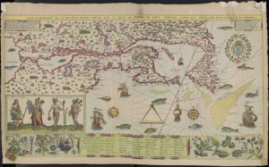
1612, Samuel de Champlain, “Carte geographique de la Nouvelle Franse” – https://oshermaps.org/map/4072
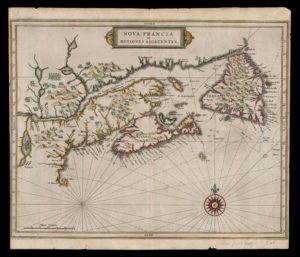
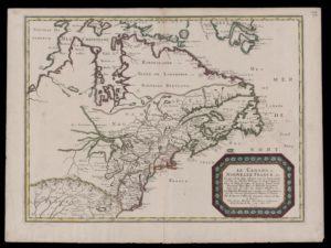
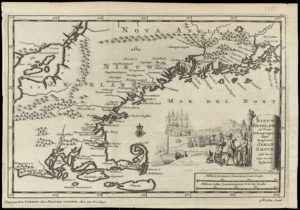
1630, Joannes de Laet, “Nova Francia et Regiones Adiacentes” – https://oshermaps.org/map/43477
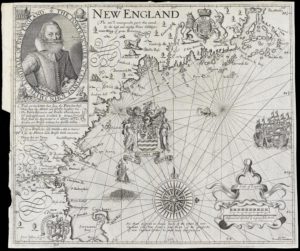
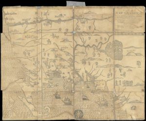
1637, John Smith, “New England” – https://oshermaps.org/map/12548
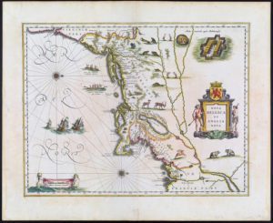
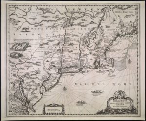
1638, Willem Janszoon Blaeu, “Nova Belgica et Anglia Nova” – https://oshermaps.org/map/408
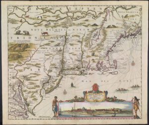
1651, Jan Jansson, “Belgii Novi, Angliae Novae” – https://oshermaps.org/map/437
1656, Nicolas Sanson, “Canada, or New France” – https://oshermaps.org/map/4078
1662, Hugo Allardt, “Niew Amsterdam op’t Eylandt Manhattans” – https://oshermaps.org/map/459.0001
1677, John Foster, “A Map of New-England” – https://oshermaps.org/map/492
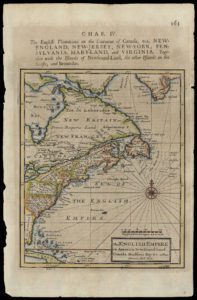
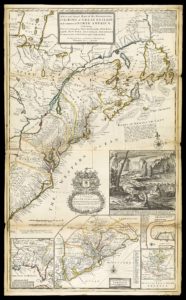
1701, Herman Moll, “The English Empire in America” – https://oshermaps.org/map/2482
1702, Cotton Mather, “Magnalia Christi Americana” – https://oshermaps.org/map/1807.0006
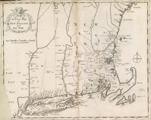
1707, Pieter Van Der Aa, “Nieuw Engeland in Twee Scheeptotgen door Kapitein Johan Smith” – https://oshermaps.org/map/578
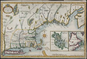
1720, James Clark, “A New Map of New England According to the Latest Observations” – https://oshermaps.org/map/1830
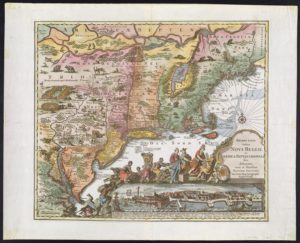
1730, Matthaus Seutter, “Recens Edita totius Novi Belgii in America Septentrionali” – https://oshermaps.org/map/4719
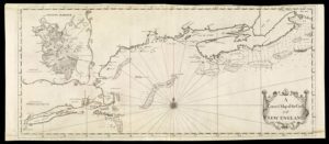
1731, Cyprian Southack, “A Correct Map of the Coast of New England” – https://oshermaps.org/map/629
1732, Herman Moll, “A New and Exact Map of the Dominions of the King of Great Britain on ye Continent of North America” – https://oshermaps.org/map/632
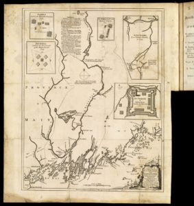
1755, Thomas Johnston, “A Plan of Kennebek and Sagadahok Rivers, with the adjacent Coasts” – https://oshermaps.org/map/7404.0013