
Are you a classroom teacher within the Greater Portland area? We are happy to lend high-quality printed reproductions of this map set at no cost as part of an Activity Kit for use in your classroom. The kit will also include a variety of age-appropriate worksheet activities, answer keys, hands-on craft or game, and all necessary instructions. If within a 30 minute drive from Portland, OML educators will deliver and pick up the activity kit from your school office. Please contact Renee Keul at renee.keul@maine.edu for more information or to reserve this map set. You may also reserve this map set at oshermaps.org/teach/activity-kits
Use these activities and maps of Portland from the Revolutionary War to the beginning of the twentieth century to investigate the destructions, resurrections, and transformations of Maine’s largest city.
In creating this Learn at Home theme, we have tried to make it as customizable as possible so it can be used with a variety of ages and skill sets. The “Independent Use” worksheets can be done apart from the Map Set, and have been created as PDF Forms so they do not need to be printed for your students to complete. The “Map Set” worksheets are also created as PDF Forms and use the maps listed below (or downloadable as a PDF).
Crossword Puzzle (can be used independently)
Portland “Then and Now” Worksheet (can be used independently)
Challenge Questions Sheet (to be used with map set below)
Scavenger Hunt (to be used with map set below)
Portland Discussion Questions (to be used with map set below)
Map Observation and Discussion Activity (to be used with maps below)
Map Research Activity (to be used with map set below)
Primary Source Analysis Tool (to be used with map set below)
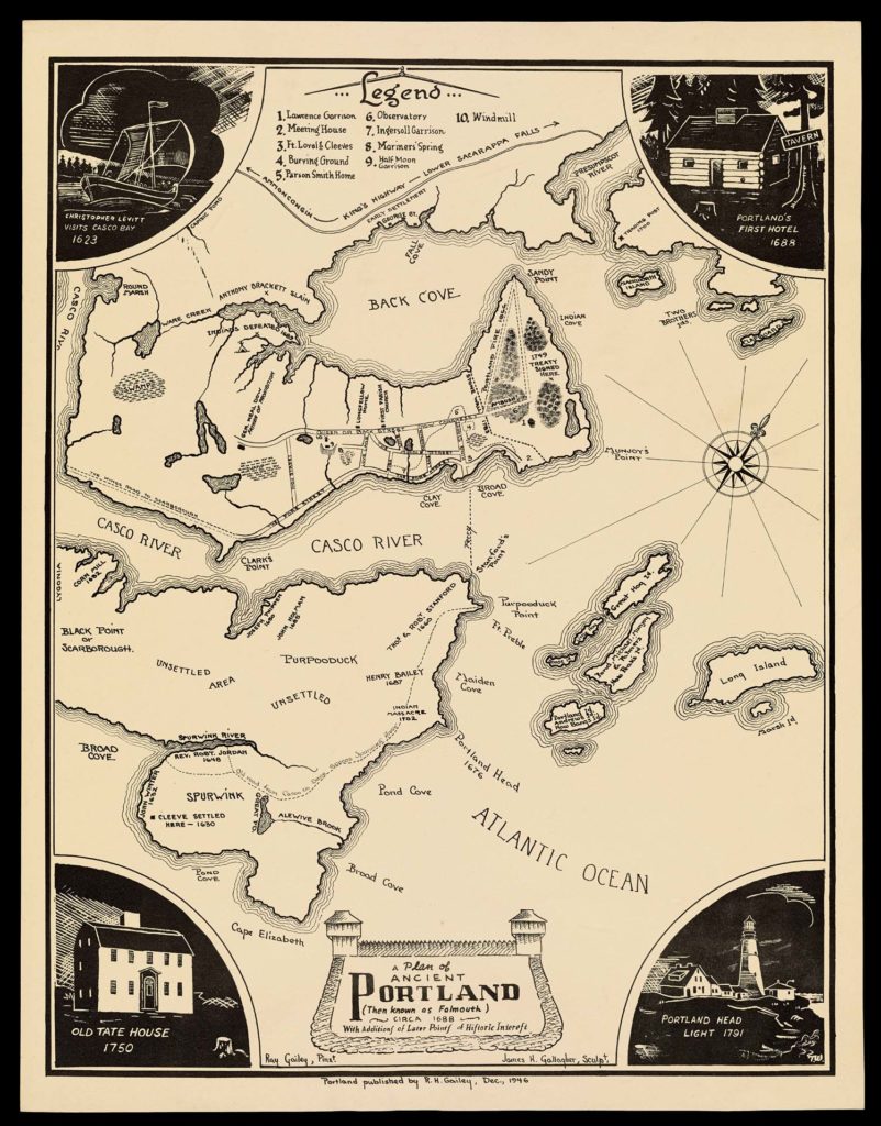
1688 [depicting], 1946, James H. Gallagher, “A Plan of Ancient Portland” – https://oshermaps.org/map/3203
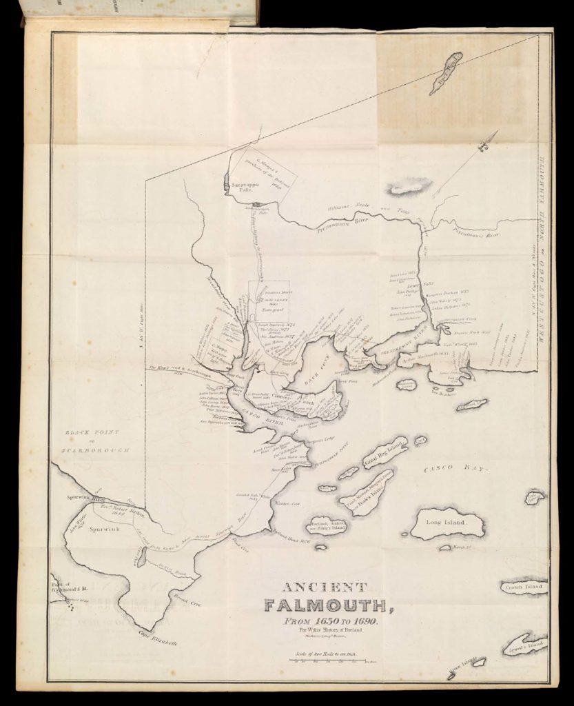
1690 [depicting], 1831, William Willis, “Ancient Falmouth, from 1630 to 1690” – https://oshermaps.org/map/7529.0013
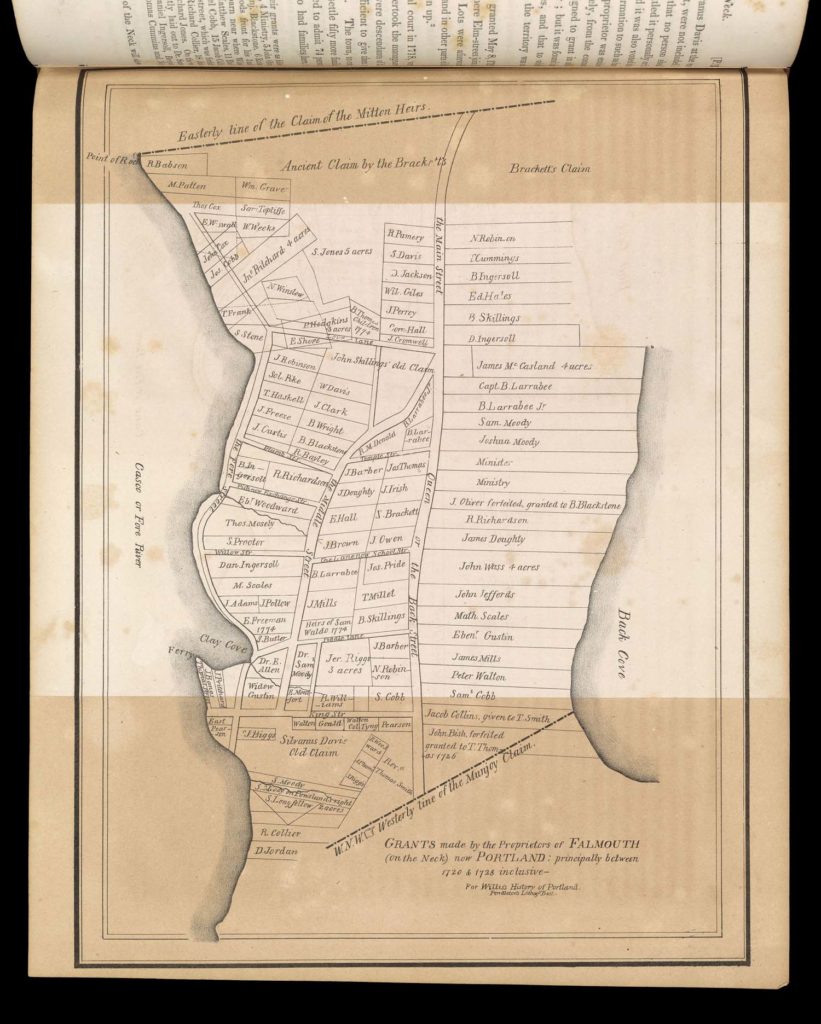
1728 [depicting], 1831, William Willis, “Grants made by the proprietors of Falmouth ” – https://oshermaps.org/map/7529.0284
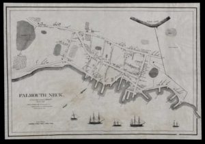
1775 [depicting], 1831, William Willis, “Falmouth Neck, As it was when destroyed by Mowett” – https://oshermaps.org/map/3568
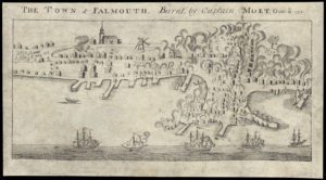
1782, John Norman, “Town of Falmouth burnt by Captain Moet, Octbr. 18th 1775” – https://oshermaps.org/map/43443
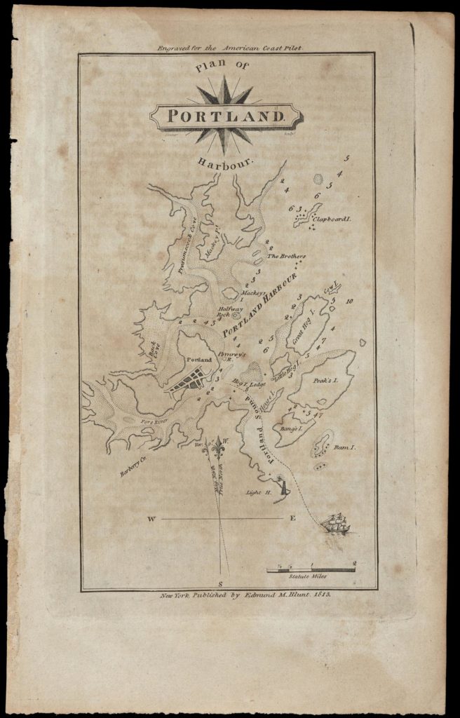
1815, Edmund Blunt, “Plan of Portland Harbour” – https://oshermaps.org/map/928
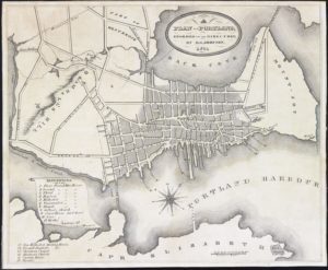
1831, Griffing D. Johnson, “Plan of Portland, Engraved for the Directory” – https://oshermaps.org/map/12023
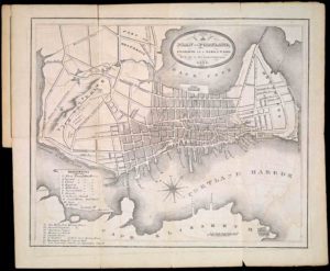
1856, Samuel Hodgson Colesworthy, “Plan of Portland : Engraved as a Directory” – https://oshermaps.org/map/3628
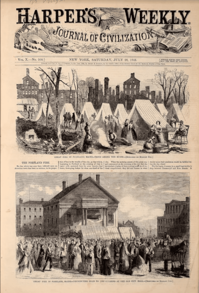
1866, Harper’s Weekly, [frontpage] – https://oshermaps.org/map/42513
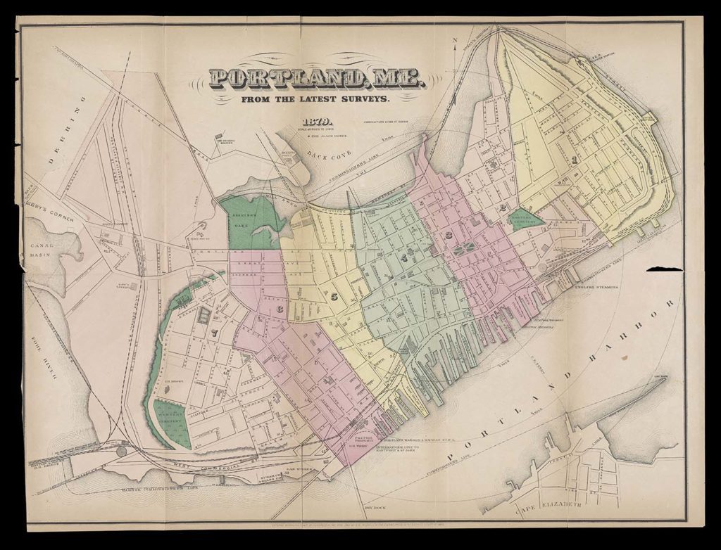
1879, J. Mayer & Co., “Portland, ME From the Latest Surveys” – https://oshermaps.org/map/9947
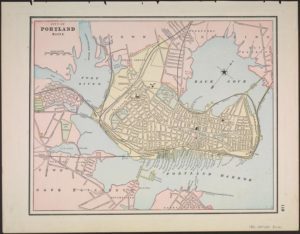
1891, Gaylord Watson, “City of Portland Maine” – https://oshermaps.org/map/1225
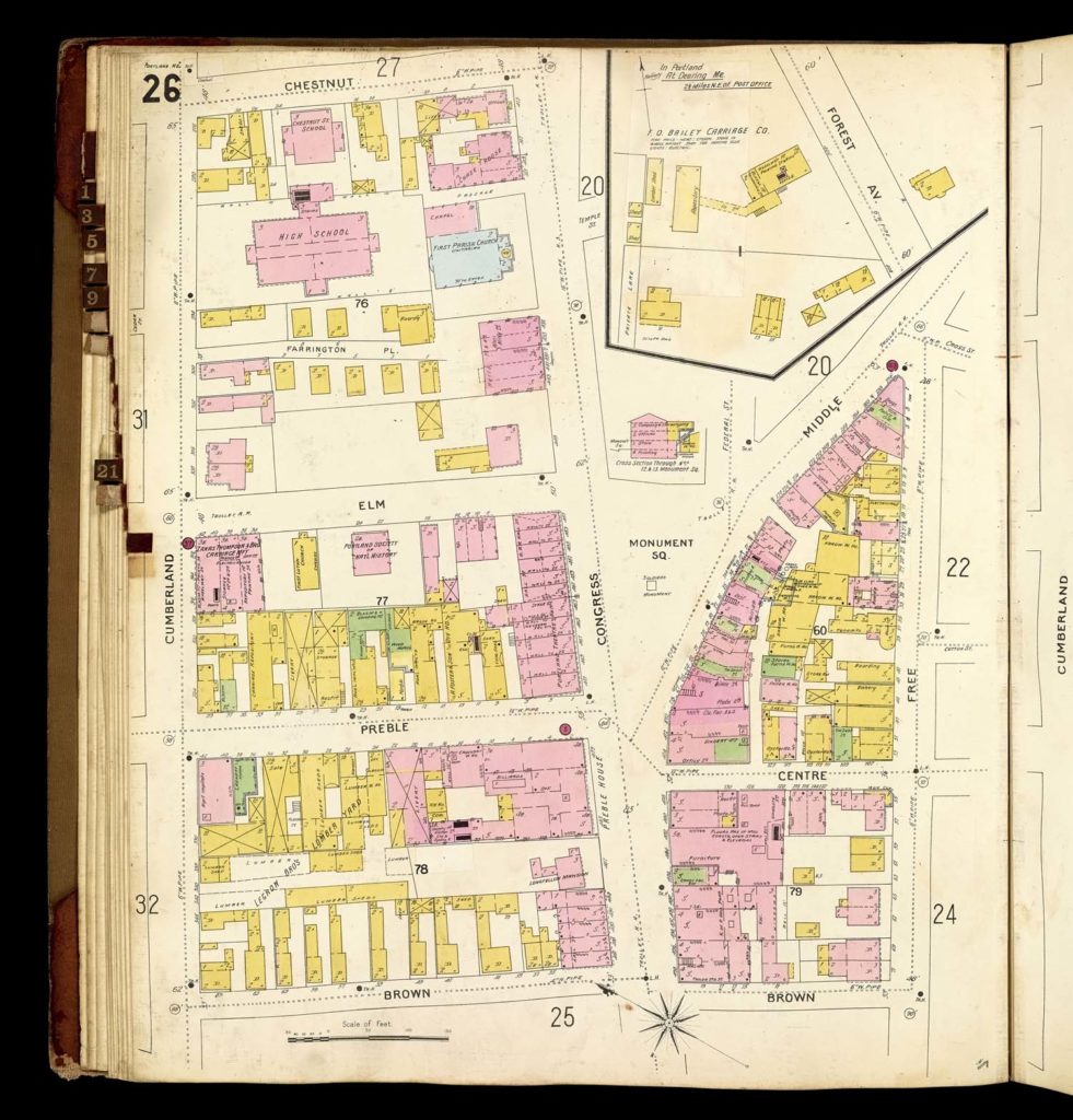
1896, Sanborn-Perris Map Company, “Insurance Maps of Portland, Maine” – https://oshermaps.org/map/11483.0038
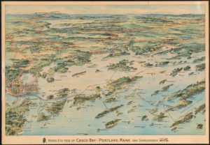
1906, Geo. H. Walker & Co., “Birds Eye View of Casco Bay: Portland, Maine and Surroundings.” – https://oshermaps.org/map/1351
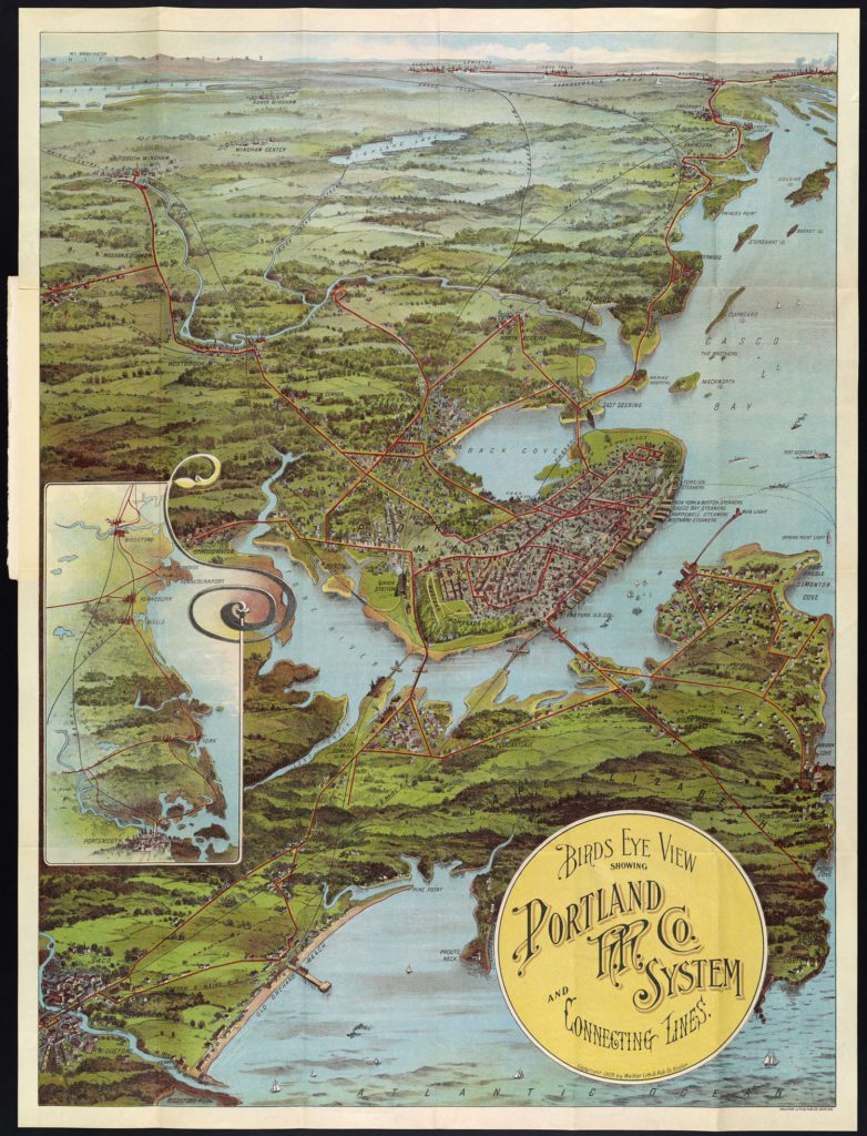
1909, Walker Lith. & Pub Co., “Birds Eye View showing Portland” – https://oshermaps.org/map/1371
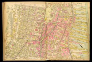
1914, Richards Map Company, “[Plate 1]” – https://oshermaps.org/map/2982.0014C
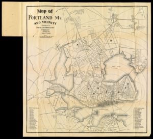
1922, Portland Directory Company, “Map of Portland Me. and Vicinity” – https://oshermaps.org/map/1436
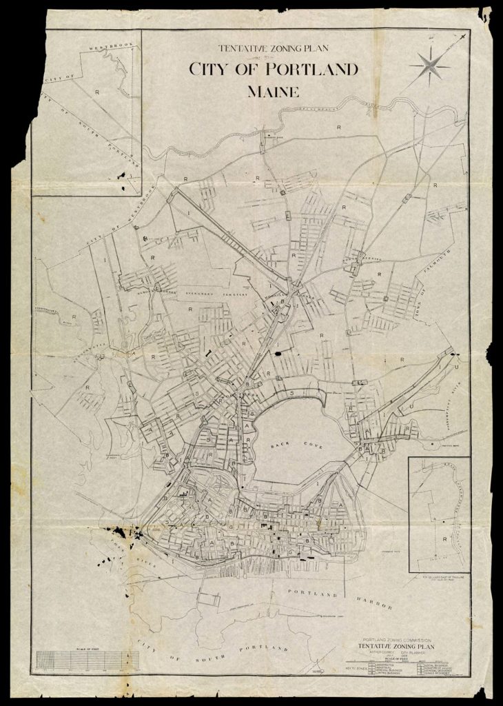
1926, Arthur Coleman Comey, “Tentative Zoning Plan City of Portland Maine” – https://oshermaps.org/map/1452
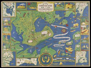
1928, Kathrine Dudley, Portland Bay Hygiene and Child Welfare, “A Map of Portland Maine and some places thereabout” – https://oshermaps.org/map/48086
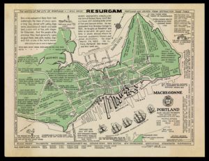
1932, William J. Dow, “Portland also called Falmouth first settled 1632 chartered as a city 1832” – https://oshermaps.org/map/11860
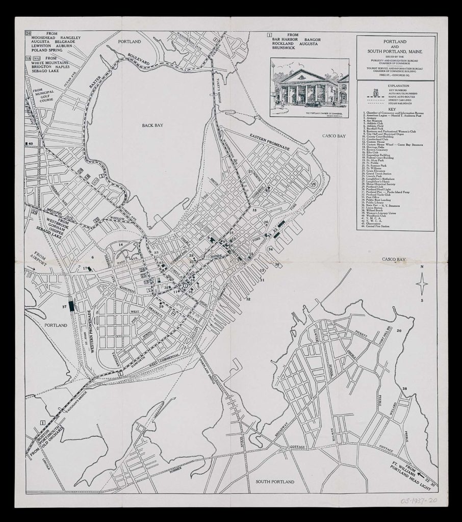
1937, Portland Maine Chamber of Commerce, “Portland and South Portland Maine” – https://oshermaps.org/map/1503