
Section 3a – Moses Greenleaf’s Promotional Work
Moses Greenleaf actively promoted the settlement and economic development of Maine’s interior. In 1806 he began work as the agent for the absentee proprietor of Williamsburg, just north of Sebec and close to the geographical center of the state [see 11–12], and he moved his family to the frontier town in 1812. He augmented his search for resources to exploit (notably slate and iron) by interpreting placenames he learned from the Wabanaki for clues to the physical character of particular places.
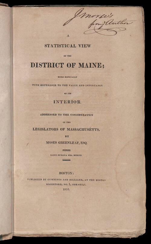
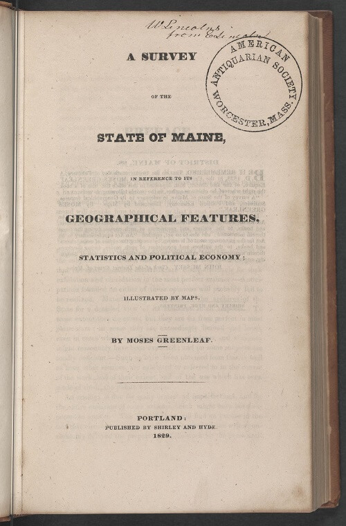
Greenleaf embraced the task of educating others about Maine’s self-sufficiency and economic potential. He not only mapped Maine, he wrote detailed and comprehensive analyses of its population and economy. His 1815 map [11] was accompanied in 1816 by his Statistical View of Maine [16], and his 1829 map [15] by the 1829 Survey of the State of Maine [17].
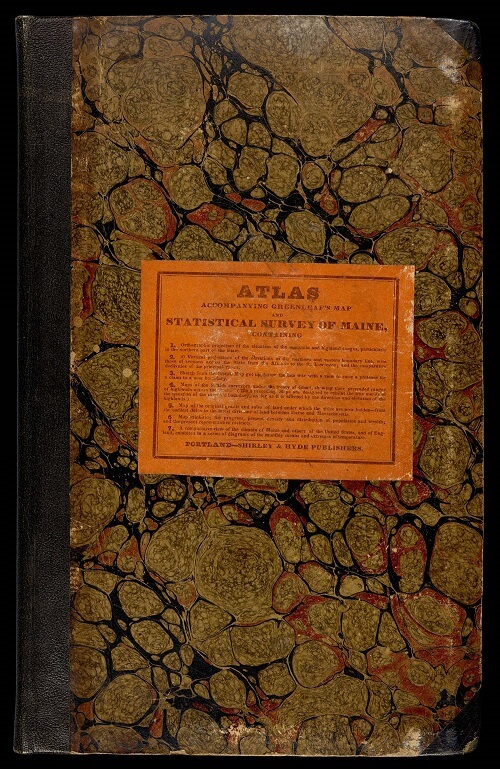
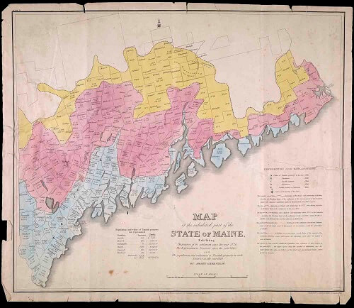
And Greenleaf made a remarkable atlas to accompany the larger map and Survey [18]. The atlas’s seven plates construct a clear argument about the current state and future of Maine. He again mapped Maine’s patents and towns, now categorizing them the granting authority [20]. His map of the history of Maine’s colonization depicted English and American settlement to the Revolution (blue), to 1800 (red), and after 1800 (yellow) [19]. A..E mark the movement of the center of settlement northwards to the star, just above his home in Williamsburg, marking the geometric center of the state, as if to say to readers: look how much land was yet to be colonized!
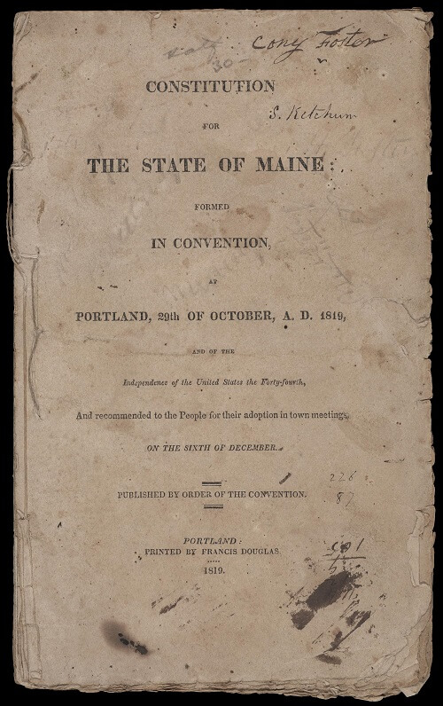
Finally, this case also includes a rare impression of Maine’s constitution from the 1819 convention [15].
15
Constitution for the State of Maine Formed in Convention at Portland, 29th October, A.D. 1819
(Portland: Francis Douglas, 1819).
Letterpress pamphlet, 22 cm
OML Collections, Gift of Rockport Public Library
https://oshermaps.org/map/54061.0001
16
Moses Greenleaf
A Statistical View of the District of Maine, More Especially with Reference to the Value and Importance of Its Interior (Portland, 1816).
Letterpress book, 23 cm
Osher Collection
https://oshermaps.org/map/7473.0001
17
Moses Greenleaf
A Survey of the State of Maine, in Reference to Its Geographical Features, Statistics and Political Economy (Portland, 1829).
Letterpress book, 35 cm
Osher Collection
https://oshermaps.org/map/7522.0001
18
Moses Greenleaf
Atlas Accompanying Greenleaf’s Map and Statistical Survey of Maine (Portland: Shirley & Hyde, 1829).
Atlas of 7 copper plate maps and diagrams, 34 cm
OML Collections, Gift of Harry Pringle in honor of Peggy Osher
https://oshermaps.org/map/45936.0001
19
Moses Greenleaf
Map of the Inhabited Part of the State of Maine, Exhibiting the Progress of Its Settlement since 1778, the Representative Districts since 1820, and the Population and Valuation of Taxable Property in Each District at the Year 1820 (Portland: Shirley & Hyde, 1829).
Hand-colored copper engraving, 49 × 58.5 cm
Osher Collection
https://oshermaps.org/map/11905.0001
20
Moses Greenleaf
Map Exhibiting the Principal Original Grants & Sales of Lands in the State of Maine (Portland: Shirley & Hyde, 1829).
Hand-colored copper engraving, 79 × 59.5 cm
Osher Collection
https://oshermaps.org/map/12857.0001
