Maine’s northern interior was subject to the desires and schemes imposed by American settlers because of its poor definition. The boundary between Maine and Canada was uncertain, the territory extensible and malleable. The reason was that, in 1782, as the Revolutionary war came to an end, American and British diplomats in Paris had acted just like the monarchs of old when they used a map to imagine a distant landscape. They defined a boundary line using geographical features that, inevitably, proved different from how such features looked on the map. In doing so, they ignored the presence of the Wabanaki throughout the region who, for thousands of years, had freely moved about what were now borderlands between the United States and Canada.
First, from the Gulf of Maine, the boundary ran up the St. Croix river, the river where Samuel de Champlain wintered in 1604–5. But which of the rivers flowing into Passamaquoddy Bay was it? The British claimed it was the Schoodic [item 31], the Americans the Magaguadavic (“St. Croix” on 31). The location of the remains of Champlain’s brief settlement in 1798 forced the Americans to accept that the Schoodic was the “true” St. Croix. (Much to the relief of the Loyalists settled by the British at St. Andrews on Passamaquoddy Bay).
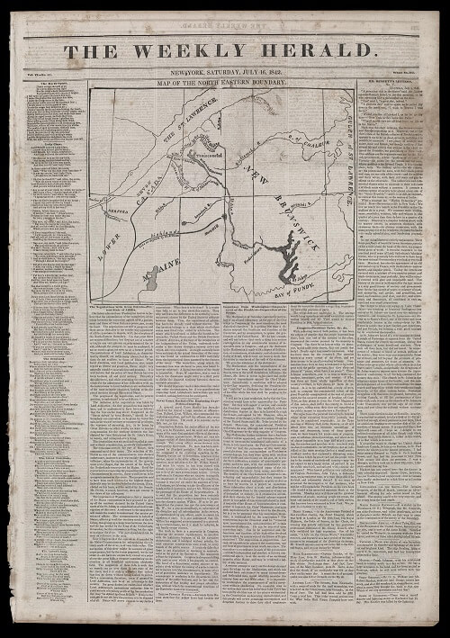
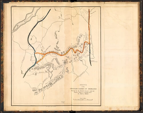
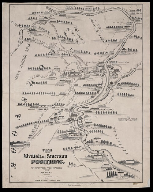
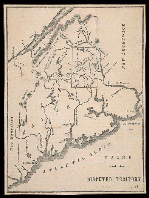
From the source of the St. Croix, the boundary ran north to the “height of land” forming the watershed between the Atlantic and the St. Lawrence. But, as became clear by the 1820s, the watershed was ambiguous, the single height of land “imaginary” [32]. Arbitration by the king of the Netherlands in 1831 failed. Eventually, British and American competition over timberlands almost led to actual war in 1839—the so-called Aroostook War [33, 34]—and finally prompted the acceptance of the compromise line in 1842, settled by the Webster-Ashburton Treaty [35]. The Maine frontier was “closed,” and with it the expansive dreams of interior settlement.
31
Osgood Carleton
Map of the District of Maine Drawn from the Latest Surveys and Other Best Authorities, from James Sullivan, The History of the District of Maine
(Boston: I. Thomas and E. T. Andrews, 1795).
Copper engraving, 52 × 41.5 cm
OML Collections, Gift of Susan K. Hamill
https://oshermaps.org/map/52047.0001

32
Moses Greenleaf
Sketch of the Imaginary Ranges of Highlands Reported by the British Surveyors under the Treaty of Ghent, as Extending across the State of Maine, in Atlas Accompanying Greenleaf’s Map and Statistical Survey of Maine
(Portland: Shirley & Hyde, 1829).
Hand-colored copper engraving, 31 × 27 cm
Osher Collection
https://oshermaps.org/map/3564.0010
33
Nathaniel Dearborn
Plan of the British and American Positions, on the Disputed Territory, by an Eye Witness, engr. Bouvé & Sharp, Boston (Boston, 1843).
Lithograph, 74 × 59 cm
Osher Collection
https://oshermaps.org/map/1024.0001
34
Maine and the Disputed Territory, from Family Magazine 6, no. 2 (1839): 408–11.
Wood engraving with foundry type, 19 × 14 cm
Smith Collection
https://oshermaps.org/map/4689.0001
35
Map of the North Eastern Boundary,
in Weekly Herald 6, no. 43 (16 July 1842).
Wood engraving with foundry type, 20 × 24.5 cm,
on page 57 × 40 cm
Osher Collection
https://oshermaps.org/map/47464.0001