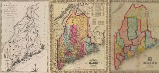

Edward V. Thompson, Guest Curator
Printed Maps of the District and State of Maine, 1793-1860, celebrates Edward V. Thompson’s recent publication of the same title (published by the Nimue Books & Prints in Bangor). This period is very important in the geographic history of Maine and the cartographic history of the United States because it was during this time that Maine’s boundaries were established and the state was organized as a discrete territory (see the timeline). When the first map of Maine was printed in 1793, Maine had only five counties; the sixteenth and last was formed in 1860. The maps published between these two dates reveal the steady increase in people’s geographical knowledge about the state: the location and contours of interior lakes and rivers; the construction of an extensive railroad system; the laying out of new townships; and the expansion of Maine’s ports and mill towns. For the United States, the decades from the ratification of the Constitution to the outbreak of the Civil War witnessed the emergence and maturation of a distinctive cartographic tradition. Printed Maps of Maine displays key examples of the wide variety of works produced, from atlas maps (including a very rare “rolled” atlas), wall maps, pocket maps, and maps from books and newspapers. A wide range of “quality” is evident in the maps on display, from true cartographic masterpieces by some of the greatest U.S. mapmakers to news maps intended to have only a short life.