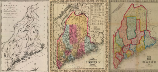

Maine’s northern boundaries — the U.S. northeastern boundary — remained contested after the Revolutionary War. The dispute heated up in the 1830s and led to the military stand-off known as the Aroostook War. The real threat of war led the U.S. and Britain finally to compromise on the boundary in the 1842 Treaty of Washington, better known as the Webster-Ashburton Treaty. As with most political compromises, it was universally despised. The keen interest in the affair generated many maps on both sides of the Atlantic. Most show only the precise scene of the controversy in northern Maine and New Brunswick. But some, such as those included here, featured the entire state. Many of the maps accompanied newspaper or magazine articles and few have survived. Map 24 is known from only one example. Map 25 is an amazingly delicate map, with some fanciful content (such as the roads radiating from Fredericton, New Brunswick) whose original context remains unclear; we know nothing about its maker, Wilber Curtiss. By contrast, we know more about the maker of the equally rare Map 26: state legislator John Deane (1785-1839) took part in the state’s 1838 commission; this posthumous map was perhaps prepared by William Anson (see Map 30).
Maine and the Disputed Teritory
From The Family Magazine [New York] 4 (1839): 305
Wood block with inserted type; 19cm x 16.5cm
Thompson, no. 101 — State I
Wilber Curtiss
Map of the Seat of War Showing the Disputed Territory
Boston: Wilbur Curtiss, [1839] Lithograph; 25cm x 20.5cm
Thompson, no. 103
John G. Deane
Map of the State of Maine … Showing the Boundaries of the State, and Parts of the Adjacent British Provinces
Portland, 1842
Engraving, hand-colored; 84cm x 57cm
Thompson, no. 108 — State II