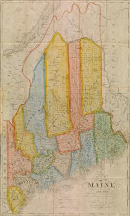
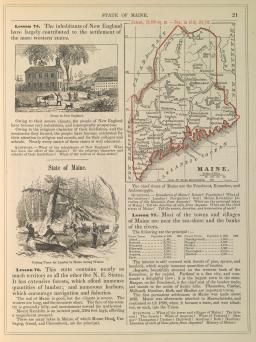
Maine was represented on a wide variety of maps between 1834 and 1852. Vermont-native Lewis Robinson produced a variety of wall maps which he actively marketed throughout New England via peddlers; all, including his map of Maine, are now very rare [map 28]. Mainer William Anson also made maps for the local market, with wall maps that could also be sold as pocket maps; he issued seven variants of his map of Maine between 1837 and 1853 [30]. Of course, the state continued to be shown, often in a rather undistinguished manner, in atlases [29]. Finally, the state began to appear on dedicated maps in a variety of forms intended for grade-schoolers [31-33]. (Map 33 is in the central floor case.)

Lewis Robinson
An Improved Map of Maine
[South Reading, Vt.]: Lewis Robinson & Co., 1835
Engraving, hand-colored; two sheets, 72.5cm x 61cm combined
Thompson, no. 109 — State I

Thomas G. Bradford
Maine
From T. G. Bradford, A Comprehensive Atlas Geographical, Historical & Commercial (Boston, 1835)
Engraving, hand-colored; 25cm x 18.5cm
Thompson, no. 111 — State I
William Anson
Map of Maine
Portland: S. H. Colesworthy, 1853
Engraving, hand-colored; 60cm x 36cm, folding to about 12.5cm x 7.5cm
Thompson, no. 126 — State VII

S. Augustus Mitchell
No. 5.
From Mitchell’s Series of Outline Maps for the Use of Academies and Schools (Philadelphia: S. Augustus Mitchell, [1841])
Lithograph, hand-colored; 69.5cm x 58.5cm
Thompson, no. 128

George W. Fitch
Fitch’s Mapping Card — Plate No. 3
From George W. Fitch, The Youth’s Mapping Book (Brooklyn, 1848)
Lithograph; 11cm x 9cm
Thompson, no 135
Samuel G. Goodrich
Maine
From S. G. Goodrich, A National Geography for Schools (New York, 1850)
Lithograph; 11.5cm x 8cm
Thompson, no. 136