Winslow Homer
[Manuscript pencil drawing of a Map of Great Britain], ca. 1846
Osher Sheet Map Collection
https://oshermaps.org/map/1033
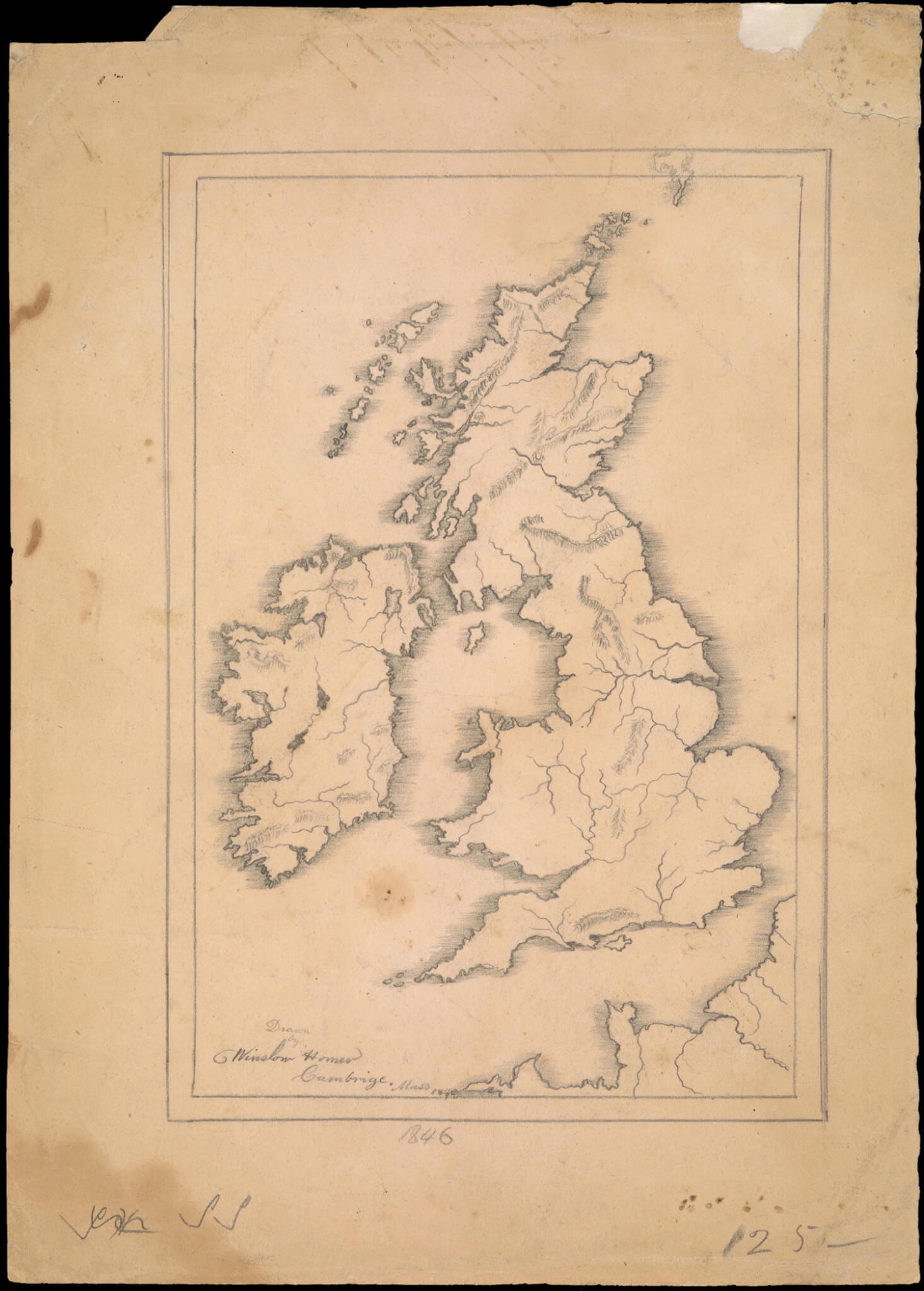
This schoolboy map of Great Britain, rendered in pencil, was drawn by Winslow Homer sometime between 1846 and 1849. While the date under the border reads 1846, the date under the signature appears to be an 1848 changed to 1849. Homer was born in 1836, and so this sketch was done in Cambridge, Massachusetts, sometime between ten and thirteen years of age, making it one of his earliest extant drawings. It is a carefully drawn map, with rivers and mountains indicated, and was once part of a larger notebook, likely containing other maps, a common practice for mid-nineteenth century school children, as is evident elsewhere in the exhibit. Note that the distinctive “W” and “H” in Homer’s signature were already present, even as a young boy. Homer was actively sketching and painting as early as 1846 and 1847; some early examples of his work may be found at the Bowdoin College Museum of Art, gifted by the Homer family.
George H. Babbitt
Map of the Southern States, 1866
Osher Map Library Sheet Map Collection
https://oshermaps.org/map/53265
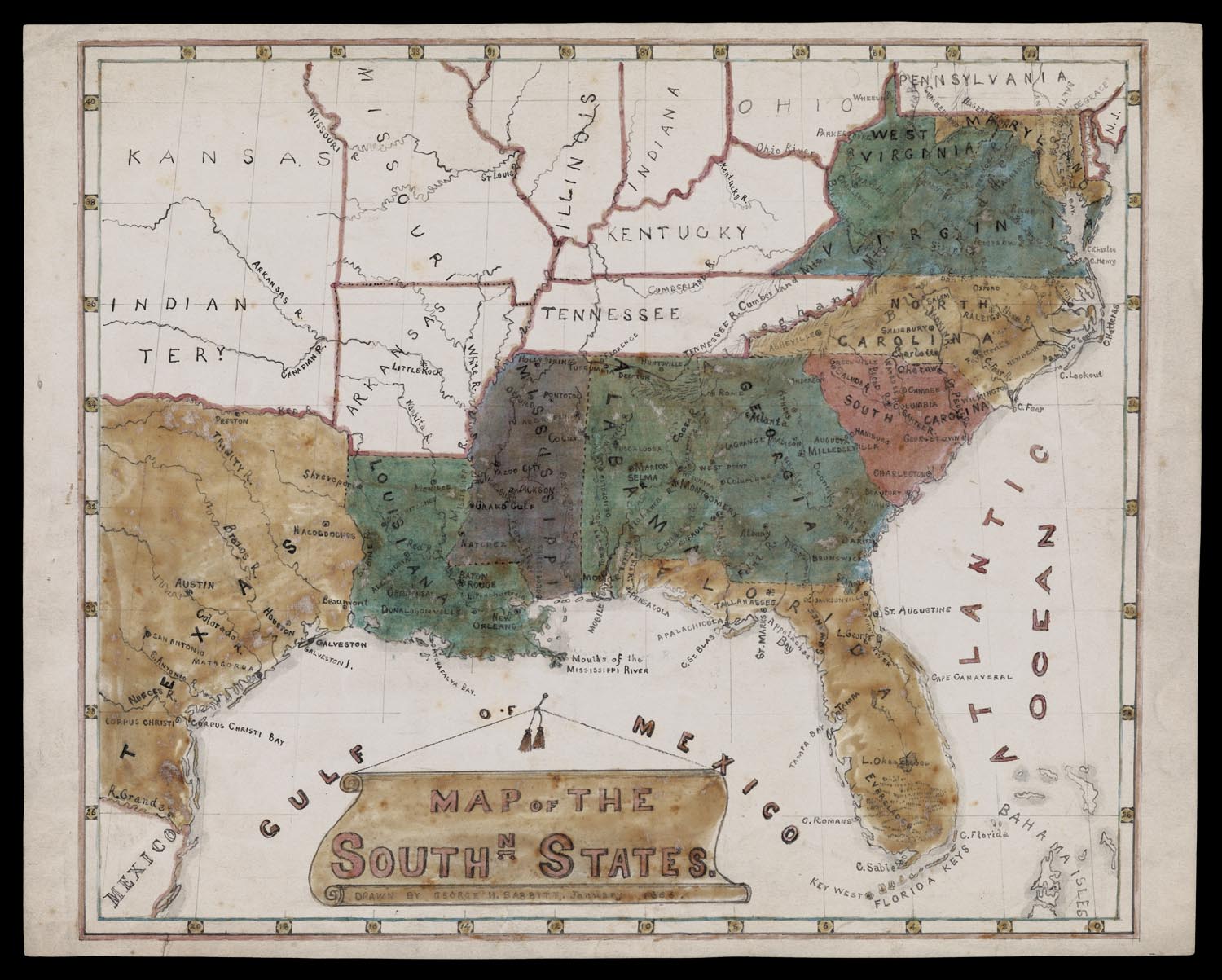
While elaborate schoolgirl maps from the first decades of the nineteenth century are featured prominently in the exhibition, it is important to note that school boys also drew maps. Indeed, as depicted in the case around the corner, map drawing became an important aspect of public school geographic education for boys and girls in the mid to late-nineteenth century.
George H. Babbitt’s map of the Southern States was drawn in 1866, the year following the close of the Civil War. It is interesting that he chose to color in the majority of Confederate states, but has left the border states, Kentucky, Tennessee, Missouri, and Arkansas, also members of the CSA, unshaded, while choosing to shade West Virginia. Given the inclusion of West Virginia, which became a state in 1863, the map he was drawing from was likely published later in the war.
Homer’s and Babbitt’s maps, like many schoolboy maps of the era, are more about the study of geography and the practice of rendering landforms, longitude, and latitude, and less concerned with art, penmanship, and accomplishment. His map is not without flourish, however, as his clever title cartouche depicts a scroll pinned to the wall like a classroom map. A pencil notation on the verso posits that Babbitt later went to Northwestern University and became a newspaper man in Chicago.