Lucia Wadsworth
Lucia Wadsworth Geography Notebook, 1794
Collections of the Maine Historical Society
https://oshermaps.org/map/4000390.0019
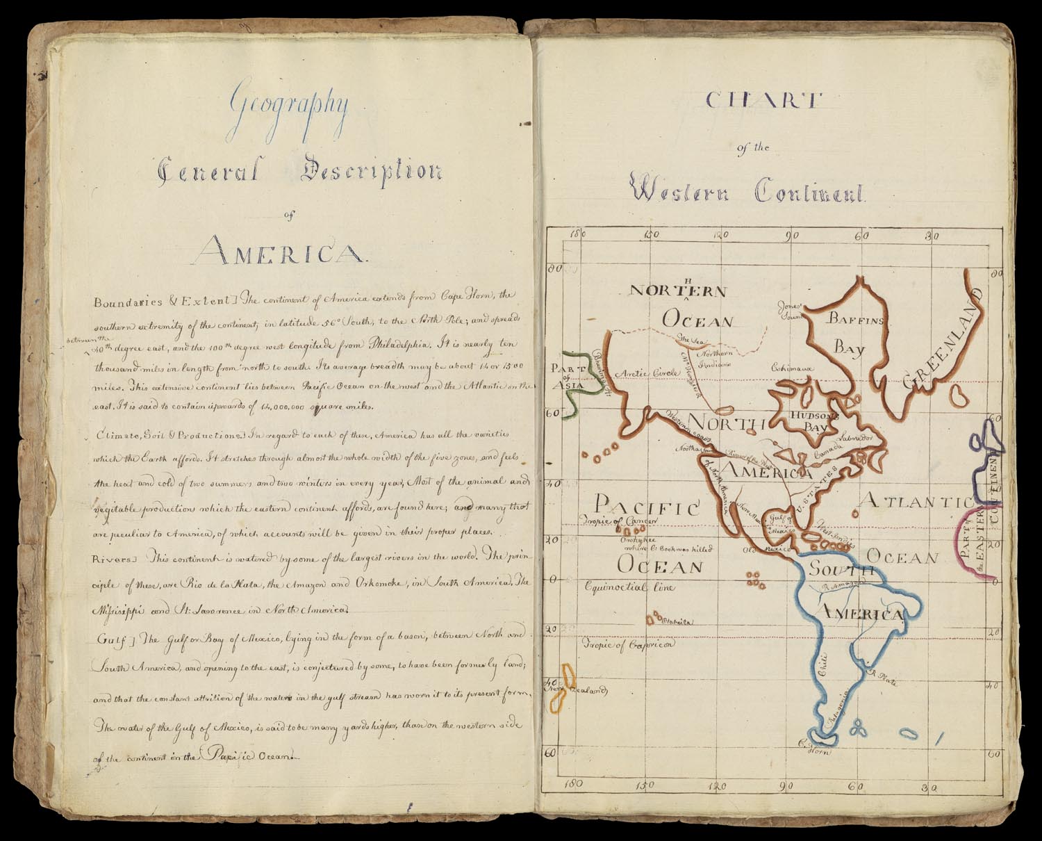
Lucia Wadsworth (1784-1864) was the fifth of Peleg and Elizabeth Bartlett Wadsworth’s ten children. Lucia, who remained single, spent most of her life in the Wadsworth- Longfellow house on Congress Street in Portland, Maine, which her father built in 1785, and is now owned by the Maine Historical Society. Known as “Aunt Lucia,” she lived in the house with her sister and brother-in-law Zilpah and Stephen Longfellow, and assisted in rearing their eight children, including the poet Henry Wadsworth Longfellow. Lucia remained in the house with her niece, Anne Longfellow Pierce, a widow, until her death in 1864.
Lucia Wadsworth’s Geography Notebook, completed in 1794, is the earliest example of schoolgirl mapping included in this exhibition. Wadsworth was only ten years old when she created her geography notebook, and throughout its pages, one can see descriptions and word maps, as well as colorful maps such as this “Chart of the Western Continent.” Like the other school children working through their geography lessons in these notebooks, Wadsworth practiced her penmanship and her spelling. Small spelling corrections, like adding an h to “Northern,” remind us that these maps were learning experiences and works in progress.
Caroline McBurrough
Caroline McBurrough’s Book, ca. 1809
Osher Atlas Collection
https://oshermaps.org/map/12494.0027
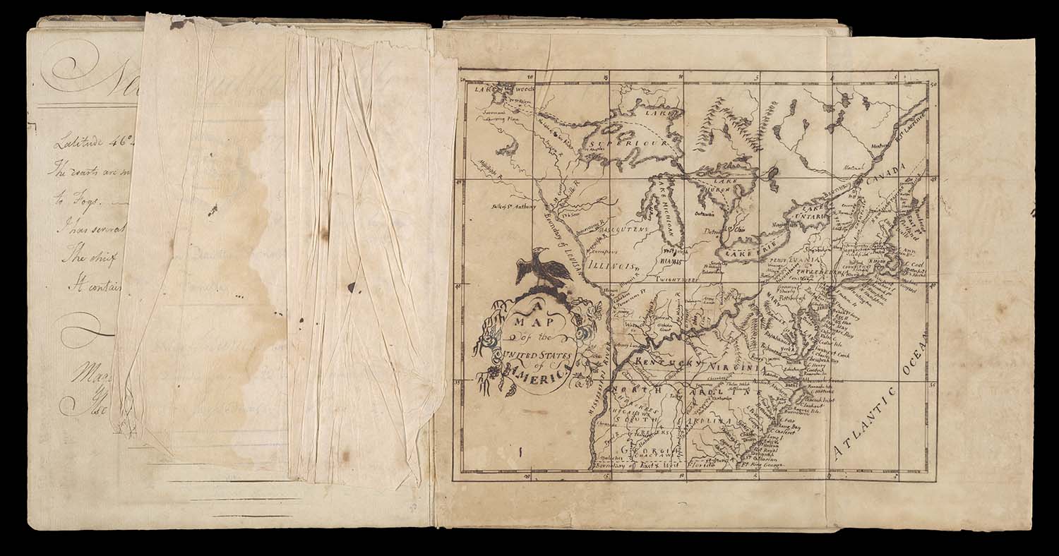
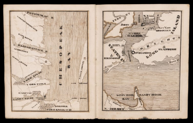
In addition to a lengthy introductory section where Caroline McBurrough copied passages from Scottish minister and University of Edinburgh professor Hugh Blair’s Lectures on Rhetoric and Belles Lettres in an attempt to master composition, she drew eighteen maps throughout her copy book. McBurrough’s maps were derived from Jedidiah Morse’s American Gazeteer, including the one of Massachusetts on display here. Morse, a Connecticut school teacher, was the author of some of the earliest and most widely used geography textbooks in the United States, and thus his work would have been readily available to copy from. McBurrough’s maps are largely concerned with geographic accuracy and place names, and are less ornate and colorful than some of the other copy books featured in this case. She clearly took great pride in her penmanship, which is highlighted in her more than thirty “word maps” introducing her visual maps of various states and territories. These word maps were common in late-eighteenth and early-nineteenth century geography texts, and can be found in each of the copy books and notebooks on display here. The graphic arrangement of statistical, geographic, and historical information about each territory would help students remember what they were learning.
Warren Rowley
Warren Rowley’s Note Book, 1821
Osher Map Library Diary Collection
https://oshermaps.org/map/46923
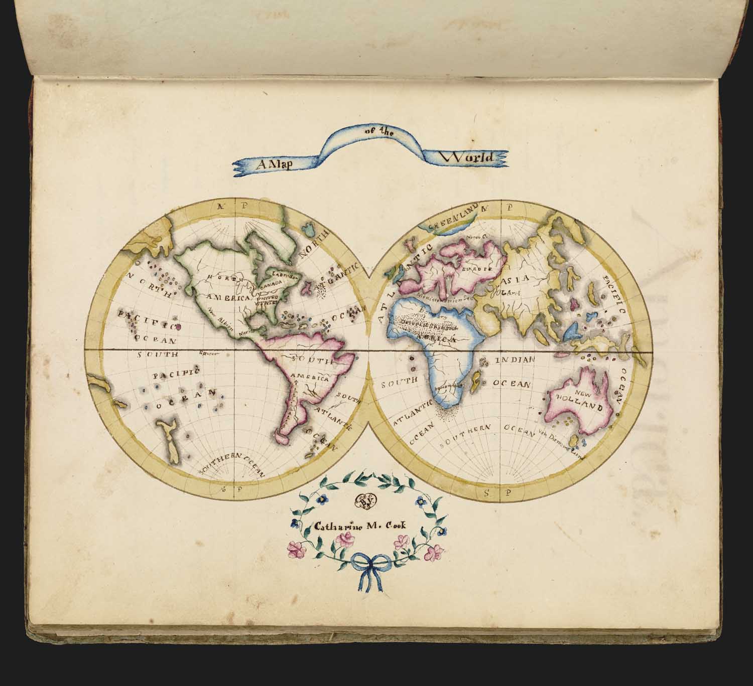
Catharine M. Cook
Catharine M. Cook’s Book of Penmanship, 1818
Osher Atlas Collection
https://oshermaps.org/map/7480.0029
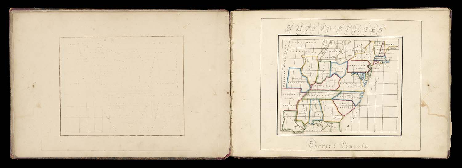
Harriet Lincoln
[Harriet Lincoln Map Sketch Book], ca. 1830
Osher Map Library Atlas Collection
https://oshermaps.org/map/53346.0007
Mary Ann Roorbach
Reward of Merit, 1823
Osher Map Library Ephemera Collection
https://oshermaps.org/map/53776
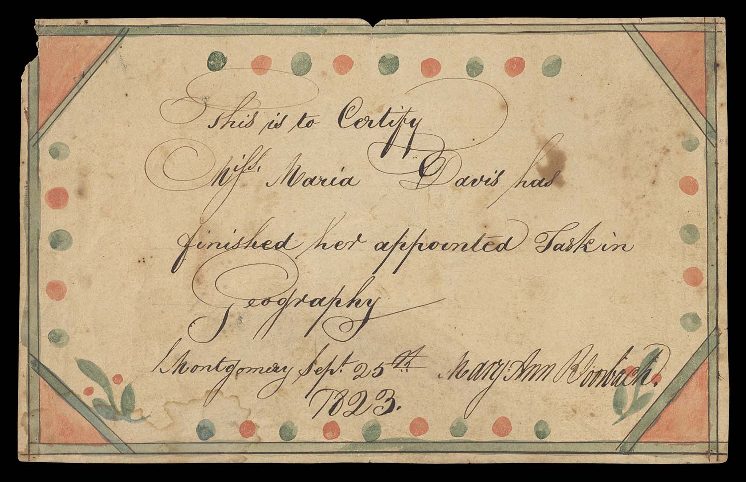
This charming ink and watercolor “Reward of Merit,” was presented to Miss Maria Davis for having “finished her appointed task in Geography” in Montgomery on September 25th, 1823, by her teacher, Mary Ann Roorbach. Although we do not know where this reward was given, it represents the type of certificate that many school children received when they completed important tasks such as the creation of maps and copy books. Many academies and seminaries held end of term exhibitions and recitations that were attended by teachers and local townspeople, who took great pride in the accomplishments of the young students.
Eliza Langdon
[Letter to Reverend Joseph Langdon], ca. 1810
Osher Map Library Ephemera Collection
https://oshermaps.org/map/53792
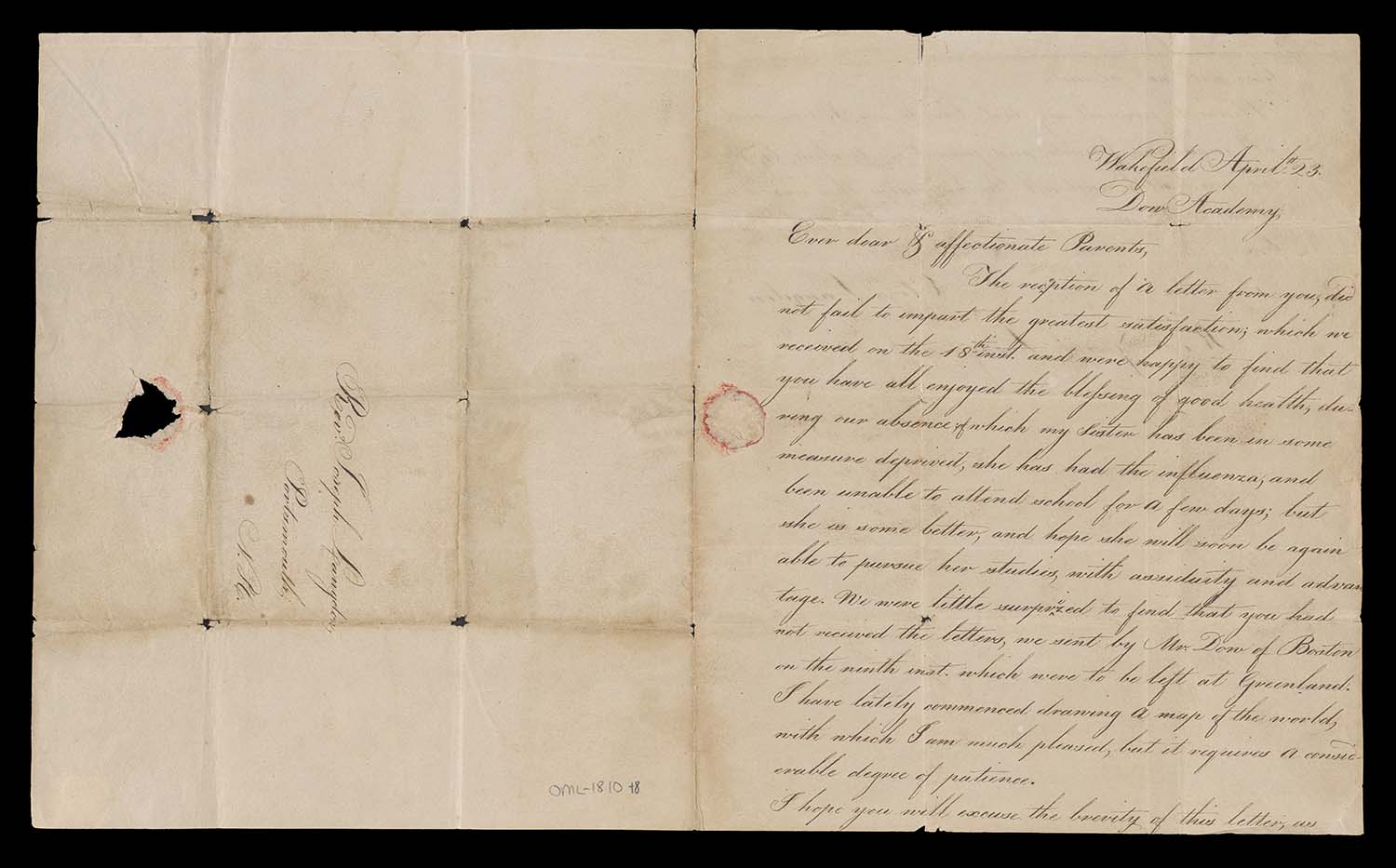
This handwritten letter by Eliza Langdon was sent to her father, the Reverend Joseph Langdon, a minister in Newington, New Hampshire. Eliza attended Dow Academy with her sister Hannah, who she mentions had the “influenza.” Near the bottom of the first page of the letter, she wrote to her father about her attempt at “drawing a map of the world, with which I am much pleased, but it requires a considerable degree of patience.” This letter exemplifies the importance and the ubiquitous nature of map drawing in the curricula of female academies in the early decades of the nineteenth century, and gives modern readers a glimpse into the pride these young women took in their work.