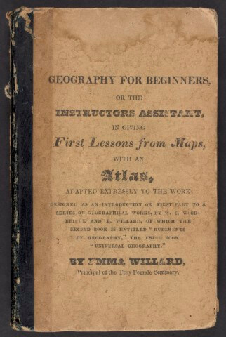
Emma Willard and Oliver Cook
Geography for Beginners, 1826
Smith Collection
https://oshermaps.org/map/2174
Emma Willard
Abridged History of the United States, 1848
Osher Collection
https://oshermaps.org/map/7644

Emma Willard
Abridged History of the United States, 1871
Osher Map Library Collection
https://oshermaps.org/map/3681
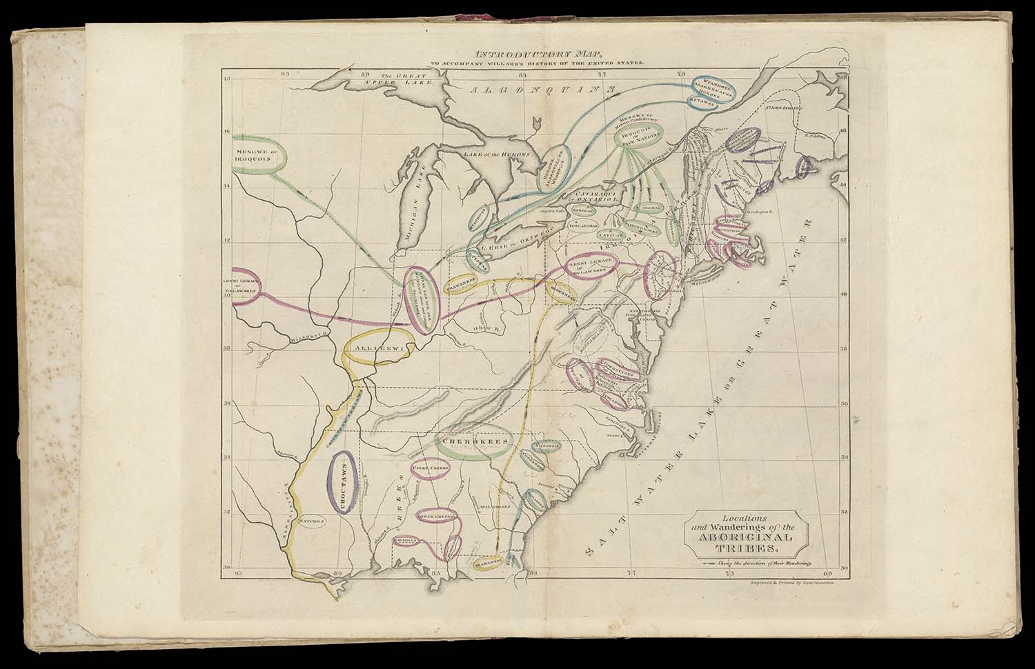
Emma Willard
A Series of Maps to Willard’s History of the United States, 1828
Osher Map Library Collection
https://oshermaps.org/map/52565
Emma Willard, Pioneering Educator of Geography and History
“…in history, I have invented the map.” –Emma Willard, 1848
In the antebellum United States, Emma Willard’s history and geography textbooks would have been as familiar to American educators and school children as Noah Webster’s speller. Born and raised in Connecticut, Emma Hart Willard (1787-1870) was a pioneering educator who founded the influential Troy Female Seminary in New York in 1821. Prior to founding Troy, Willard taught school in Connecticut and Vermont. The Troy Female Seminary provided higher education opportunities for boarding and day students, and by 1831, Willard had enrolled over 300 students. Unlike many female academies of the era, Willard wished to provide her female students with instruction in every academic area, including math and science.
In her 1819 pamphlet Plan for Improving Female Education, Willard wrote:
It is the duty of a government, to do all in its power to promote the present and future prosperity of the nation, over which it is placed. This prosperity will depend on the character of its citizens. The characters of these will be formed by their mothers; and it is through the mothers, that the government can control the characters of its future citizens, to form them such as will ensure their country’s prosperity. If this is the case, then it is the duty of our present legislators to begin now, to form the characters of the next generation, by controlling that of the females, who are to be their mothers, while it is yet with them a season of improvement.
In addition to teaching and advocating for the education of women, Willard became a prolific writer. Willard’s History of the United States, or Republic of America first appeared on the market in 1828, and it was reprinted 53 times before the last edition appeared in 1873, three years after Willard’s death, selling nearly a million copies. The text was marketed to libraries, academies, and common schools around the nation, and brought Willard both fame and fortune.
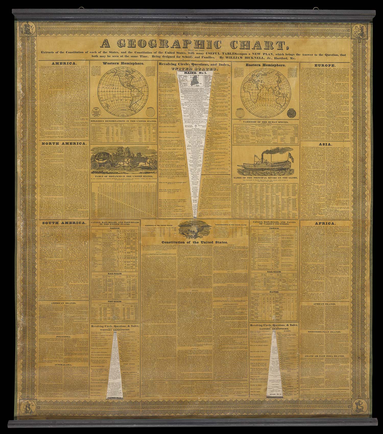
William Bicknell, Jr.
A geographic chart to which are added extracts of the Constitution of each of the states, 1833
Osher Collection
https://oshermaps.org/map/53724
William Bicknell, Jr.
The Constitution of the United States with a summary view of each state in the union, 1834
Osher Collection
https://oshermaps.org/map/13142
William Bicknell, Jr. of Hartford, Maine
The two large pieces on this wall were both completed by William Bicknell, Jr. of Hartford, Maine, within a two-year span, from 1833-34. “Master Bicknell,” as his pupils called him, was a beloved teacher in Hartford and the surrounding communities from 1822, when he began teaching school at the age of 18, until 1870 when he finished teaching his fifty-fifth and final school term.
Bicknell was active in the community, writing for a number of local papers, including the Oxford Democrat, for which he wrote under the nom de plume “Hartford” for over twenty years. He typically wrote of the local happenings for the “Postal Brigade,” but his writings also included a variety of political topics, such as temperance and women’s suffrage.
On the left, “The Constitution of the United States with a Summary View of each State in the Union,” was completed by Bicknell in 1834. The centerpiece of this chart is the entirety of the Constitution of the United States, with its (then) twelve amendments. Along the edges are small maps of each state in the union, as well as a brief history of each state. As was typical in the antebellum United States, Bicknell acknowledged the unique qualities of the individual states in the larger context of the Union. On the right, his large Geographic Chart features three wedge-shaped cutouts and three volvelles (mounted behind the chart by fasteners). The volvelles, once attached to the back of the chart, can be rotated to reveal different “wedges” of information. These facts correspond to the list of questions flanking the cutouts. This format allowed the user to quiz others or test their own knowledge. At the bottom of the chart, Bicknell noted that his invention “may be hung up in the school-room, the sitting-room of the family, the office, or the work-shop; and while it may be used for the daily instruction of the young in one of the most useful of the sciences, a single look will enable persons of all ages and classes to fix some important fact in the mind.”
Bicknell’s charts provide an interesting window into the life of a Maine teacher during this time. Until the establishment of the Maine Board of Education in 1846, and the Teacher’s Institutes in 1847, teachers in Maine were provided with little to no formal training before stepping into a schoolroom. Nevertheless, many Maine teachers were able to use their creativity and drive to create engaging and successful classrooms, and to share their techniques with teachers around the state and region.