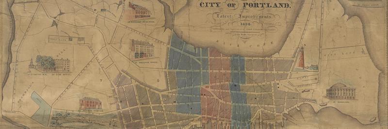

This special, online exhibition offers a history of the printed urban maps of Portland, Maine, from the early nineteenth century to the great fire of July 4th, 1866. It is a history of how Portland was construed as a distinctive urban place, as a moral center of commerce, as a victim of perfidy, and as a site of remarkable and repeated rebirth and growth. In many respects, the story it tells is unique: as with any other city, the mapping of Portland has shared in and indeed has helped to create the city’s exceptional character. In other ways, the story is rather generic: the kinds of pressures to map the city were felt in many other cities in the antebellum U.S. This combination of the individual with the general permits us to see, in some detail, how mapping practices can create and cement a sense of community.
Matthew H. Edney
Osher Professor in the History of Cartography, University of Southern Maine
1 July 2017
Cite this Page
Edney, Matthew H. “References to the Fore! Local Boosters, Historians, and Engineers Map Antebellum Portland, Maine.” www.oshermaps.org/special-map-exhibit/references-to-the-fore. Published online, 1 July 2017.