
| date | map | section | author, title | archive |
|---|---|---|---|---|
| 1761 | sec. 1 | Small, map of Maine [manuscript] | OML | |
| 1781 | sec. 1 | Holland, [chart of Falmouth Harbour] | OML | |
| 1782 | sec. 2 | Town of Falmouth, Burnt by Captain Moet | OML | |
| 1815 ca | 1 | sec. 3 | Barnes, Plan of Portland | Harvard |
| 1823 | 2.1 | sec. 3 | Bowen, New and Correct Plan of Portland [variant 1] | MHS |
| 1823 | 2.2 | sec. 4 | Bowen, New and Correct Plan of Portland [variant 2] | MHS |
| 1826 | 3 | sec. 3 | Moody, “Portland” [manuscript] | MHS |
| 1827 | 4.1 | sec. 4 | Johnson, Plan of Portland [variant 1] | Harvard |
| 1828 | sec. 1 | Moody, Chart of Portland Harbour and Islands | OML | |
| 1831 | 4.2 | sec. 4 | Johnson, A Plan of Portland [variant 2] | OML |
| 1833 | 6 | sec. 6 | Falmouth Neck | OML |
| 1833 | sec. 7 | Poole, Map of Portland Harbor | OML | |
| 1834 | 4.3 | sec. 4 | Johnson, A Plan of Portland [variant 3] | OML |
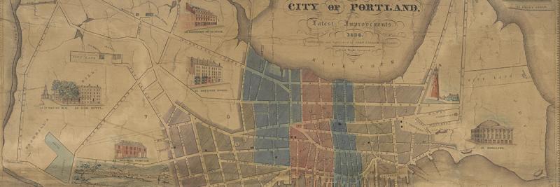
| 1836 | 5 | sec. 5 | Cullum, Map of the City of Portland | OML |
| 1837 | 10 | sec. 7 | Hall, Plan of the City of Portland | MHS |
| 1838 | sec. 1 | Longfellow, “Plan of a Lot of Land” manuscript | MHS | |
| 1846 | 4.4 | sec. 4 | Colesworthy, A Plan of Portland [variant 4] | Rumsey |
| 1847 | 4.5 | sec. 4 | Colesworthy, A Plan of Portland [variant 5] | OML |
| 1849 | 7 | sec. 6 | Falmouth Neck | OML |
| 1850 | 4.6 | sec. 4 | Colesworthy, A Plan of Portland [variant 6] | OML |
| 1850 circa | 8 | sec. 6 | Falmouth Neck | MHS |
| 1851 | 11 | sec. 7 | Walling, Map of the City of Portland | Rumsey |
| 1852 | 4.7 | sec. 4 | Colesworthy, A Plan of Portland [variant 7] | OML |
| 1856 | 4.8 | sec. 4 | Colesworthy, A Plan of Portland [variant 8] | OML |
| 1857 | 12.1 | sec. 7 | Chace, Plan of Portland, detail on Map of Cumberland County | OML |
| 1858 | 12.2 | sec. 7 | Chace, Plan of Portland, | MHS |
| 1858 | 13 | sec. 7 | Bufford, Plan of Portland | MHS |
| 1863 | 14 | sec. 7 | Plan of Portland | OML |
| 1865 | 9 | sec. 6 | Falmouth Neck | MHS |
| 1866 | 15.1 | sec. 7 | Bufford, Plan of Portland / Great Fire at Portland [variant 1] | MHS |
| 1866 | 15.2 | sec. 7 | Bufford, Plan of Portland [variant 2] | OML |
| 1883 | sec. 6 | Edwards after Moody, “Plan of Falmouth now Portland” [manuscript] | MHS | |
| 1885 | sec. 6 | Fernald, Plan of Falmouth Neck, Now Portland, 1690 | OML |
Cite this Page
Edney, Matthew H. “Chronological Listing of Maps of Portland, Maine, Featured in this Exhibition.” In “References to the Fore! Local Boosters, Historians, and Engineers Map Antebellum Portland, Maine.” www.oshermaps.org/special-map-exhibit/references-to-the-fore. Published online, 1 July 2017.