33. Kuthing Swatow Co., 1895
[Teacup Globe]
Smith Collection: SM-1895-34
www.oshermaps.org/map/2353.0001
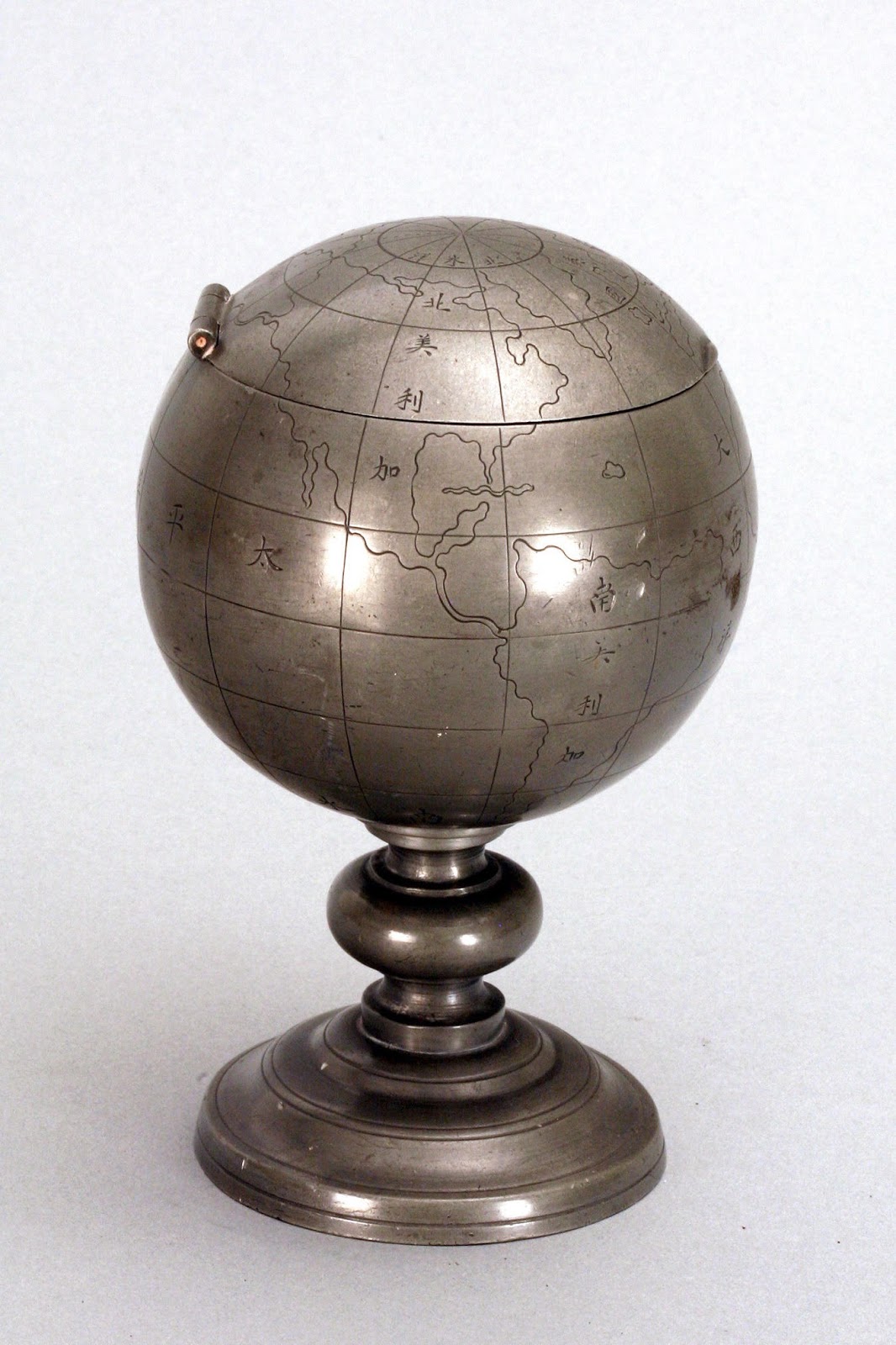
This Chinese pewter globe (#33), made in 1895, is a terrestrial globe that lacks much accuracy but makes a great collector’s piece. The Chinese characters on the globe label major countries, bodies of water, and continents.
The globe has a hinged lid that opens to a hollow column in the middle of the globe. Inside is a removable lidded container, also made of pewter.
This globe was originally made by the Kuthing Swatow Co. as one piece of a complete tea set. Each piece of the tea set was contained inside globes like this one. The globes contained lidded containers, cups, and even a tiny functional teapot.
EXHIBIT NAVIGATION
Section Display, left
Section Display, right
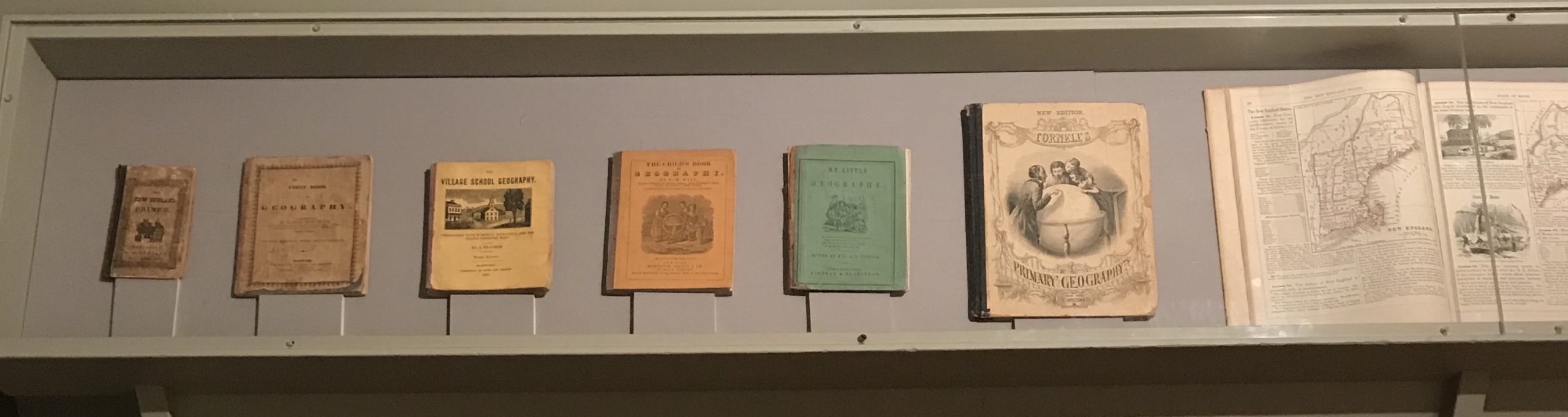
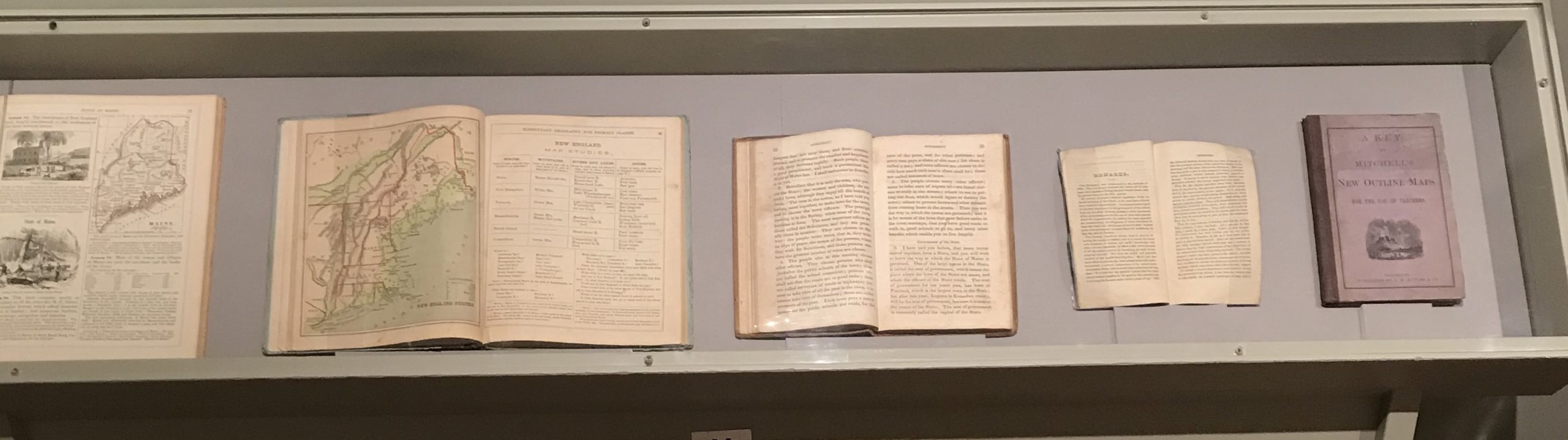
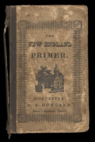
S.A. Howland
The New England Primer: Containing the Assembly’s Catechism; the Account of the Burning of John Rogers, 1844
Osher Map Library Atlas Collection
https://oshermaps.org/map/53775
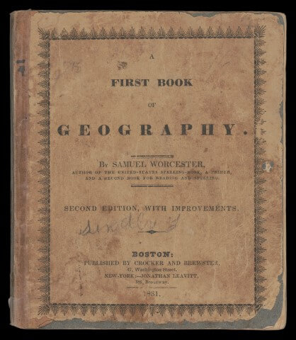
Samuel Worcester
A First Book of Geography, 1831
Osher Book Collection
https://oshermaps.org/map/3569
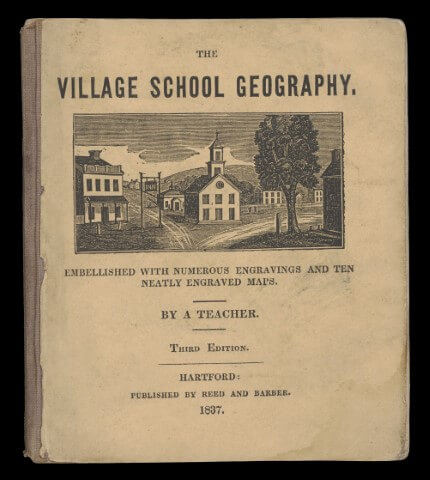
Oliver G. Steele
The Village School Geography, 1837
Smith Atlas Collection
https://oshermaps.org/map/2203
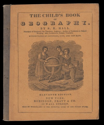
Samuel Read Hall
The Child’s Book of Geography, 1840
Smith Book Collection
https://oshermaps.org/map/2209
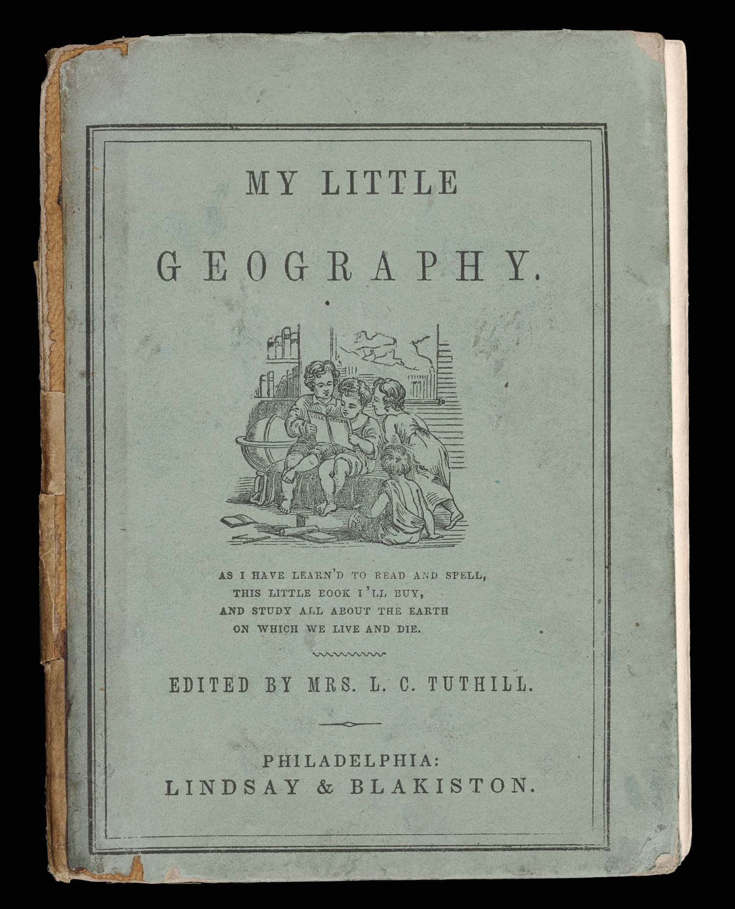
Louisa Caroline Tuthill
My Little Geography, 1847
Smith Atlas Collection
https://oshermaps.org/map/2216
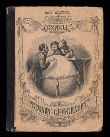
Sarah Sophia Cornell
Cornell’s Primary Geography, 1871
Osher Book Collection
https://oshermaps.org/map/3679
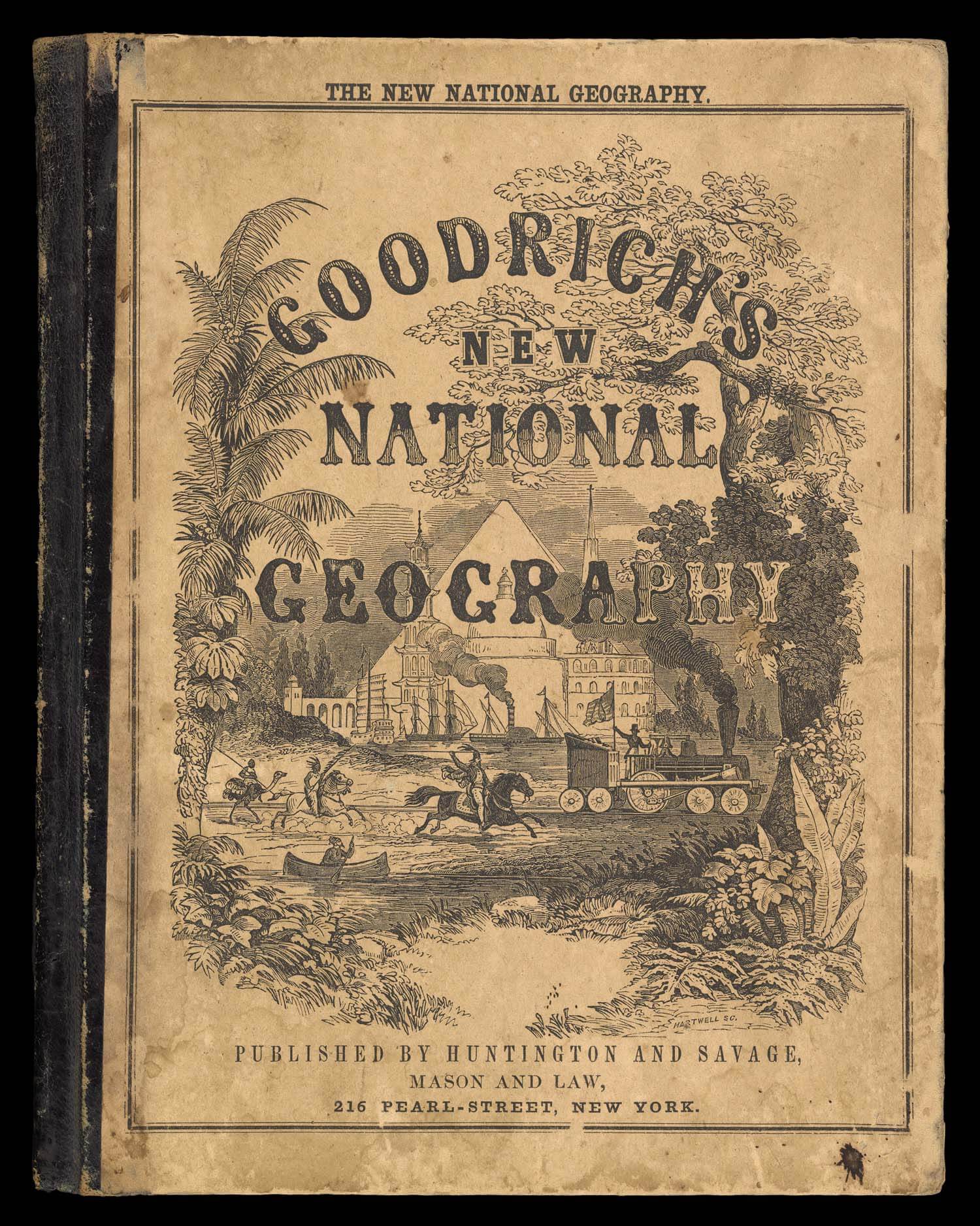
Samuel Griswold Goodrich
A National Geography, for Schools, 1850
Osher Atlas Collection
https://oshermaps.org/map/7654
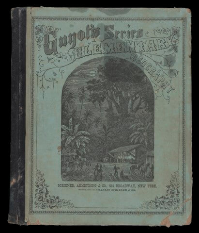
Arnold Guyot
Elementary Geography for Primary Classes, 1872
Osher Book Collection
https://oshermaps.org/map/3682
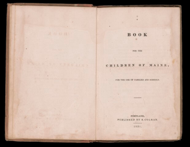
Samuel Colman
A Book for the Children of Maine, 1831
Osher Map Library Book Collection
https://oshermaps.org/map/47456
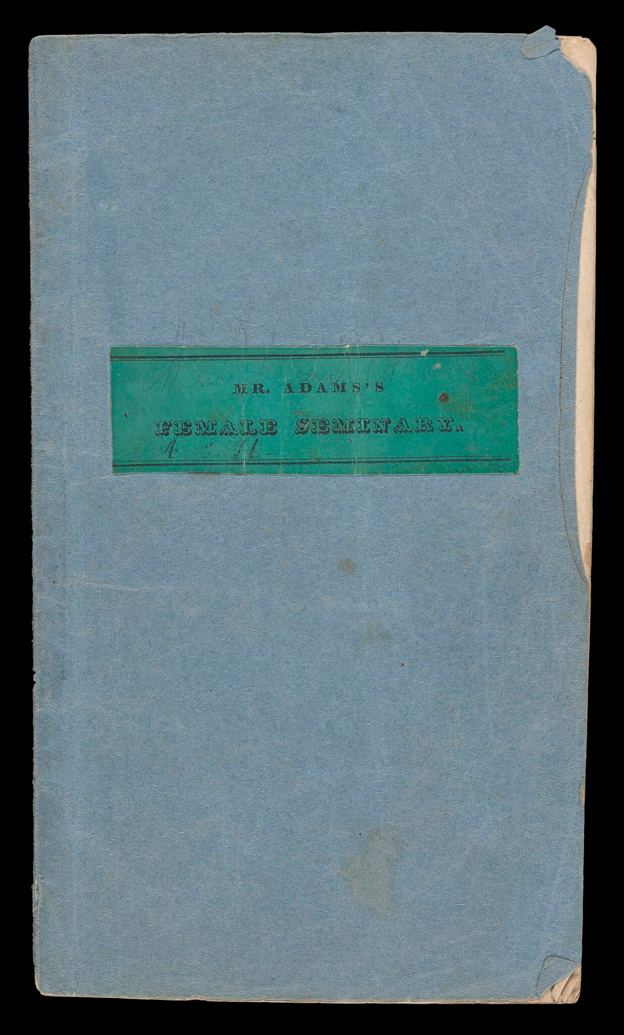
Mr. Adams’ Seminary for Females
Catalogue of the Members of Mr. Adams’ Seminary for Females, 1834
Osher Map Library Atlas Collection
https://oshermaps.org/map/53774
S. Augustus Mitchell
A Key to Mitchell’s New Outline Maps, 1875
Osher Map Library Book Collection
https://oshermaps.org/map/53754
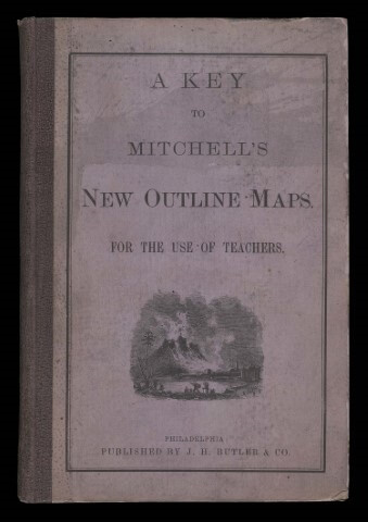
EXHIBIT NAVIGATION
Resources
Maps of Maine
See More- Sanborn Maps of Maine from the Fogler Library at the University of Maine at Orono
- Maps at the Maine Cultural Building – from the Collections of the Maine State Library and the Maine State Archive
- Library of Congress maps of Maine
- Maine Historical Maps
- Part of mainegenealogy.net this search engine allows you to search through 3,997 historical maps from 11 depositories (including ours!)
Other Collections
If you are looking for a map from a particular area, the best bet is to try a collection from that area.
Within the U.S. (organized by state)If the collection has a digital database or part of its collections available online, the link will be posted below the name.
Arizona
- David Rumsey Map Center at the Stanford University Library
- The Huntington Map Collection
- UC Berkeley Earth Sciences and Map Library
- UCLA’s Henry J. Bruman Map Collection
- UC Santa Barbara
- UCONN Map and Geographic Information Center (MAGIC)
- Yale University Library Map Collection at the Beinecke Library
- The Touchton Map Library at the Tampa Bay History Center
- University of Florida Map & Imagery Library
- Newberry Library Map Collection
- University of Chicago Library Map Collection
- University of Illinois at Urbana-Champaign Map Library
Iowa
Minnesota
- Mary B. Ansari Map Library at the University of Nevada, Reno
- University of Nevada, Las Vegas
Oregon
Pennsylvania
Rhode Island
- Perry Castaneda Library Map Collection at the University of Texas
- Online collection available at link above
- Virginia Garrett Cartographic History Library at the University of Texas Arlington Libraries Special Collections
International Collections
British Library Digitized Collection of Maps
List of UK Map Collections from the British Cartographic Society
Online Resources
Interactive Map Servers (IMS)
Exploring Historical Maps with IMS- Atlascope
- The Atlascope project brings nearly 100 atlases of Boston and its surroundings into a seamless digital interface.
- Land Catalog
- An online application through the Bureau of Land Management that lets the public search for Patents, Surveys, Land Status Records, etc.
- Mapping Inequality
- Interactive maps looking at redlining practices
- NYPL Building Inspector
- “This app is the latest in a series of public-facing tools designed by The New York Public Library Labs to extract, correct and analyze data from historical maps.”
- NYPL Map Warper
- “The NYPL Map Warper is a tool for digitally aligning (“rectifying”) historical maps from the NYPL’s collections to match today’s precise maps.”
- USGS mapView
- Discover geologic maps through the interactive map database.
- USGS topoView
- Search for topographic maps by using this interactive map database.
MIY- Map it Yourself
Mapping Historical Events
- Battle of Gettysburg Storymap
- A Storymap taking the user through a timeline of the battle and the important locations from it.
- Border Land: The Struggle for Texas, 1820-1879
- “This project maps sites of conflict between Native Americans and Euro-Americans in Texas from the creation of the First Mexican Republic to the outbreak of the U.S.-Mexico War (1821-1846).”
- Mapping History at the University of Oregon
- Bureau of Land Management Weekly Story Maps
Mapping Indigenous Nations, territories, treaties, and languages
- Native Land
- “Native Land is a tool that maps out Indigenous territories, treaties, and languages. This tool is not meant to be an official, legal, or archival resource. It is instead a broadly researched and crowdsourced body of information.”
- Whose Land
- “Whose Land is a web-based app that uses GIS technology to assist users in identifying Indigenous Nations, territories, and Indigenous communities across Canada.”
Mapping Information and Data
- Climate Maps at NOAA –
- GIS at the Center for Disease Control
- Health Map –
- US Census Bureau Maps – Scroll down the page to Maps and Visualizations
Map Collections Online
Many map collections have some of their collection digitized and available online. Many of the collections listed above have additional links to their digital collections. The links below are more general, or highly recommended.
- Bureau of Land Management from the U.S. Department of the Interior
- Library of Congress Online Map Collections
- National Geologic Map Database –
- Old Maps Online – This site can be particularly helpful if you are looking for a map of a particular place. You can set the search for the area you are looking for and narrow it down by time frame as well.
- USGS Topographic Maps
Cartographic and Geographic Reference Resources
GIS Resources
- Cornell Libraries – Links to GIS Data & Maps
- Cornell Libraries – Links to GIS Resources
- Links to general GIS resources from the Cornell Libraries website
- NYU Spatial Data Repository –
Section 4. Games: Modern Trains
EXHIBIT NAVIGATION
1. Railroads in Maine
2. Railroads in Portland
3. Tourism and Railroads
4. Games: Modern Trains
5. Maps and Objects
6. Games: Older Train Imagery
7. Miscellaneous
Most of the board games here represent the advancement of riding the rails: fast, comfortable and streamlined. Names like “Silver Streak” and “Rocket” conjured up speed. “Sunset Limited” and “The 20th Century Limited” had this type of designation because they were overnight trains with few stops along the way which was an advantage for a business traveler.

Milton Bradley Co., The Streamline Express Game, 1936.
Osher Artifact Collection.
www.oshermaps.org/map/36886
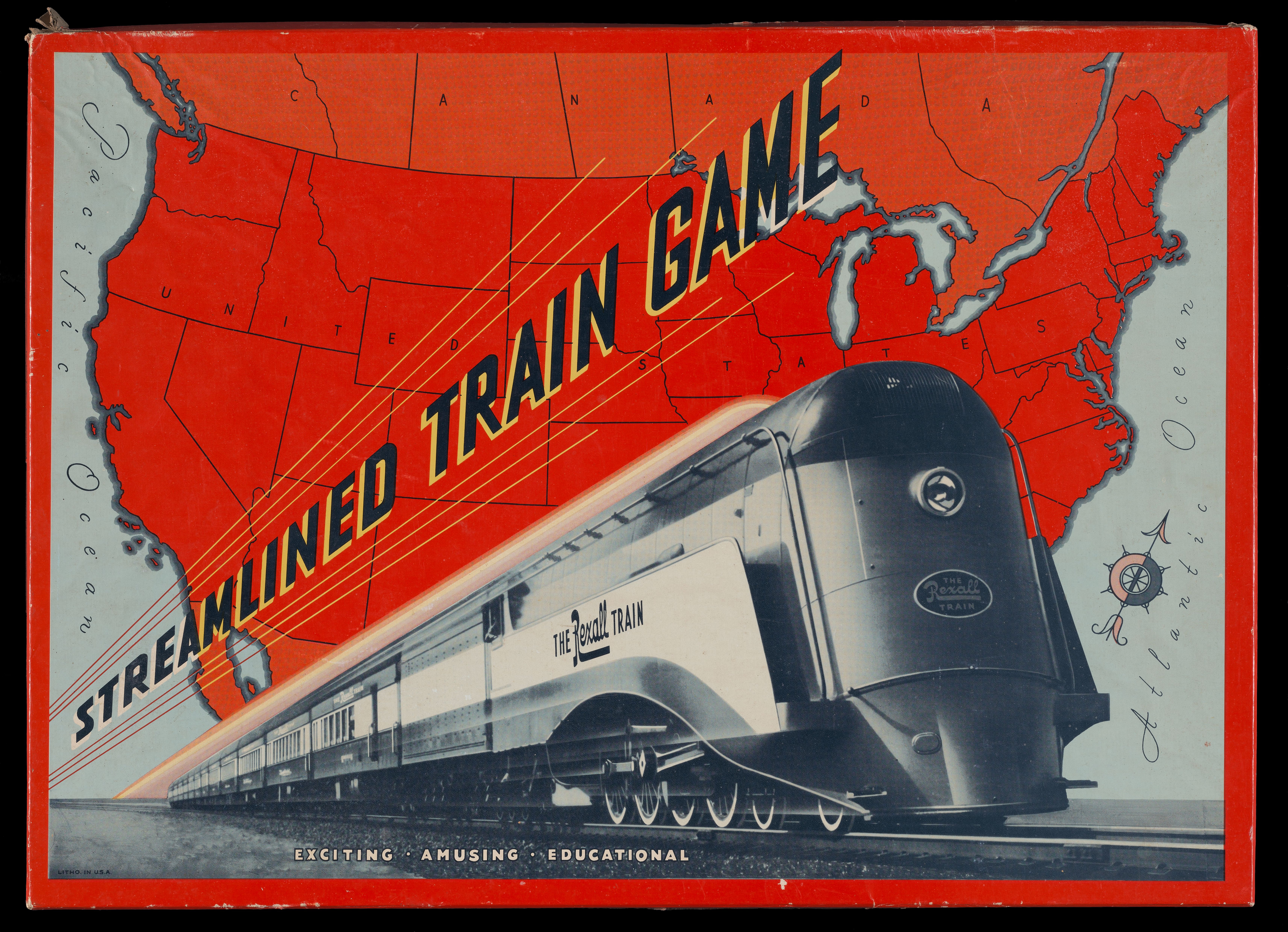
Rexall, Streamline Train Game, 1936.
Osher Artifact Collection.
www.oshermaps.org/map/36922
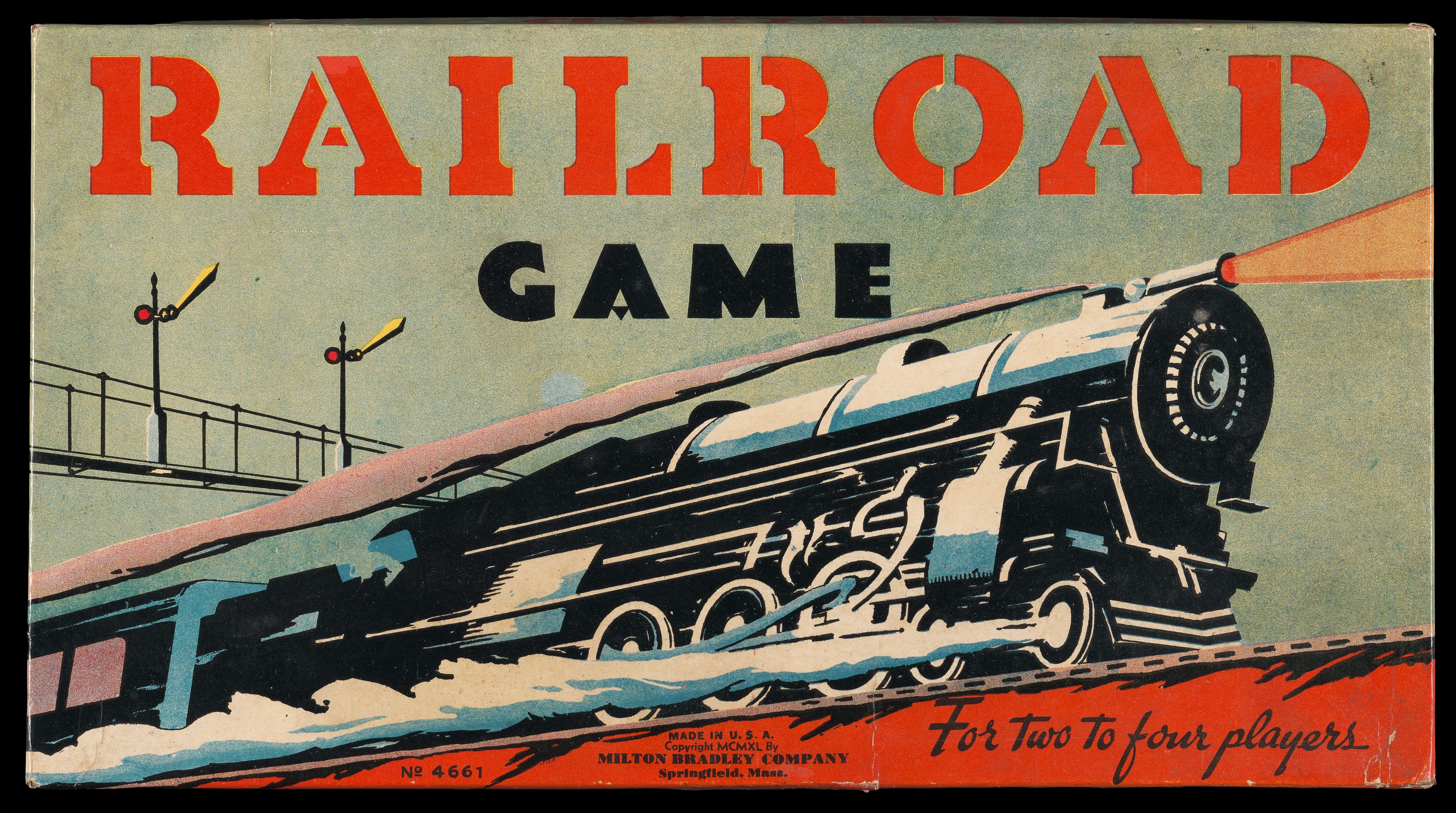
Milton Bradley Co., Railroad Game, 1940.
Osher Artifact Collection.
www.oshermaps.org/map/36887
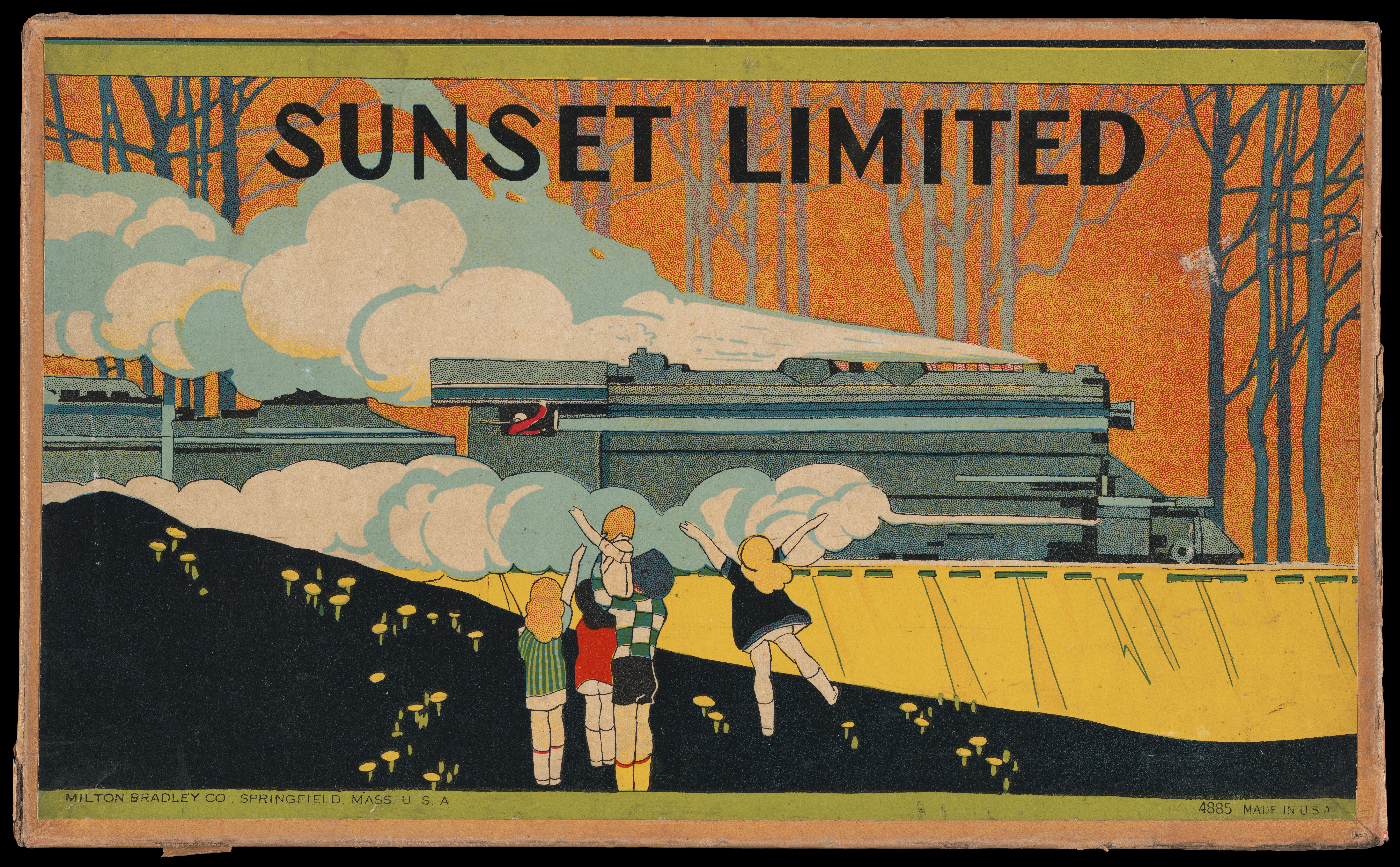
Milton Bradley Co., Sunset Limited, 1920.
Osher Artifact Collection.
www.oshermaps.org/map/37011
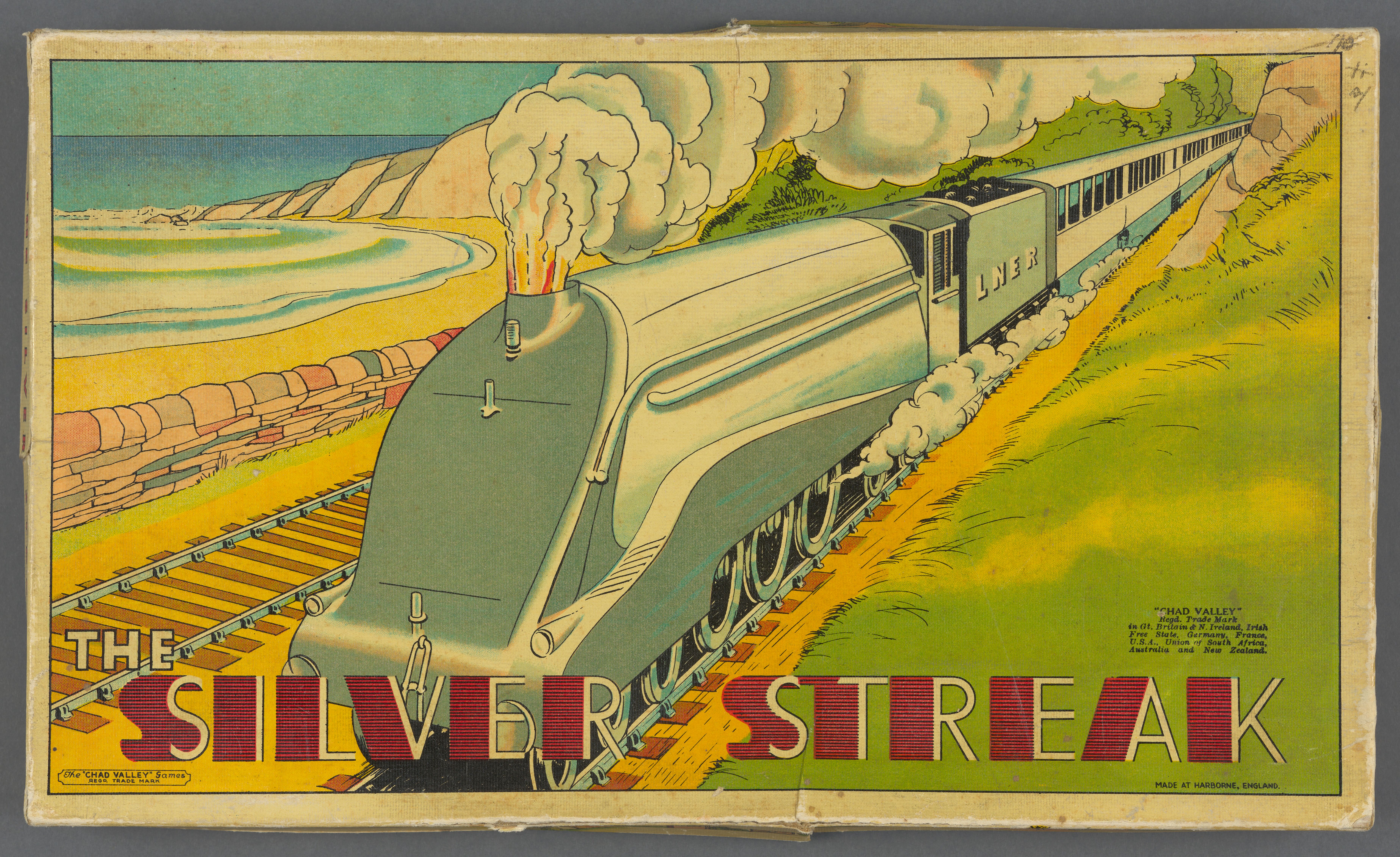
The “Chad Valley” Games, The Silver Streak, 1930.
Osher Artifact Collection.
www.oshermaps.org/map/36920
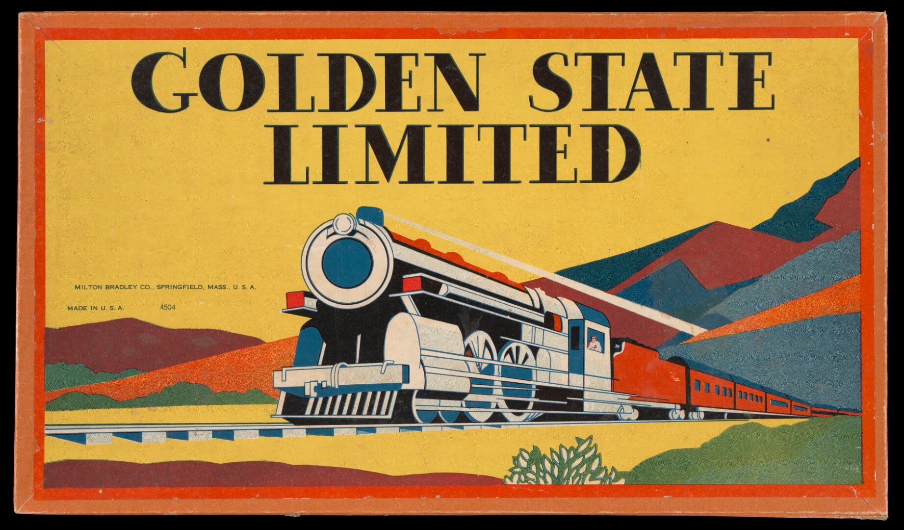
Milton Bradley Co., Golden State Limited, 1935.
Osher Artifact Collection.
www.oshermaps.org/map/36983
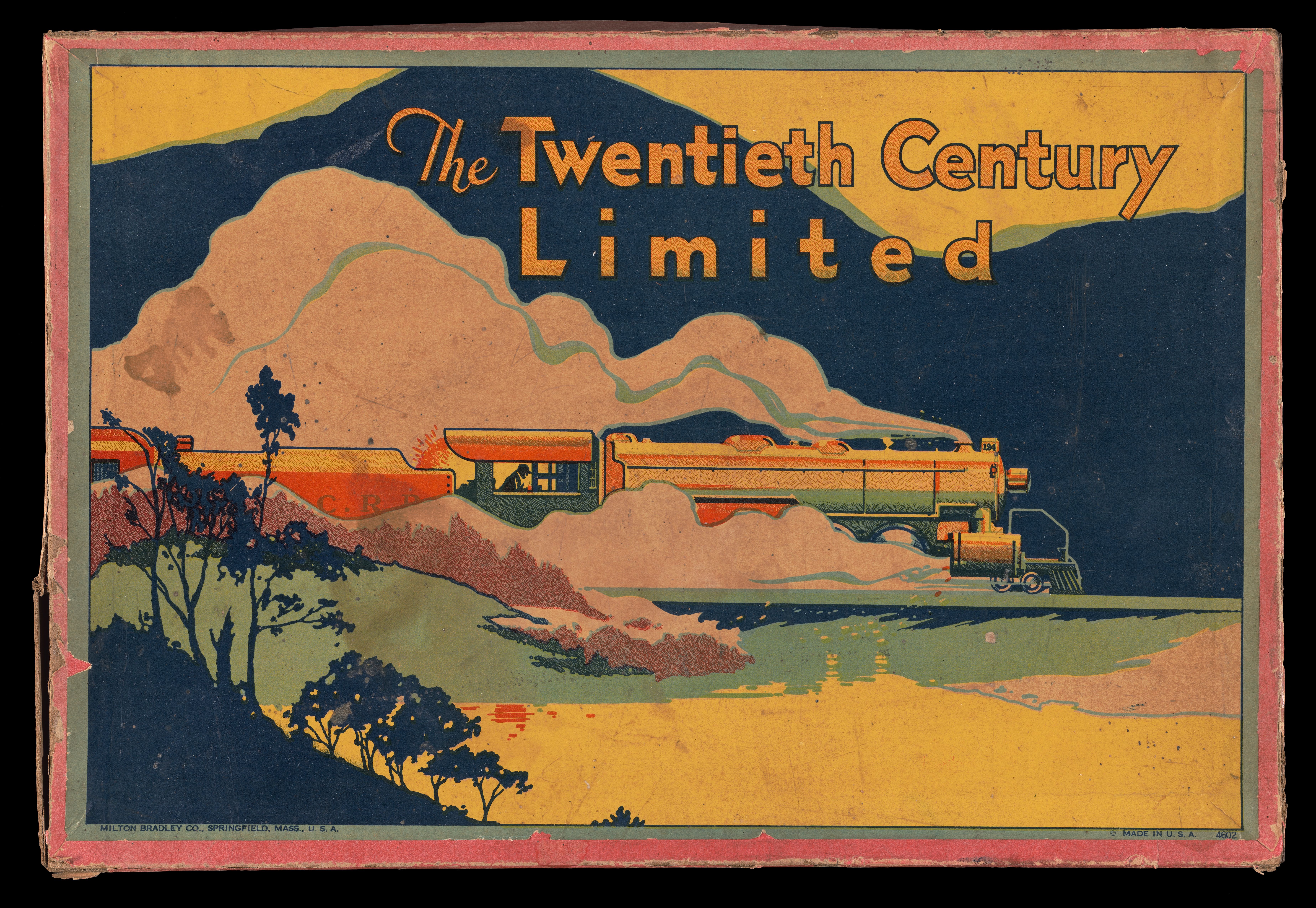
Milton Bradley Co., The 20th Century Limited, 1925.
Osher Artifact Collection.
www.oshermaps.org/map/37035
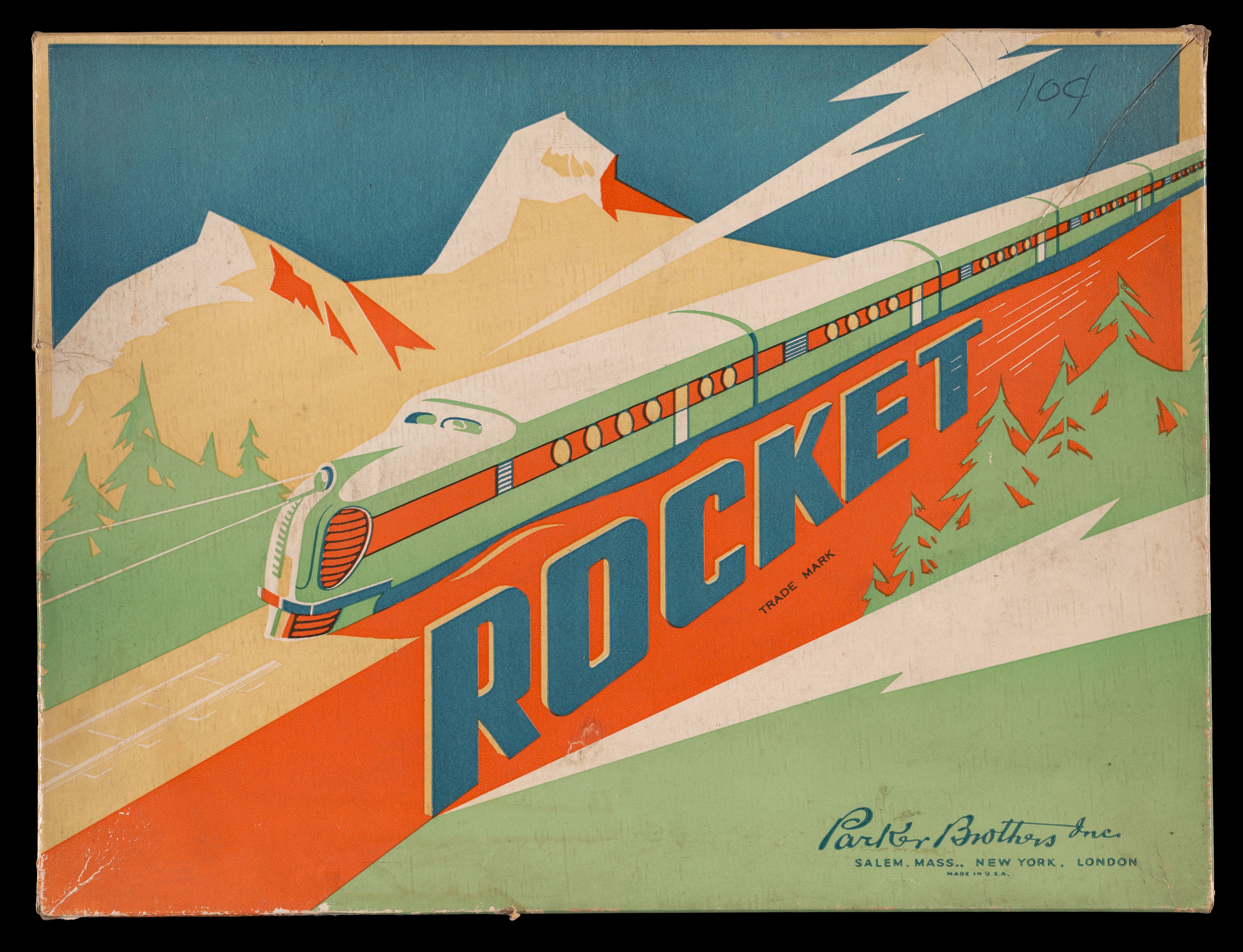
Parker Brothers, Inc., Rocket, 1937.
Osher Artifact Collection.
www.oshermaps.org/map/37055
EXHIBIT NAVIGATION
1. Railroads in Maine
2. Railroads in Portland
3. Tourism and Railroads
4. Games: Modern Trains
5. Maps and Objects
6. Games: Older Train Imagery
7. Miscellaneous
EXHIBIT NAVIGATION
1. Persuasive Maps
2. Propaganda Posters
3. Newsmaps
4. Military Maps
5. Wartime Atlases
6. Miscellaneous
44. [William Hunter’s journal]
William Hunter was a U.S. infantryman in the 79th Division, which famously encountered some of the fiercest fighting and most formidable fortifications of the Western Front during the capture of Montfaucon and Nantillois, the most difficult operation of the Meuse-Argonne campaign. Hunter’s regiment, the 315th, fought alongside the 316th in the capture of Nantillois under intense artillery fire by the Germans and without the support of their own artillery brigade. Partway through the operation, the commander of the 316th sent an urgent message to his superior, reading “Being fired at point blank by field pieces. For God’s sake get artillery or we’ll be annihilated.” By the end of the day, half of the 315th regiment were dead, injured, or missing. Nevertheless, they accomplished their objective and took Nantillois, despite having had almost no food or rest for days.
Like many World War I soldiers, Will saved mementos from his time on the front, including a poem written to his mother, a list of items he had on his person, discharge papers, and even a Christmas card written by the commander of the 79th, Major General Joseph Kuhn. Will also kept a diary in which he recorded his experiences on the front lines. His entries for the days of the Battle of Montfaucon include chilling descriptions of the deaths of comrades-in-arms, including one man who was killed by a “shell [that] tore his intestines right out” and another who was “killed… by a grenade he was carrying.” On September 29, Will describes going over the top while under fire from German “automatics.” When two of his companions, Robbins and Snyder, were shot in the legs, Will carried Snyder back to safety.
While he doesn’t mention rations, Will’s accounts of his sleeping arrangements each evening provide a clear picture of how tired the men of the 315th must have been. On September 26, he reports that he “laid in [a] shell hole all night with shells breaking all around, expecting any minute for one to come in.” Two evenings later, he “dug in for the night… and woke up in 3 inches of water.”
![44. [William Hunter's journal]](https://oshermaps.org/wp-content/uploads/2019/03/49785.0044.jpg "44. [William Hunter's journal]")
44. [William Hunter’s journal]
William Hunter, 1918
Courtesy Stuart Hunter
URL: www.oshermaps.org/map/49785
45. [William Hunter’s picture]

45. [William Hunter’s picture]
[Unknown Photographer], 1917
Courtesy Stuart Hunter
URL: www.oshermaps.org/map/49786
46. [William Hunter’s poem]

46. [William Hunter’s poem]
William Hunter, 1918
Courtesy Stuart Hunter
URL: www.oshermaps.org/map/49788
47. [William Hunter’s discharge papers]
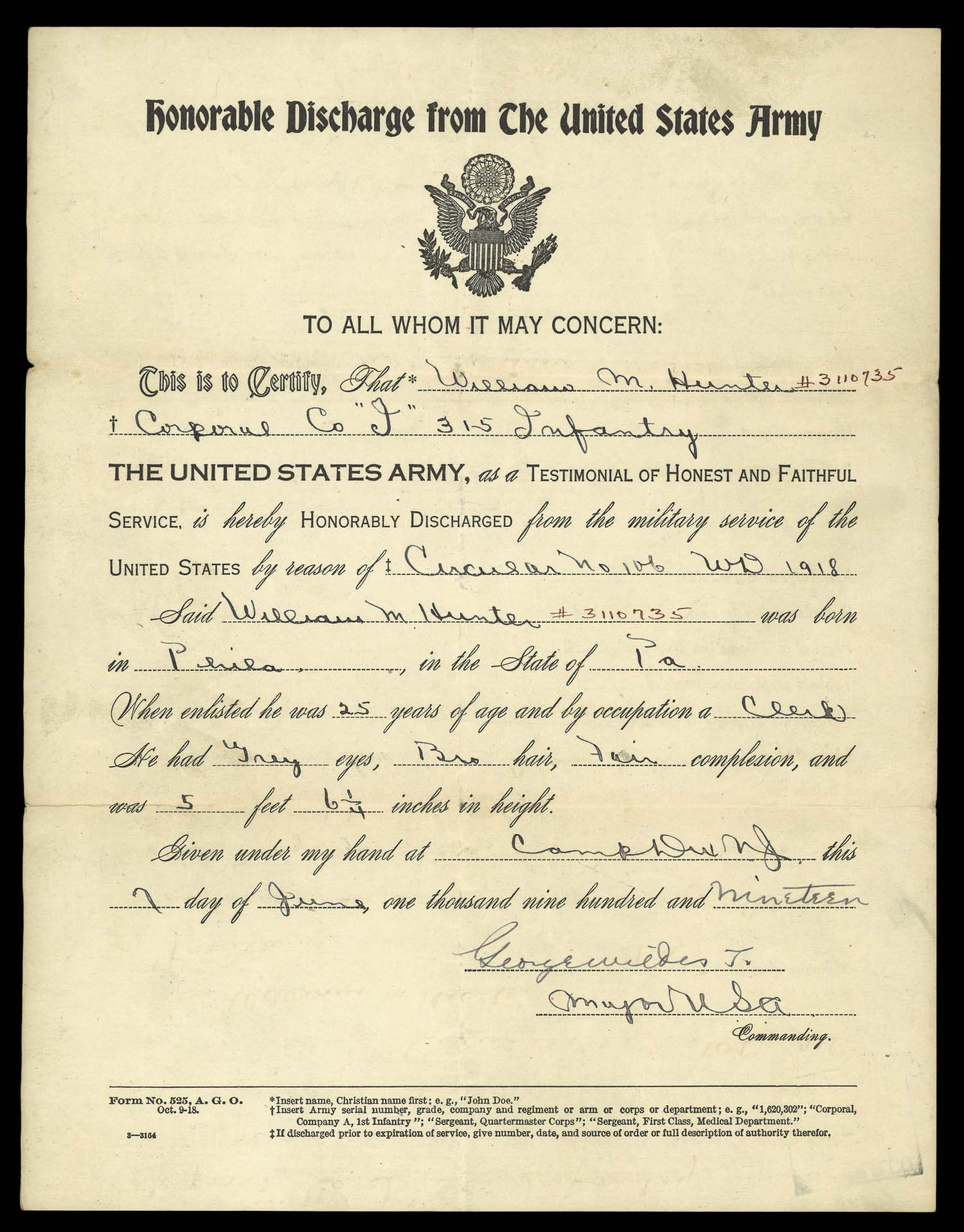
47. [William Hunter’s discharge papers]
American Expeditionary Forces, 1919
Courtesy Stuart Hunter
URL: www.oshermaps.org/map/49788
48. [William Hunter’s list of “junk”]
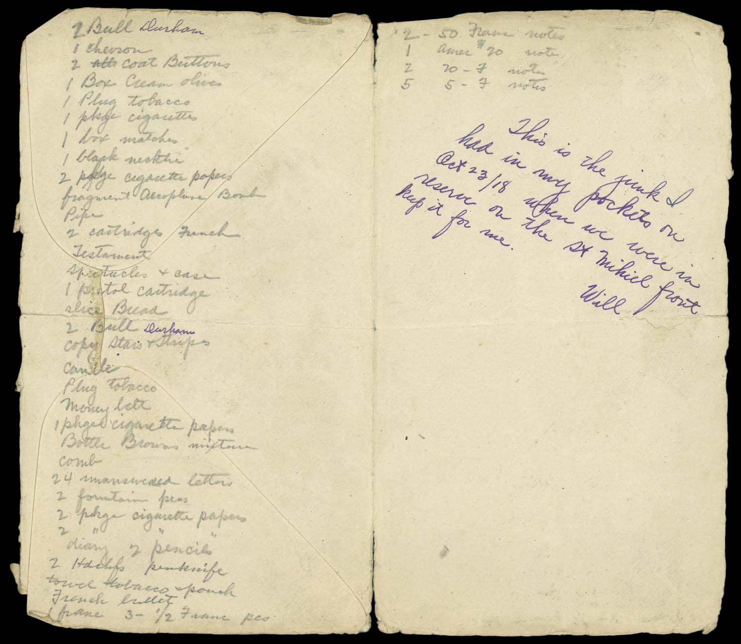
48. [William Hunter’s list of “junk”]
William Hunter, 1918
Courtesy Stuart Hunter
URL: www.oshermaps.org/map/49788
49. [79th Division Christmas Card]
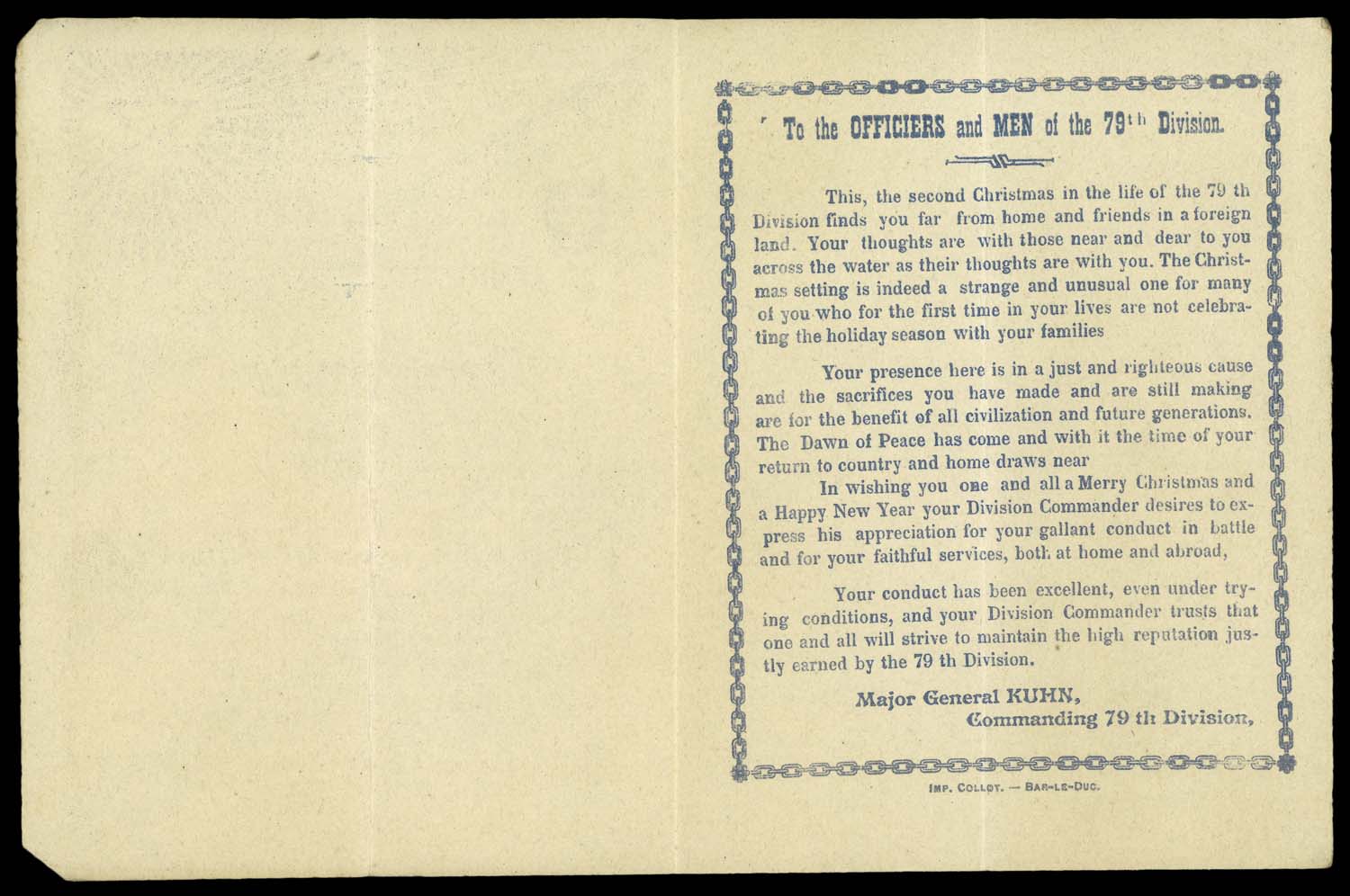
49. [79th Division Christmas Card]
Joseph Kuhn, 1918
Courtesy Stuart Hunter
URL: www.oshermaps.org/map/49788
50. European War 1914
This notebook contains essays on the “European War” written by Dr. Frank Crane, a speaker and former minister who wrote countless articles throughout his career, eventually publishing a ten-volume set of his “Four Minute Essays.” In this handwritten manuscript, Crane analyzes the initial causes of hostility in Europe, the significant events in the war as it progressed, and America’s role and responsibility in the conflict.
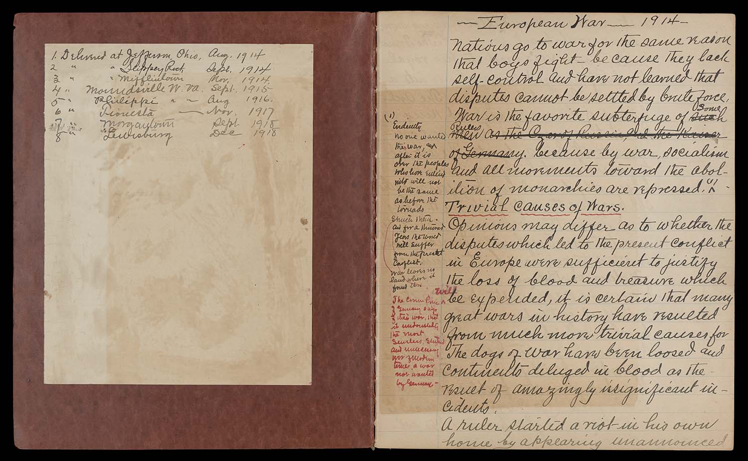
50. European War 1914
Dr. Frank Crane, 1914-18
OML Collection
URL: www.oshermaps.org/map/11595
51. [Map of France with top and bottom torn away showing battle-lines of WWI]
This map shows the action and the positions held by the Allied and Central Powers from the first German advance in 1914 to near the end of the war in 1918. Towns in the east that were captured by the German Army are circled in red, and dates of capture are shown for the major towns. The solid light blue line that extends from Belgium past Amiens and south toward Paris represents the limit of the German advance up to the the First Battle of the Marne in September 1914. The blue dotted line is the Allied position in February 1915, six months after the beginning of the war. The purple solid line corresponds to the Allied lines before the German offensive on March 21st, 1918. The purple dotted and dashed line and dashed line is the position of the Allies after the German offensive to July, 1918. The various red lines represent the positions of the German Army during the same phases of the war. On the verso of the map is a signature presumably of the map’s original owner and the date 1918. From the map’s condition and from viewing similar maps in other collections, we believe this map was printed in Europe.

51. [Map of France with top and bottom torn away showing battle-lines of WWI]
[Unknown Author], 1918
Rice Collection
URL: www.oshermaps.org/map/43190
EXHIBIT NAVIGATION
1. Persuasive Maps
2. Propaganda Posters
3. Newsmaps
4. Military Maps
5. Wartime Atlases
6. Miscellaneous

“Hall School: Before the Renovation”
Delia C. of Portland, Maine
Fred P. Hall Elementary

“Dover-Foxcroft Zoo”
Kiernan S. of Dover-Foxcroft, Maine
Sedomocha Middle School

“Chebeague Island Map”
Jack H. of Chebeague Island, Maine
North Yarmouth Academy

“Central New Jersey”
Carmello B. of Cape Elizabeth, Maine
Cape Elizabeth Middle School
“Hall School: Before the Renovation”
Delia C. of Portland, Maine
Fred P. Hall Elementary
“Dover-Foxcroft Zoo”
Kiernan S. of Dover-Foxcroft, Maine
Sedomocha Middle School
“Chebeague Island Map”
Jack H. of Chebeague Island, Maine
North Yarmouth Academy
“Central New Jersey”
Carmello B. of Cape Elizabeth, Maine
Cape Elizabeth Middle School

“Old School Portland”
Arianna Z. of Buxton, Maine
Buxton Center Elementary School
Top Ten!

“Pangea and its Prehistoric Wildlife”
Kodi Q. of Anson, Maine
Homeschool

“Native American Tribal Regions”
Lucy R. of Cape Elizabeth, Maine
Cape Elizabeth Middle School

“Historical Map of the United States”
Margaret G. of St. George, Maine
St. George School

“Discoveries of America: Erikkson & Columbus”
Quinn T. of Topsham, Maine
Homeschool

“Once Upon a Time”
Tenley of Portland, Maine
Reiche Elementary School